Enable Location

We need your location to show you interesting places around you

Discover nearby places

Find interesting locations and hidden gems around you

Precise directions

Get accurate directions and distances to places

Your location is never shared with other users. It's only used when you tap the location button.

Backbone State Park

Log in to your account

Start exploring — it's free

Trusted by 62,441 travelers worldwide

Continue with Google
Continue with Apple
or

We will send you a code to connect

By continuing, you accept our Terms and Conditions and our Privacy Policy

Check your inbox

We've sent a pincode in your inbox. Please enter the code below.

Backbone State Park, State park with limestone cliffs in Delaware County, United States

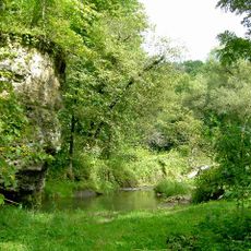
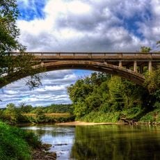
Backbone State Park is a nature reserve in Delaware County featuring limestone cliffs that rise above the Maquoketa River. The landscape includes narrow rock ridges, lakes, streams, and thick forests that form a complex ecosystem.

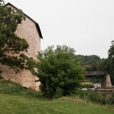
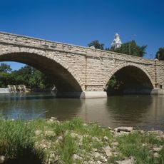
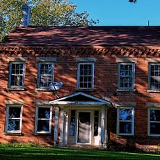
The park was founded in 1920 as Iowa's first state park venture. During the 1930s, the Civilian Conservation Corps shaped the landscape with dams, cabins, and bridges that remain visible today.

The name comes from the distinctive rocky ridge that dominates the landscape like a backbone. Visitors experience this connection directly while walking the trails along the high edges of the formation.

The park offers two separate camping areas with different amenities depending on your preferences. Visitors should note the steep trails and wear proper footwear, especially when exploring the rock ridges.

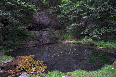
A natural spring within the park, Richmond Springs, continuously pumps water from the ground year-round. This cold flowing water creates the conditions that support the park's thriving trout population in its streams.

The community of curious travelers

AroundUs brings together thousands of curated places, local tips, and hidden gems, enriched daily by 60,000 contributors worldwide.

Start exploring
Location
Inception
1919
Elevation above the sea
335 m
GPS coordinates
42.63310,-91.56170
Latest update
December 6, 2025 16:04
Historic sites and natural spaces in Iowa: caves, botanical gardens, historic bridges, museums

Iowa combines outdoor spaces and built history in ways that appeal to different interests. The state has caves and rock formations that draw geology enthusiasts, along with old mills and gardens connected to farming life. Museums here cover transportation history, including trains and trucks, while...

Around this place
Cedar Rock State Park
United States of America

Cedar Rock State Park

30.5 km
Fountain Springs Park
United States of America

Fountain Springs Park

21.5 km
Saints Peter and Paul Church
United States of America

Saints Peter and Paul Church

29.8 km
Delaware County Courthouse
United States of America

Delaware County Courthouse

19.3 km
St. Joseph's Catholic Church
United States of America

St. Joseph's Catholic Church

27.5 km
Schmidt House
United States of America

Schmidt House

27.5 km
Motor Mill Historic District
United States of America

Motor Mill Historic District

25.9 km
Elkader Keystone Bridge
United States of America

Elkader Keystone Bridge

27.9 km
Elkader Opera House
United States of America

Elkader Opera House

27.8 km
Timothy Davis House
United States of America

Timothy Davis House

27.8 km
Coffin's Grove Stagecoach House
United States of America

Coffin's Grove Stagecoach House

14.9 km
Clayton County Courthouse
United States of America

Clayton County Courthouse

27.9 km
Alexander-Dickman Hall
United States of America

Alexander-Dickman Hall

30.3 km
Elkader Downtown Historic District
United States of America

Elkader Downtown Historic District

27.8 km
Hotel Mealey
United States of America

Hotel Mealey

29.2 km
Carter House
United States of America

Carter House

27.9 km
McGee School
United States of America

McGee School

15 km
J.C. Stemmer House
United States of America

J.C. Stemmer House

27.6 km
Lincoln Elementary School
United States of America

Lincoln Elementary School

19.1 km
Mederville Bridge
United States of America

Mederville Bridge

18.5 km
Bay Settlement Church and Monument
United States of America

Bay Settlement Church and Monument

30.8 km
J.J. Hoag House
United States of America

J.J. Hoag House

18.3 km
Richardson-Jakway House
United States of America

Richardson-Jakway House

14.6 km
Erza McKenzie Round Barn
United States of America

Erza McKenzie Round Barn

30.7 km
Alfred Hanson House
United States of America

Alfred Hanson House

29.3 km
Maple View Sanitarium
United States of America

Maple View Sanitarium

29.3 km
Rialto Price House
United States of America

Rialto Price House

27.7 km
Ruth Suckow House
United States of America

Ruth Suckow House

29.7 km
Show the full map
« Backbone State Park - State park with limestone cliffs in Delaware County, United States » is provided by Around Us (aroundus.com). Images and texts are derived from Wikimedia project under a Creative Commons license. You are allowed to copy, distribute, and modify copies of this page, under the conditions set by the license, as long as this note is clearly visible.

Discover hidden gems everywhere you go!

From secret cafés to breathtaking viewpoints, skip the crowded tourist spots and find places that match your style. Our app makes it easy with voice search, smart filtering, route optimization, and insider tips from travelers worldwide. Download now for the complete mobile experience.

Around Us App Screenshot

A unique approach to discovering new places

Le Figaro

All the places worth exploring

France Info

A tailor-made excursion in just a few clicks

20 Minutes

Around Us
Travel Guide & Maps
Download

Send to your phone

QR Code
1

Open the camera app on your mobile.

2

Point at the QR code with your camera. A notification will appear.

3

Tap the notification to open the link.