Paumanok Path, Hiking trail in Rocky Point, United States.
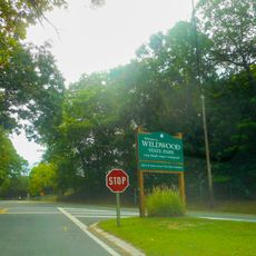
The Paumanok Path is a hiking trail in Suffolk County, New York, running from Rocky Point in the west to Montauk Point at the eastern tip of Long Island. The route crosses forests, coastal dunes, and heathlands, marked throughout with white blazes on trees and posts.
The trail takes its name from Stephen Talkhouse, a Montaukett man from the 19th century who was known for walking long distances across eastern Long Island as a regular way of travel. The modern route was established in the latter half of the 20th century by conservation groups and volunteers who worked to connect existing paths into one continuous trail.
The name Paumanok comes from the Lenape language and means roughly "land shaped like a fish tail," a reference to the shape of Long Island itself. Walking the trail today means moving through land that Indigenous peoples of this region traveled and lived on for centuries.
The trail is clearly marked throughout, but carrying a detailed map is a good idea since some sections pass through remote areas with few landmarks. Footwear that works on both firm ground and loose sand will serve well, as the surface changes noticeably along the way.
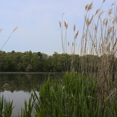
Some sections of the trail cross parabolic dunes formed by wind over thousands of years, and these same formations act as natural collection points for rainwater that feeds Long Island's underground water supply. The depressions between the dunes gather and filter water slowly, making them a working part of the island's natural water system rather than just a landscape feature.
The community of curious travelers
AroundUs brings together thousands of curated places, local tips, and hidden gems, enriched daily by 60,000 contributors worldwide.