Tân Quy Đông, Stadtviertel in Vietnam
Location: Sa Đéc City
Elevation above the sea: 5 m
GPS coordinates: 10.32030,105.73898
Latest update: December 4, 2025 23:11


Mỹ Thuận Bridge
19.3 km
Vàm Cống bridge
25.7 km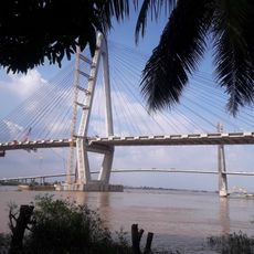
My Thuan 2 Bridge
19 km
Cao Lanh Bridge
14 km
Quyt Hong Lai Vung
15.1 km
Tân Thành
17.5 km
Hoi Phuoc temple
18.1 km
Khu du lịch văn hóa Phương Nam
8.1 km
Làng gạch An Hiệp
6.4 km
Childhood home of Marguerite Duras
4.6 km
Flower market
785 m
Nhà cổ Huỳnh Thủy Lê
4.4 km
Xeo quyt relic site
7.5 km
Xeo Quyt Forest
11.2 km
Dong Thap provincial museum
18.9 km
Khu Du Lịch Vinh Sang
24.2 km
Trung tâm hành hương Đức mẹ Fatima
22.5 km
Nha
25.8 km
Bang Lang Bird sanctuary
26 km
Kiến an cung
4.2 km
Ao cá
9.7 km
Nhà Trân
9.7 km
Quán ăn sáng Sông Hân
19.5 km
Nhà Anh Danh
21 km
Bến Phà Tân Lộc - Bằng Tăng
19.7 km
Scenic viewpoint
20.1 km
Viewing Tower
11.2 km
Nha may X55
26.2 kmVisited this place? Tap the stars to rate it and share your experience / photos with the community! Try now! You can cancel it anytime.
Discover hidden gems everywhere you go!
From secret cafés to breathtaking viewpoints, skip the crowded tourist spots and find places that match your style. Our app makes it easy with voice search, smart filtering, route optimization, and insider tips from travelers worldwide. Download now for the complete mobile experience.

A unique approach to discovering new places❞
— Le Figaro
All the places worth exploring❞
— France Info
A tailor-made excursion in just a few clicks❞
— 20 Minutes