Vejle Fjord, Danish fjord in Vejle Municipality, Denmark
Vejle Fjord is a waterway extending roughly 22 kilometers from the town of Vejle to the Kattegat Sea, lined with forested hills and steep rocky cliffs along both shores. The surrounding landscape creates a striking natural border with dense woodlands rising sharply from the water.
The fjord was formed through glacial processes during the Ice Age and was later shaped by human intervention, particularly through river modifications and agricultural projects from medieval times onward. These interventions altered the landscape and water conditions that define the waterway today.
Environmental organizations gathered 1,000 people in April 2024 to raise awareness about the fjord's ecological condition through a symbolic funeral ceremony.
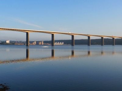
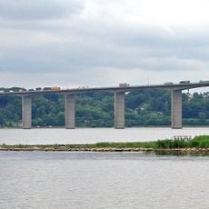
The area is easily reached via the E45 highway and the Vejle Fjord Bridge, which connects both shores and allows traffic to cross. The bridge also provides good vantage points to observe the water and surrounding landscape.
The fjord faces environmental stress from nitrogen runoff caused by farming activities, which damages seagrass meadows in the water. Local groups are actively replanting seagrass to restore marine life and improve water conditions.
The community of curious travelers
AroundUs brings together thousands of curated places, local tips, and hidden gems, enriched daily by 60,000 contributors worldwide.