Sonning Backwater Bridges

Log in to your account

AroundUs is a community-driven map of interesting places, built by curious explorers like you. It grows with every review, story, and photo you share.
Connect to save your favorite spots, contribute locations, and create personalized routes.
Continue with Google
Continue with Apple
Continue with X
Continue with Facebook
Continue with email
By continuing, you accept our Terms and Conditions and our Privacy Policy
Create an account

Sonning Backwater Bridges

Add to collection
Map
Suggest a change
Share

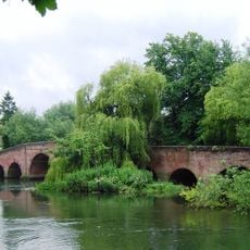
Sonning Backwater Bridges, Road bridge in Sonning Eye, England.

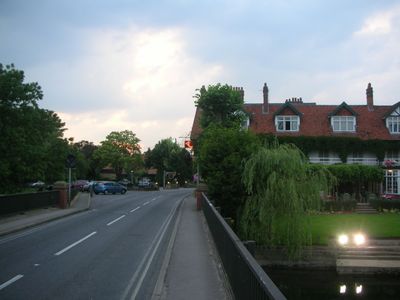
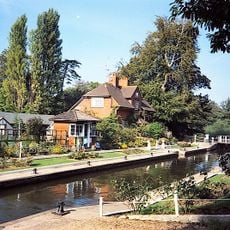
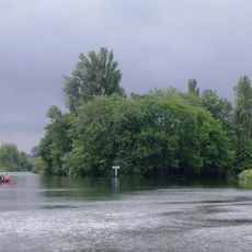
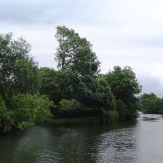
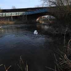
Sonning Backwater Bridges are two concrete structures that span the weir stream and millrace sections of the River Thames near the village of Sonning. They allow passage across both waterways and connect the surrounding land to the island on which the historic mill buildings stand.

Built in 1986, these bridges replaced older wooden structures that had struggled with the weight of traction engines in the early 1900s. The newer construction was designed to handle increased traffic and provide a more reliable crossing over the Thames.

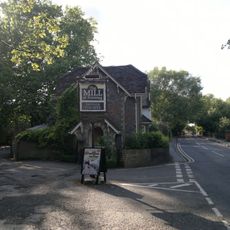
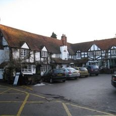
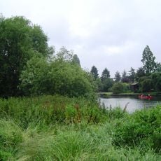
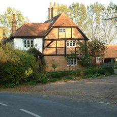
The bridges connect to the Mill at Sonning, a former watermill that now operates as a dinner theater situated on an island between river channels. This venue has become a gathering place for local entertainment and regional cultural events.

These bridges form the sole Thames crossing between Reading and Henley-on-Thames, so the B478 road regularly becomes congested. Visitors should expect delays during peak times and may want to plan their journey timing carefully or explore alternative routes if passing through the area.

An artist named Impro installed a letterbox on one of the bridge supports in 2013 that can only be accessed by people traveling by water. This hidden postal feature surprises boaters passing through and represents an imaginative intervention in the landscape.

Inception: 1986

Official opening: 1986

GPS coordinates: 51.47667,-0.91583

Latest update: December 14, 2025 16:47

Photos
Around this place
The Deanery
United Kingdom

The Deanery

395 m
Caversham Park
United Kingdom

Caversham Park

3 km
The Mill at Sonning
United Kingdom

The Mill at Sonning

85 m
St Andrew's Church, Sonning
United Kingdom

St Andrew's Church, Sonning

341 m
Sonning Bridge
United Kingdom

Sonning Bridge

168 m
Bull Inn
United Kingdom

Bull Inn

426 m
Palmer Park Stadium
United Kingdom

Palmer Park Stadium

3.1 km
Sonning Lock
United Kingdom

Sonning Lock

494 m
St John the Evangelist Church, Woodley
United Kingdom

St John the Evangelist Church, Woodley

2.6 km
Phillimore Island
United Kingdom

Phillimore Island

3 km
The Lynch
United Kingdom

The Lynch

2.4 km
Buck Ait
United Kingdom

Buck Ait

1.9 km
Alder Moors
United Kingdom

Alder Moors

2.9 km
Hallsmead Ait
United Kingdom

Hallsmead Ait

2.2 km
Ali's Pond Local Nature Reserve
United Kingdom

Ali's Pond Local Nature Reserve

754 m
Church of St Peter and St Paul, Shiplake
United Kingdom

Church of St Peter and St Paul, Shiplake

2.8 km
Church of St Bartholomew
United Kingdom

Church of St Bartholomew

3.1 km
The Red Cow Public House
United Kingdom

The Red Cow Public House

3.1 km
Milestone, On Grass Verge Back Of Pavement 500 Metres East Of Junction With Sonning Lane
United Kingdom

Milestone, On Grass Verge Back Of Pavement 500 Metres East Of Junction With Sonning Lane

1.3 km
Railway Bridge And Attached Accommodation Bridge Over River Kennet At SU 7306 7381
United Kingdom

Railway Bridge And Attached Accommodation Bridge Over River Kennet At SU 7306 7381

3.1 km
Milestone On Grass Verge,100 Metres East Of Junction With Bath Road
United Kingdom

Milestone On Grass Verge,100 Metres East Of Junction With Bath Road

1.8 km
Milestone At Ngr 7850 7605
United Kingdom

Milestone At Ngr 7850 7605

3.1 km
Shiplake College, Water Tower Approximately 90 Metres North West
United Kingdom

Shiplake College, Water Tower Approximately 90 Metres North West

2.8 km
Shiplake Rise Farmhouse
United Kingdom

Shiplake Rise Farmhouse

2.6 km
Pump, South End Of Deanery Wall
United Kingdom

Pump, South End Of Deanery Wall

450 m
The Flame by Neil and Auriol Lawson Baker (Reading)
United Kingdom

The Flame by Neil and Auriol Lawson Baker (Reading)

1.5 km
Milestone, London Road; Earley Court, half way up hill near electrical power compound
United Kingdom

Milestone, London Road; Earley Court, half way up hill near electrical power compound

2.2 km
Milestone, Thames Street; opp. the Deanery
United Kingdom

Milestone, Thames Street; opp. the Deanery

318 m
Show the full map
Reviews

Visited this place? Tap the stars to rate it and share your experience / photos with the community! Try now! You can cancel it anytime.

« Sonning Backwater Bridges - Road bridge in Sonning Eye, England » is provided by Around Us (aroundus.com). Images and texts are derived from Wikimedia project under a Creative Commons license. You are allowed to copy, distribute, and modify copies of this page, under the conditions set by the license, as long as this note is clearly visible.

Discover hidden gems everywhere you go!

From secret cafés to breathtaking viewpoints, skip the crowded tourist spots and find places that match your style. Our app makes it easy with voice search, smart filtering, route optimization, and insider tips from travelers worldwide. Download now for the complete mobile experience.

Around Us App Screenshot

A unique approach to discovering new places

Le Figaro

All the places worth exploring

France Info

A tailor-made excursion in just a few clicks

20 Minutes