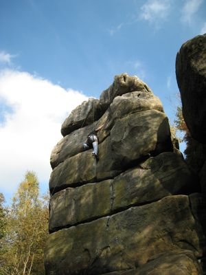
Harrison's Rocks, Sandstone climbing area in East Sussex, England
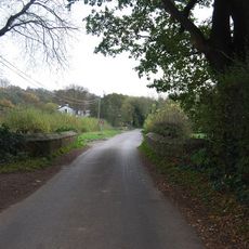
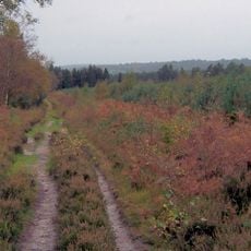
Harrison's Rocks is a sandstone climbing area in southeastern England set within woodland terrain. The site features several hundred routes of varying difficulty on rock walls that range between 6 and 12 meters in height.
The British Mountaineering Council acquired this site in the early 20th century to preserve the sandstone formations. This early protection ensured the area remained available for climbing activities across the decades that followed.
The climbing community here shows respect for the sandstone through specific practices you can observe while visiting. You will notice climbers using soft shoes and techniques designed to protect the delicate rock from damage.
Climbing conditions are best during dry weather, as wet sandstone becomes slippery and unsafe for activities. Visitors should wear sturdy walking shoes to navigate the woodland terrain and stick to marked pathways when moving around the site.
The sandstone composition requires a different approach than most climbing areas, as traditional leader-placed anchors cannot be used. This means climbers here rely exclusively on fixed anchor systems already installed in the rock to keep their gear in place.
GPS coordinates: 51.09830,0.18658
Latest update: December 11, 2025 11:02
Groombridge Place
2.1 km
Buckhurst Park
3.2 km
Leyswood
598 mBowles Rocks
2.7 km
Holy Trinity Church, Eridge Green
2.6 km
Church of St Thomas the Apostle
1.4 km
Chapel Of St John The Evangelist
2.2 km
The Nevill Crest And Gun Hotel
2.6 km
The Dorset Arms Hotel
3.6 km
The Old Town Post Office Including Front Area Railings
2.2 km
Bridge Over The River Medway Between The Former Railway Line And Summerford Farm
3.5 km
The Crown Including Service Buildings Adjoining To North
2.2 km
3 And 4, Bird-in-hand Street
2.2 km
The Stables To The North East Of The Neville Crest And Gun Hotel
2.6 km
Langton Green War Memorial
3.8 km
Whitehouse Farmhouse
3.4 km
Renby Farmhouse Eridge Station
1.4 km
3, 4, 5 And 6, The Walks
2.2 km
7, 8 And 9, The Walks
2.2 km
Stables Approximately 10 Metres North East Of Hollonds Farmhouse
3.8 km
Mill House
2.1 km
Hollonds Farmhouse
3.8 km
The Oasthouse
1.3 km
The Old Butchers
2.2 km
Stone Cross Farmhouse
3.6 km
Broadwater Warren RSPB Reserve
2.9 km
Corseley Farmhouse
1.3 km
Milestone, Withyham Road; Groombridge
2 kmVisited this place? Tap the stars to rate it and share your experience / photos with the community! Try now! You can cancel it anytime.
Discover hidden gems everywhere you go!
From secret cafés to breathtaking viewpoints, skip the crowded tourist spots and find places that match your style. Our app makes it easy with voice search, smart filtering, route optimization, and insider tips from travelers worldwide. Download now for the complete mobile experience.
A unique approach to discovering new places❞
— Le Figaro
All the places worth exploring❞
— France Info
A tailor-made excursion in just a few clicks❞
— 20 Minutes