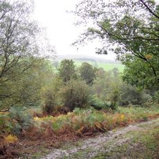
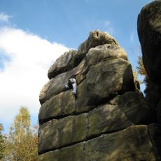
Bowles Rocks, Sandstone climbing area in Rotherfield, England
Bowles Rocks is a south-facing sandstone crag near Rotherfield with more than 230 climbing routes spread across different walls and surfaces, ranging from beginner to advanced difficulty. The rock consists of soft sandstone with a textured, uneven surface that creates distinct climbing challenges and opportunities at different heights.
The site served as a military firing range during World War II before John Walters converted it into a climbing venue in the 1960s. This transformation turned a wartime training ground into a place for outdoor recreation and sport climbing.
The Bowles Rocks Trust operates this space, running climbing lessons and educational programs that draw young people from the surrounding area. Visitors find a community of climbers of all levels who gather here regularly to practice their skills.
The soft sandstone requires specific climbing techniques and prohibits rope lowering to prevent surface damage and erosion. Visitors need to understand that these rules protect the rock and require careful planning of movement and anchoring methods.
Square holes from former pig enclosures and bullet marks from wartime remain visible across the rock surface. These physical traces create an unexpected historical layer for climbers to discover as they explore the walls.
The community of curious travelers
AroundUs brings together thousands of curated places, local tips, and hidden gems, enriched daily by 60,000 contributors worldwide.