Horsted Place

Log in to your account

AroundUs is a community-driven map of interesting places, built by curious explorers like you. It grows with every review, story, and photo you share.
Connect to save your favorite spots, contribute locations, and create personalized routes.
Continue with Google
Continue with Apple
Continue with X
Continue with Facebook
Continue with email
By continuing, you accept our Terms and Conditions and our Privacy Policy
Create an account
Add to collection
Map
Suggest a change
Share

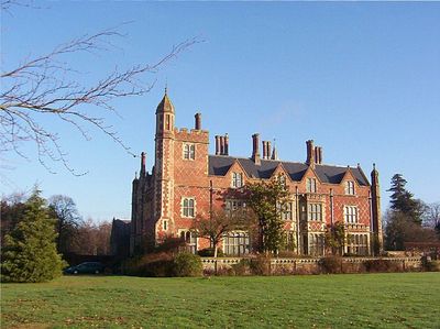
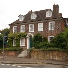
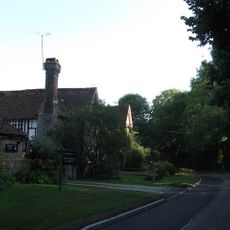
Horsted Place, English country house in Little Horsted, England.

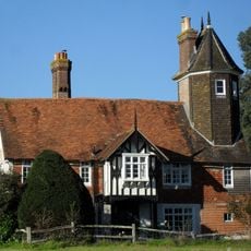
Horsted Place is an English country house built in Tudor Revival style with distinctive towers and high brick chimneys that define its roofline. The interior is organized around a central gallery that runs through the entire length of the building and connects the spaces.

The estate was built in 1850 by architects Samuel Daukes and George Myers for a wealthy London merchant who had inherited his fortune from his godfather. It later became a favored retreat for British high society in the 20th century.

The house served as a gathering place for the British upper classes and played a role in the social life of the surrounding area. Visitors can still see the rooms that were once used for formal receptions and social occasions.

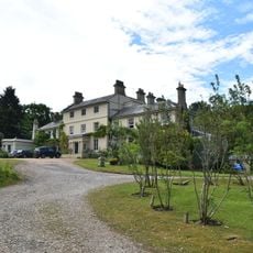
The location now functions as a country house hotel welcoming visitors who wish to explore both the history and stay overnight. The estate sits on larger grounds with a registered park and garden, offering opportunities for outdoor exploration.

The property received protected status for both the building and its gardens and park grounds, reflecting double significance for cultural heritage. This combined recognition makes it a rare example where architecture and landscape are equally valued.

Location: Little Horsted

Architectural style: Tudor Revival architecture

GPS coordinates: 50.94678,0.08949

Latest update: December 8, 2025 21:03

Photos
Around this place
Bentley Wildfowl and Motor Museum
United Kingdom

Bentley Wildfowl and Motor Museum

3 km
Plashett Park Wood
United Kingdom

Plashett Park Wood

3 km
The Baptist Church
United Kingdom

The Baptist Church

3.4 km
Copping Hall
United Kingdom

Copping Hall

3 km
St Thomas à Becket Church
United Kingdom

St Thomas à Becket Church

3.2 km
The Parish Church of St Margaret, Isfield
United Kingdom

The Parish Church of St Margaret, Isfield

2.5 km
The Parish Church of St Michael and All Angels
United Kingdom

The Parish Church of St Michael and All Angels

235 m
The Parish Church of the Holy Cross
United Kingdom

The Parish Church of the Holy Cross

3 km
The Maiden's Head Hotel
United Kingdom

The Maiden's Head Hotel

3 km
Hooke Hall
United Kingdom

Hooke Hall

3.1 km
Isfield pound
United Kingdom

Isfield pound

2 km
Beckets
United Kingdom

Beckets

3.3 km
Buckham Hill House
United Kingdom

Buckham Hill House

3 km
Barn And Oasthouse To East Of Vuggles Farmhouse
United Kingdom

Barn And Oasthouse To East Of Vuggles Farmhouse

3.3 km
Cart Shed, Granary And Oasthouse To East Of Banks Farmhouse
United Kingdom

Cart Shed, Granary And Oasthouse To East Of Banks Farmhouse

4.4 km
Isfield Signal Box And Railway Level Crossing Gates
United Kingdom

Isfield Signal Box And Railway Level Crossing Gates

2.2 km
224 And 226, High Street
United Kingdom

224 And 226, High Street

3.1 km
Sharps Bridge House
United Kingdom

Sharps Bridge House

3.7 km
Bradness
United Kingdom

Bradness

3.7 km
Lichfield
United Kingdom

Lichfield

191 m
Uckfield War Memorial
United Kingdom

Uckfield War Memorial

3 km
Milepost, High Street jct with Bell Lane, at traffic lights
United Kingdom

Milepost, High Street jct with Bell Lane, at traffic lights

2.6 km
Milepost, jct with Isfield Road, N of the Old Ship PH
United Kingdom

Milepost, jct with Isfield Road, N of the Old Ship PH

3.4 km
Milepost, Eastbourne Road, between Timberley Gardens and Meadow View
United Kingdom

Milepost, Eastbourne Road, between Timberley Gardens and Meadow View

1.8 km
Milepost, between Crockstead Stables and Sand Hill Lane jct, by lane to farm
United Kingdom

Milepost, between Crockstead Stables and Sand Hill Lane jct, by lane to farm

2.8 km
Milepost, Ringles Cross PH, London Road
United Kingdom

Milepost, Ringles Cross PH, London Road

4.2 km
Milepost, Ridgewood, Lewes Road, just S of jct with New Road
United Kingdom

Milepost, Ridgewood, Lewes Road, just S of jct with New Road

1.2 km
Milepost, High Cross Lake, road to Halland
United Kingdom

Milepost, High Cross Lake, road to Halland

2 km
Show the full map
Reviews

Visited this place? Tap the stars to rate it and share your experience / photos with the community! Try now! You can cancel it anytime.

« Horsted Place - English country house in Little Horsted, England » is provided by Around Us (aroundus.com). Images and texts are derived from Wikimedia project under a Creative Commons license. You are allowed to copy, distribute, and modify copies of this page, under the conditions set by the license, as long as this note is clearly visible.

Discover hidden gems everywhere you go!

From secret cafés to breathtaking viewpoints, skip the crowded tourist spots and find places that match your style. Our app makes it easy with voice search, smart filtering, route optimization, and insider tips from travelers worldwide. Download now for the complete mobile experience.

Around Us App Screenshot

A unique approach to discovering new places

Le Figaro

All the places worth exploring

France Info

A tailor-made excursion in just a few clicks

20 Minutes