Dartmoor National Park

Log in to your account

AroundUs is a community-driven map of interesting places, built by curious explorers like you. It grows with every review, story, and photo you share.
Connect to save your favorite spots, contribute locations, and create personalized routes.
By continuing, you accept our Terms and Conditions and our Privacy Policy

Dartmoor National Park

Add to collection
Map
Suggest a change
Share

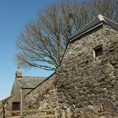
Dartmoor National Park, National park in Devon, England

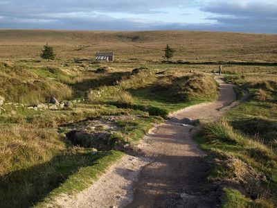
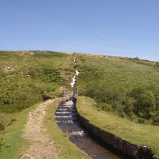
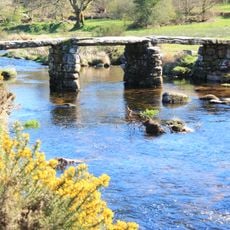
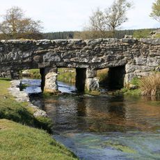
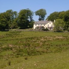
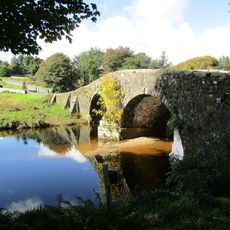
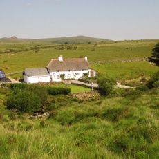
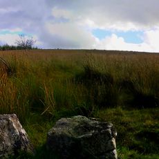
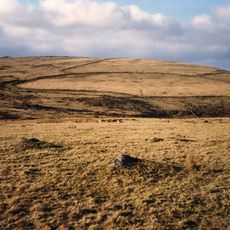
Dartmoor National Park encompasses 368 square miles of expansive moorlands, deep river valleys, granite tors, and heather-covered hills that provide diverse habitats for rare wildlife species throughout the Devon countryside.

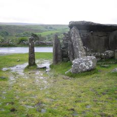
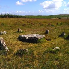
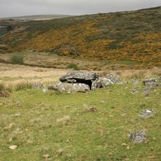
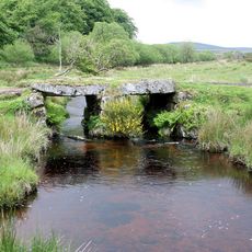
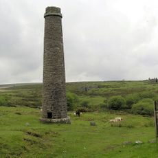
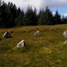
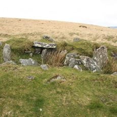
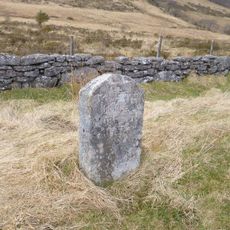
Established as a protected area in 1951, Dartmoor contains the most important Bronze Age archaeological sites in western Europe, including numerous stone circles, ancient hut circles, and Neolithic burial sites dating back thousands of years.

The park inspired Sir Arthur Conan Doyle's Sherlock Holmes stories and Agatha Christie's detective tales, while local folklore includes legends of phantom hounds and spectral figures that continue to attract visitors interested in mystical narratives.

Visitors can access Dartmoor through three visitor centers that provide maps, guided walks, and educational programs, with train stations in nearby Exeter, Newton Abbot, and Plymouth offering convenient transportation from London within four hours.

Dartmoor hosts the world's largest land slug, the Black Ash Slug, which can exceed 20 centimeters in length, alongside the rare Bog Hoverfly that exists nowhere else on Earth.

Location: Devon

Inception: 1951

Website: http://dartmoor-npa.gov.uk

GPS coordinates: 50.57191,-3.92069

Latest update: July 25, 2025 20:35

Around this place
Show the full map
Wistman's Wood
United Kingdom

Wistman's Wood

3 km
Devonport Leat
United Kingdom

Devonport Leat

3.1 km
Postbridge Clapper Bridge
United Kingdom

Postbridge Clapper Bridge

2.6 km
Bellever Tor Cairns
United Kingdom

Bellever Tor Cairns

217 m
Dunnabridge Pound
United Kingdom

Dunnabridge Pound

2 km
Ring cairn with cist on Lakehead Hill
United Kingdom

Ring cairn with cist on Lakehead Hill

1.1 km
Roundy Park prehistoric enclosure and cairn with cist, 560m north east of Archerton
United Kingdom

Roundy Park prehistoric enclosure and cairn with cist, 560m north east of Archerton

3.2 km
Church of St Gabriel
United Kingdom

Church of St Gabriel

3 km
Clapper Bridge Across Walla Brook On Road From Cator To Bellever
United Kingdom

Clapper Bridge Across Walla Brook On Road From Cator To Bellever

3.1 km
Prince Hall
United Kingdom

Prince Hall

2.7 km
Old Bridge
United Kingdom

Old Bridge

3.6 km
Powder Mills Clapper Bridge
United Kingdom

Powder Mills Clapper Bridge

1.4 km
Bridge At Sx 625738
United Kingdom

Bridge At Sx 625738

3 km
Clapper Bridge At Sx 672749
United Kingdom

Clapper Bridge At Sx 672749

3.5 km
Smith Hill Farm
United Kingdom

Smith Hill Farm

1.4 km
Kraps Ring
United Kingdom

Kraps Ring

1.7 km
Broadun prehistoric enclosed settlement, 780m NNW of Archerton
United Kingdom

Broadun prehistoric enclosed settlement, 780m NNW of Archerton

3.5 km
Post Bridge
United Kingdom

Post Bridge

2.6 km
Powder Mills
United Kingdom

Powder Mills

1.6 km
Barn Approximately 10 Metres To South-East Of Dunnabridge Pound Farmhouse
United Kingdom

Barn Approximately 10 Metres To South-East Of Dunnabridge Pound Farmhouse

1.9 km
Five cairns, two stone alignments and three cists, forming part of a ritual complex on Lakehead Hill
United Kingdom

Five cairns, two stone alignments and three cists, forming part of a ritual complex on Lakehead Hill

1.2 km
Cairn and cist 875m north west of Arch Tor
United Kingdom

Cairn and cist 875m north west of Arch Tor

2.7 km
Milestone, half mile SW of Postbridge, opp. Plantations
United Kingdom

Milestone, half mile SW of Postbridge, opp. Plantations

1.7 km
Milestone, Higher Cherrybrook Bridge, 200m SW of bridge, 300m from turn to Pottery
United Kingdom

Milestone, Higher Cherrybrook Bridge, 200m SW of bridge, 300m from turn to Pottery

979 m
Milestone, 300m W of turning to Prince Hall Hotel
United Kingdom

Milestone, 300m W of turning to Prince Hall Hotel

2.5 km
Milestone, St Gabriel's Church, 80m NE of church, opp. Beechwood
United Kingdom

Milestone, St Gabriel's Church, 80m NE of church, opp. Beechwood

3.1 km
Milestone, Cherry Brook Hotel, 60m W of entrance
United Kingdom

Milestone, Cherry Brook Hotel, 60m W of entrance

2.1 km
Milestone, between Cherry Brook Lower and Dunnabridge
United Kingdom

Milestone, between Cherry Brook Lower and Dunnabridge

1.6 km
Show the full map

Reviews

Visited this place? Tap the stars to rate it and share your experience / photos with the community! Try now! You can cancel it anytime.

« Dartmoor National Park: National park in Devon, England » is provided by Around Us (aroundus.com). Images and texts are derived from Wikimedia project under a Creative Commons license. You are allowed to copy, distribute, and modify copies of this page, under the conditions set by the license, as long as this note is clearly visible.

Discover hidden gems everywhere you go!

From secret cafés to breathtaking viewpoints, skip the crowded tourist spots and find places that match your style. Our app makes it easy with voice search, smart filtering, route optimization, and insider tips from travelers worldwide. Download now for the complete mobile experience.

Around Us App Screenshot

A unique approach to discovering new places

Le Figaro

All the places worth exploring

France Info

A tailor-made excursion in just a few clicks

20 Minutes