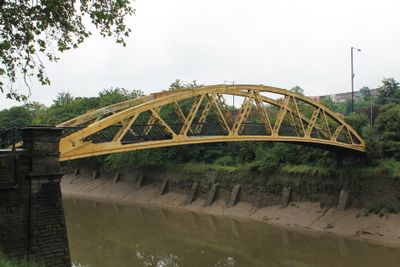
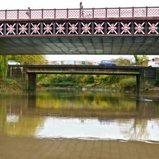
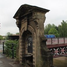
Langton Street Bridge, Grade II listed footbridge in Bristol, England.
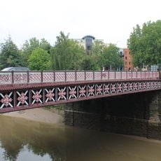
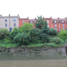
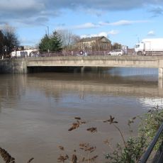
Langton Street Bridge is a footbridge crossing the New Cut of the River Avon in Bristol, built from squared Pennant rubble with elliptical arches and diagonal braces. Crossed railings provide safety as pedestrians walk across the water at this point.
Built in 1883 as a temporary crossing during the construction of Bedminster Bridge, the structure was later relocated to its current location on Langton Street. It represents a piece of Bristol's infrastructure development from that era.
The bridge earned its informal name 'Banana Bridge' because of its curved shape, which led to its yellow and black painting. These colors have become a recognizable feature that locals associate with this crossing.
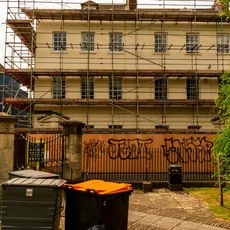
The bridge is currently undergoing extensive restoration work, so visitors should use alternative crossings. Bath Bridge and Bedminster Bridge offer nearby alternate routes for pedestrians in the area.
Although Langton Street was destroyed during World War II bombing raids, the bridge structure remained intact and continues to function. This makes it a rare survivor that endured the destruction of that period.
Location: City of Bristol
GPS coordinates: 51.44566,-2.58534
Latest update: December 14, 2025 09:45
St Mary Redcliffe
424 m
British Empire and Commonwealth Museum
382 m
Bristol General Hospital
523 m
Bristol Jamia Mosque
461 m
Redcliffe Shot Tower
468 m
Bedminster Bridge
407 m
The Ship Inn
328 m
War Memorial, St Mary Redcliffe
418 m
Former Glass Cone, Hilton Hotel
297 m
Chatterton's House
427 m
Sign Post And Three Lamps, At Intersection With Wells Road Sign Post At Three Lamps, At Intersection With Bath Road
503 m
Bedminster Old Bridge
439 m
Fountain
269 m
1 and 2, Colston Parade
346 m
6-9, Colston Parade
386 m
Bristol And Exeter Building
420 m
Hermitage in Quaker burial ground near St Mary Redcliffe
506 m
Fry's House Of Mercy
364 m
Balustrade, Wall And Well Head 5 Metres West Of Church Of St Mary Redcliffe
450 m
Numbers 42 To 58 (Even) And Attached Front Basement Area Railings
342 m
Number 51 And Attached Basement Area Wall
400 m
Drinking Fountain Approximately 3 Metres North West Of Bedminster Bridge
441 m
Numbers 60, 62 And 64 And Attached Front Basement Area Railings
308 m
Bedminster New Bridge
373 m
Zion House And Attached Railings And Gateways
500 m
3, 4 And 5, Colston Parade
360 m
Bristol Old Station
441 m
St Mary Redcliffe And Temple School And Attached Sheds
480 mVisited this place? Tap the stars to rate it and share your experience / photos with the community! Try now! You can cancel it anytime.
Discover hidden gems everywhere you go!
From secret cafés to breathtaking viewpoints, skip the crowded tourist spots and find places that match your style. Our app makes it easy with voice search, smart filtering, route optimization, and insider tips from travelers worldwide. Download now for the complete mobile experience.
A unique approach to discovering new places❞
— Le Figaro
All the places worth exploring❞
— France Info
A tailor-made excursion in just a few clicks❞
— 20 Minutes