Chains Farmhouse, farmhouse in Sundridge with Ide Hill, Sevenoaks, Kent, UK
Location: Sundridge with Ide Hill
GPS coordinates: 51.23822,0.13211
Latest update: November 20, 2025 11:03
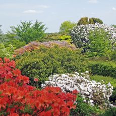
Emmetts Garden
1.7 km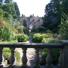
Great Comp Garden
1.7 km
Stubbs Wood Country Park
961 m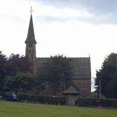
Church of St Mary at South End of Village Green
822 m
The Cock Inn
981 m
Tan House
1.4 km
The Red Lion Public House
1.2 km
Bridge Over Moat To South Of Henden Manor House
812 m
Great Norman Street Farmhouse
1.8 km
Oak Lodge Farmhouse
1 km
The Old Vicarage
745 m
Old School House
1.2 km
Oakwood Lodge
167 m
The Oast House, Henden Manor
907 m
Piggott's Cottage
1.7 km
Gates And Piers To West Of Oakwood Lodge
178 m
Anchor Cottage
955 m
Ide Hill Junior School
1 km
Henden Manor House
832 m
Ivy Cottage (Hanging Bank)
535 m
South View
1.4 km
Scords Farmhouse
1.7 km
Yorkshill Farmhouse
1 km
K6 Telephone Kiosk
963 m
Scenic viewpoint
1.7 km
Observation Point
1.7 km
Scenic viewpoint
1.6 km
Scenic viewpoint
1.6 kmReviews
Visited this place? Tap the stars to rate it and share your experience / photos with the community! Try now! You can cancel it anytime.
Discover hidden gems everywhere you go!
From secret cafés to breathtaking viewpoints, skip the crowded tourist spots and find places that match your style. Our app makes it easy with voice search, smart filtering, route optimization, and insider tips from travelers worldwide. Download now for the complete mobile experience.

A unique approach to discovering new places❞
— Le Figaro
All the places worth exploring❞
— France Info
A tailor-made excursion in just a few clicks❞
— 20 Minutes