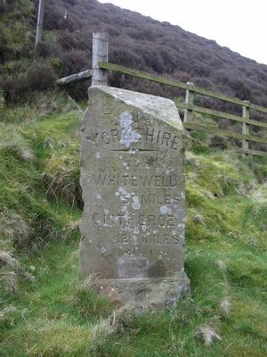
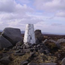
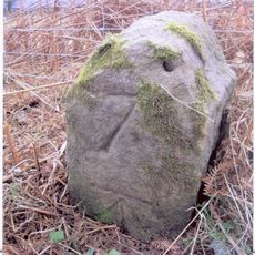
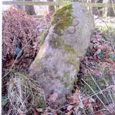
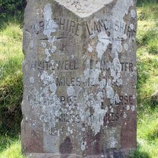
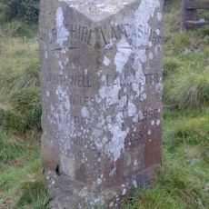
The Grey Stone of Trough, Boundary marker in Bowland Forest High, England.
The Grey Stone of Trough is a triangular sandstone marker set in Bowland Forest High with carved inscriptions on its faces. The surface displays distance measurements pointing travelers toward four neighboring villages.
The stone was installed in 1897 to mark the county boundary between Lancashire and West Riding of Yorkshire. Its placement reflected new administrative divisions that reshaped the territorial organization of the Lordship of Bowland.
The stone carries names of villages that were focal points in travelers' journeys through this region. These place names show which destinations mattered to people and how they understood their local geography.
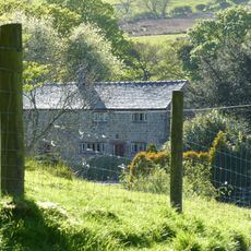
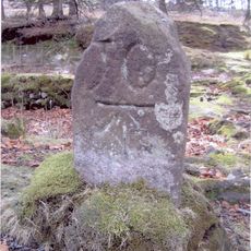
The marker stands on open moorland at a higher elevation, accessible year-round in all weather conditions. Sturdy footwear is advisable due to uneven ground and wet terrain typical of upland areas.
The carved distances appear surprisingly short by modern standards, revealing how travelers of the era perceived proximity differently than we do today. These measurements offer insight into how people experienced geography in a slower-moving world.
Location: Over Wyresdale
Location: Bowland Forest High
Part of: political border
GPS coordinates: 53.97198,-2.57744
Latest update: December 14, 2025 16:42
British hardened field defences of World War II
4 km
Abbeystead House
5.7 km
Ward's Stone
6.6 km
Fair Snape Fell
6.3 km
Wolfhole Crag
5 km
Hawthornthwaite Fell
4.6 km
The Inn at Whitewell
7.2 km
Grizedale Bridge
6.1 km
Dunsop Bridge
4.8 km
Church of St Michael
7.2 km
Giddy Bridge
7 km
Burholme Bridge
6.2 km
Church of St Hubert
4.2 km
Bowland War Memorial
4.7 km
Hareden Farmhouse
3.1 km
Burholme Farmhouse
5.9 km
Milestone at SD 657 499, approximately 150 metres south east of school
4.7 km
Milestone
5.6 km
Farm store to south-east of southern farmhouse
6.4 km
Higher Birkett Farmhouse and buildings adjoining to the east
7.2 km
Southern Farmhouse
6.4 km
Higher Whitewell Farmhouse
6.9 km
Milestone
4 km
New Laund Farmhouse
6.8 km
Milestone, ExYW at old county boundary Yorkshire/Lancashire
69 m
Lower Birkett Farmhouse
7.2 km
Milestone, E of Tower Lodge
1.5 km
Milestone, Trough of Bowland
25 mVisited this place? Tap the stars to rate it and share your experience / photos with the community! Try now! You can cancel it anytime.
Discover hidden gems everywhere you go!
From secret cafés to breathtaking viewpoints, skip the crowded tourist spots and find places that match your style. Our app makes it easy with voice search, smart filtering, route optimization, and insider tips from travelers worldwide. Download now for the complete mobile experience.
A unique approach to discovering new places❞
— Le Figaro
All the places worth exploring❞
— France Info
A tailor-made excursion in just a few clicks❞
— 20 Minutes