Hawthornthwaite Fell, Mountain summit in Forest of Bowland, England
Description
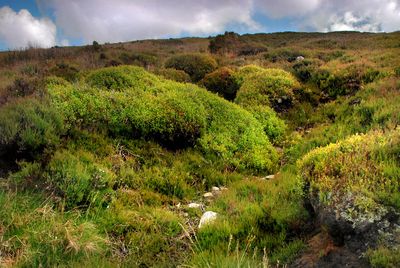
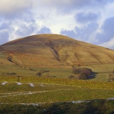
Hawthornthwaite Fell is a mountain summit in the Forest of Bowland that rises to 479 meters above sea level. The slopes are covered in heather on the northern side, while the top spreads out into boggy ground where water collects.
History
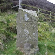
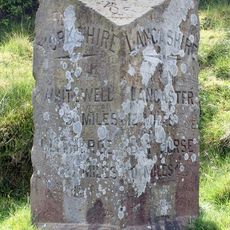
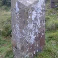
The fell originally lay within Yorkshire's West Riding before the 1974 boundary changes moved it to Lancashire. This administrative shift joined the moorland to a new county with different governance structures.
Culture
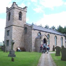
The fell sits within a moorland managed for game birds, where you can see the working landscape that has shaped these hills for generations.
Practical
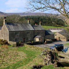
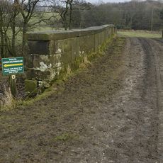
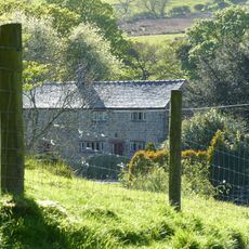
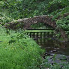
The main route to the summit starts at Stoops Bridge near Abbeystead and passes through Hawthornthwaite Farm on the climb up. Be prepared for wet, boggy conditions underfoot and bring suitable footwear and waterproof clothing.
Did you know?
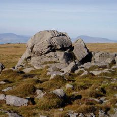
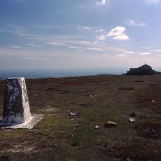
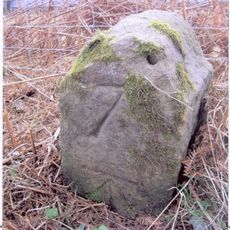
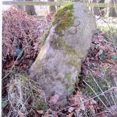
The survey marker at the top lies flat and points westward, surrounded by large concrete blocks that originally stood upright until 2005. These remnants show the long history of surveying work that has been carried out across these hills.
AroundUs brings together thousands of curated places, local tips, and hidden gems, enriched daily by 60,000 contributors worldwide. Discover all places nearby (United Kingdom).
Abbeystead House
3.2 km
Wyresdale Park
7.4 km
Ward's Stone
7.1 km
Parlick
6.7 km
Fair Snape Fell
4.6 km
Christ Church, Over Wyresdale
4 km
St Mark's Church, Dolphinholme
6.5 km
The Grey Stone of Trough
4.6 km
Grizedale Bridge
4 km
Bleasdale Circle enclosed Bronze Age urnfield
5.5 km
Pennine Tower
7.7 km
Church of St John Evangelist
6.6 km
Church of St.Eadmor
6 km
Wolfen Hall
7.3 km
Church of St Hubert
7.6 km
Bridge Over River Wyre In Grounds Of Wyreside Hall
6.2 km
Post Office, And Corless Cottages
6.6 km
Hareden Farmhouse
6.2 km
Wyreside Hall, Coach House, And Ice House
5.8 km
Over Wyresdale War Memorial
4.1 km
Farm store to south-east of southern farmhouse
7.6 km
Milestone
3.7 km
Southern Farmhouse
7.6 km
Milestone
2.7 km
Brooks Farm packhorse bridge
5.8 km
Milestone, ExYW at old county boundary Yorkshire/Lancashire
4.6 km
Milestone, Higher Moor Head
6.3 km
Milestone, Trough of Bowland
4.6 kmDiscover hidden gems everywhere you go!
From secret cafés to breathtaking viewpoints, skip the crowded tourist spots and find places that match your style. Our app makes it easy with voice search, smart filtering, route optimization, and insider tips from travelers worldwide. Download now for the complete mobile experience.
A unique approach to discovering new places❞
— Le Figaro
All the places worth exploring❞
— France Info
A tailor-made excursion in just a few clicks❞
— 20 Minutes