Fair Snape Fell, Mountain summit in Forest of Bowland, England
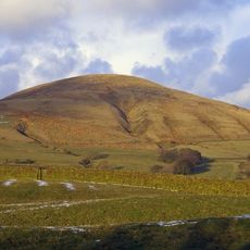
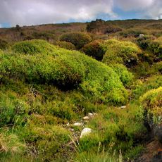
Fair Snape Fell is a mountain summit in Forest of Bowland with a height of about 520 meters, featuring grass-covered slopes and peat formations across its terrain. The peak offers open views across rolling moorland and surrounding ridges from its top.
The fell served as military training grounds during World War II, leaving behind unexploded ordnance in certain areas. This wartime use connected these remote moors to a broader historical period that shaped many British landscapes.
The name comes from Old English, where 'snape' refers to pasture, reflecting how sheep farming once shaped this hill. Visitors can observe how the slopes gently descend toward surrounding valleys, a reminder of the grazing lands that defined this area for centuries.
The summit can be reached from several directions: from Parlick to the south, Saddle Fell to the east, or Bleasdale valley to the west. The paths are generally clear and well-walked, with the best views coming on clear days when distant ridges become visible.
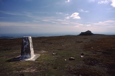
A trig point and large cairn mark the western slope, which many walkers believe to be the true summit. The actual highest point sits about 700 meters to the northeast of these structures, making it an easy spot to miss.
The community of curious travelers
AroundUs brings together thousands of curated places, local tips, and hidden gems, enriched daily by 60,000 contributors worldwide.