Obelisk At Umberslade Park, Grade II listed obelisk in Tanworth-in-Arden, England.
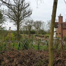
The Obelisk at Umberslade Park is a 21 meter tall limestone structure with a square-based design built in 1749. The monument rests on a stepped plinth with decorative mouldings and features a ball finial crowning its peak.
The structure was built in 1749 during a redesign of the estate when formal gardens gave way to new architectural features. It has survived as part of the property's evolving landscape design for nearly three centuries.
The obelisk stands within the grounds of a country estate where it serves as a focal point in the landscaped park. Visitors walking through the grounds can appreciate how the structure anchors the designed views across the property.
The obelisk sits within the estate grounds and is visible from public access points around the park. Walking through the landscape gives visitors the best perspective on how the monument fits into its surroundings.
A metal spike topped with a star once crowned the obelisk, making it a distinctive landmark visible across the landscape. This decorative peak has since been removed but once served as a notable symbol of the estate.
Location: Tanworth-in-Arden
Height: 21 m
Made from material: limestone
Website: https://historicengland.org.uk/listing/the-list/list-entry/1382419
GPS coordinates: 52.34229,-1.78796
Latest update: December 10, 2025 20:09
Packwood House
2.9 km
Umberslade Hall
930 m
Church of St Mary Magdalene
3.4 km
Umberslade Baptist Church
516 m
Church of Saint Thomas
918 m
Church of St Mary the Virgin, Lapworth
1.8 km
Church of St Patrick
4 km
Old Church of St Mary
4.3 km
Church of St Giles
2.7 km
War Memorial at Christ Church Baptist Church
529 m
Bulls Head Inn
3.5 km
Chest Tomb Approximately 12 Metres South Of Chancel Of The Church Of St Mary Magdalene
3.4 km
Hockley Heath War Memorial at the Junction of the A3400 and the B4439
1.2 km
Monument To Richard Lea 1 Metre South Of South Porch Of St Mary Magdalene
3.4 km
Apsley House
3.4 km
Ivy Stores And Church View And The Old Malt Shovel
3.5 km
Chest Tomb 9 Metres South Of Chancel Of Church Of St Mary Magdalene
3.3 km
Bank House A And Bank House B
3.5 km
Chest Tomb Approximatley 2 Metres South Of Chancel Of Church Of St Mary Magdalene
3.4 km
K6 Telephone Kiosk At Ngr 1127 7049
3.4 km
The Bell Inn And Adjoining House To West
3.4 km
Brome Hall Bridge (Number 35) Stratford Upon Avon Canal
4.2 km
Tanworth-in-Arden War Memorial
3.4 km
Chest Tomb Approximately 11 Metres South Of South Door Of Church Of St Mary Magdalene
3.4 km
Moated site and fishpond at Salter Street Farm
3.5 km
Brome Hall Farmhouse
4 km
Oxstall House And Arden House
3.4 km
Engineering Works Building Approximately 5 Metres West Of Lock 21, Stratford Upon Avon Canal
4.1 kmVisited this place? Tap the stars to rate it and share your experience / photos with the community! Try now! You can cancel it anytime.
Discover hidden gems everywhere you go!
From secret cafés to breathtaking viewpoints, skip the crowded tourist spots and find places that match your style. Our app makes it easy with voice search, smart filtering, route optimization, and insider tips from travelers worldwide. Download now for the complete mobile experience.
A unique approach to discovering new places❞
— Le Figaro
All the places worth exploring❞
— France Info
A tailor-made excursion in just a few clicks❞
— 20 Minutes