Enable Location

We need your location to show you interesting places around you

Discover nearby places

Find interesting locations and hidden gems around you

Precise directions

Get accurate directions and distances to places

Your location is never shared with other users. It's only used when you tap the location button.

Acton swing bridge

Log in to your account

Start exploring — it's free

Trusted by 61,553 travelers worldwide

Continue with Google
Continue with Apple
or

We will send you a code to connect

By continuing, you accept our Terms and Conditions and our Privacy Policy

Check your inbox

We've sent a pincode in your inbox. Please enter the code below.

Acton swing bridge

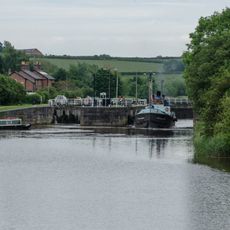
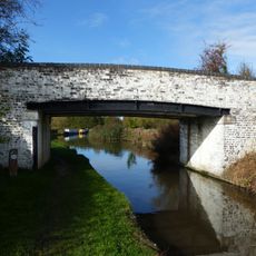
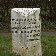
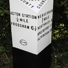
Acton swing bridge, Steel swing bridge in Acton Bridge, England

Description

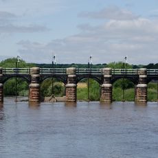
Acton swing bridge is a steel structure spanning the River Weaver, designed to rotate and allow road traffic and river vessels to use the crossing simultaneously. Twin riveted steel trusses form its framework, supporting both the A49 trunk road and the navigable waterway below.

History

The current steel structure was completed in 1933, replacing a stone bridge built during the 18th century that could only handle light loads. This shift to steel enabled the bridge to support heavier vehicles and growing river traffic.

Culture

The bridge represents the engineering advancements of early 20th century Britain, marking the transition from traditional stone structures to modern steel designs.

Practical

The bridge operates daily as a main road crossing, connecting communities on both sides of the river. When river traffic requires passage, the bridge rotates, which regular users learn to anticipate in their travel plans.

Did you know?

The structure operates on a mass concrete pontoon chamber, with its original design by J.A. Saner incorporating an empty boiler shell for manual operation.

GPS coordinates
53.27988,-2.60070
Latest update
December 14, 2025 11:24

AroundUs brings together thousands of curated places, local tips, and hidden gems, enriched daily by 60,000 contributors worldwide. Discover all places nearby (United Kingdom).

Around this place
Dutton Viaduct
United Kingdom

Dutton Viaduct

1.8 km
Dutton Horse Bridge
United Kingdom

Dutton Horse Bridge

1.8 km
Dutton Locks
United Kingdom

Dutton Locks

1.6 km
St Michael and All Angels Church, Little Leigh
United Kingdom

St Michael and All Angels Church, Little Leigh

1.5 km
Methodist Church, Weaverham
United Kingdom

Methodist Church, Weaverham

2.3 km
Dutton Park Farm Nature Reserve
United Kingdom

Dutton Park Farm Nature Reserve

2.2 km
The Wheatsheaf Hotel
United Kingdom

The Wheatsheaf Hotel

2.3 km
Trent and Mersey Canal bridge number 211
United Kingdom

Trent and Mersey Canal bridge number 211

1.5 km
Bradley Meadow Bridge (Canal Bridge Number 206)
United Kingdom

Bradley Meadow Bridge (Canal Bridge Number 206)

1.1 km
Trent and Mersey Canal bridge number 210
United Kingdom

Trent and Mersey Canal bridge number 210

522 m
Pepper Street
United Kingdom

Pepper Street

923 m
The Holly Bush Public House
United Kingdom

The Holly Bush Public House

1.1 km
Raintub Cottage
United Kingdom

Raintub Cottage

2.3 km
Trent and Mersey Canal Milepost at NGR 602 765
United Kingdom

Trent and Mersey Canal Milepost at NGR 602 765

517 m
Dutton Sluice 150 metres north east of Dutton Lock
United Kingdom

Dutton Sluice 150 metres north east of Dutton Lock

1.6 km
Trent and Mersey Canal, canal milepost south east of bridge number 206 at SJ61017538
United Kingdom

Trent and Mersey Canal, canal milepost south east of bridge number 206 at SJ61017538

1.2 km
Bartington Hall Farmhouse
United Kingdom

Bartington Hall Farmhouse

416 m
24, West Road
United Kingdom

24, West Road

2.1 km
Trent and Mersey Canal Willowgreen Bridge (Canal Bridge Number 208)
United Kingdom

Trent and Mersey Canal Willowgreen Bridge (Canal Bridge Number 208)

413 m
Ivy House
United Kingdom

Ivy House

2.3 km
Guidepost at the junction of Cliff Road, Hill Top Road and Acton Lane
United Kingdom

Guidepost at the junction of Cliff Road, Hill Top Road and Acton Lane

792 m
14 and 16, High Street
United Kingdom

14 and 16, High Street

2.3 km
12, High Street
United Kingdom

12, High Street

2.3 km
Milepost, N of Merebank
United Kingdom

Milepost, N of Merebank

1.3 km
Milepost, Runcorn Road, Smithey Lane jct
United Kingdom

Milepost, Runcorn Road, Smithey Lane jct

1.4 km
13, High Street
United Kingdom

13, High Street

2.3 km
Milepost, The Woodlands
United Kingdom

Milepost, The Woodlands

1.6 km
Milepost, Brakeley Bank Farm, opp Hole House Lane
United Kingdom

Milepost, Brakeley Bank Farm, opp Hole House Lane

2.2 km
Show the full map
« Acton swing bridge - Steel swing bridge in Acton Bridge, England » is provided by Around Us (aroundus.com). Images and texts are derived from Wikimedia project under a Creative Commons license. You are allowed to copy, distribute, and modify copies of this page, under the conditions set by the license, as long as this note is clearly visible.

Discover hidden gems everywhere you go!

From secret cafés to breathtaking viewpoints, skip the crowded tourist spots and find places that match your style. Our app makes it easy with voice search, smart filtering, route optimization, and insider tips from travelers worldwide. Download now for the complete mobile experience.

Around Us App Screenshot

A unique approach to discovering new places

Le Figaro

All the places worth exploring

France Info

A tailor-made excursion in just a few clicks

20 Minutes

Around Us
Travel Guide & Maps
Download

Send to your phone

QR Code
1

Open the camera app on your mobile.

2

Point at the QR code with your camera. A notification will appear.

3

Tap the notification to open the link.