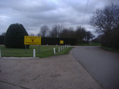
Watford Training Ground, Professional football training facility in St Albans, England
Watford Training Ground is a professional football facility located in St Albans, England. It contains multiple training pitches with various surfaces, specialized coaching areas, and support facilities designed to develop both young and senior players.
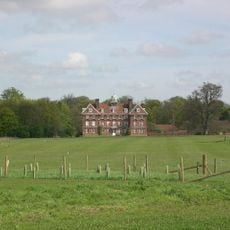
The facility was originally developed as a training ground for Arsenal Football Club before Watford FC took over its operations. This transition marked a significant shift in the club's approach to player development infrastructure.
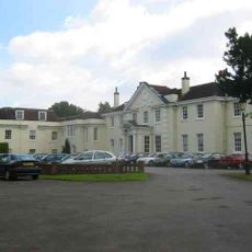
The training ground serves as a development center for youth academies and first-team players, contributing to local football education in Hertfordshire.
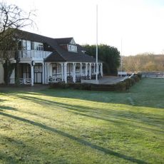
The complex is fully equipped with training centers, medical facilities, and indoor training domes for year-round use. Keep in mind that this is an active professional facility, so public access may be restricted during regular operations.
The location is shared with another major football training center, making the area a concentrated hub for professional development. This proximity creates unusual opportunities for comparison and exchange between different professional organizations.
GPS coordinates: 51.71056,-0.28000
Latest update: December 10, 2025 16:24
De Havilland Aircraft Museum
614 m
Tyttenhanger House
1.9 km
All Saints Pastoral Centre
1.4 km
Shenley Hall
1.8 km
Denis Compton Oval
2.6 km
Broad Colney Lakes
1.3 km
Redwell Wood
2.4 km
St Botolphs
1.1 km
Church of St Martin
2.3 km
Church of St Peter
1.3 km
The Green Dragon Public House
1.2 km
The Golden Lion Public House
1.6 km
Telfords Bridge
1.2 km
Salisbury Hall
611 m
The Bull Public House
1.1 km
Barn About 15 Metres West Of Rabley Park Farm House
2.2 km
London Coal Duty Marker On East Side Of Broad Colney Bridge
1.5 km
Rabley Park Farm House
2.2 km
Milestone On Verge At Junction With Haseldine Road
1.8 km
1-5, High Street
1.2 km
Shenley War Memorial, Hertfordshire
2 km
London Colney War Memorial
1.6 km
Milestone About 50 Metres East Of Ridge Hill Stud
1.5 km
London Coal Duty Marker On South Side Of Road Near Telford's Bridge
1.2 km
London Coal Duty Marker On Verge Near Number 67
1.7 km
Milestone About 300 Metres South West Of Redwell Wood Farm House
1.5 km
Barn About 60 Metres North West Of Coursers Farm House
2.5 km
Colne House
1.1 kmVisited this place? Tap the stars to rate it and share your experience / photos with the community! Try now! You can cancel it anytime.
Discover hidden gems everywhere you go!
From secret cafés to breathtaking viewpoints, skip the crowded tourist spots and find places that match your style. Our app makes it easy with voice search, smart filtering, route optimization, and insider tips from travelers worldwide. Download now for the complete mobile experience.
A unique approach to discovering new places❞
— Le Figaro
All the places worth exploring❞
— France Info
A tailor-made excursion in just a few clicks❞
— 20 Minutes