Kirtlington Quarry, Geological Site of Special Scientific Interest in Kirtlington, England
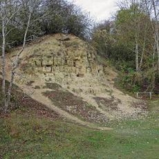
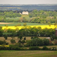
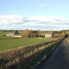
Kirtlington Quarry is a nature reserve containing Middle Jurassic limestones and clays formed about 165 million years ago when this region lay beneath a tropical sea. The exposed rock layers hold many fossils of marine animals and reptiles from that distant geological period.
From 1907 to 1928, limestone and clay were extracted here for cement production. After mining ceased, the site transformed into a nature reserve and became an important location for geological research.
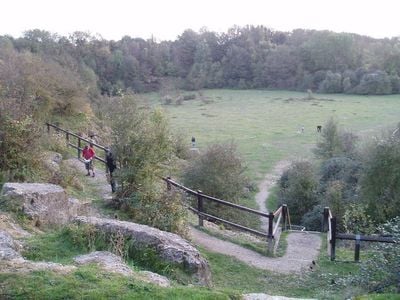
Researchers and fossil enthusiasts visit this location to examine remains from the Jurassic period that lie exposed in the walls. For visitors, walking through the quarry provides direct contact with layers of rock that show what Oxfordshire looked like millions of years ago.
Visitors should follow designated paths and observe safety guidelines, as the quarry walls can be steep and unstable. Wear sturdy footwear and take care on wet surfaces, as rain can make the ground slippery.
This location holds the richest collection of Middle Jurassic mammal fossils anywhere in the world. Paleontologists have discovered remains of early mammals that show how small creatures lived in a world dominated by large reptiles.
GPS coordinates: 51.87500,-1.28400
Latest update: December 13, 2025 17:08
Bletchingdon Park
2.1 km
White Limestone Formation
0 m
Church of St Nicholas
1.8 km
Church of St Giles, Bletchingdon
2.2 km
Church of St Mary, Kirtlington
722 m
Park Gate House
2.3 km
The Blacks Head Public House
2.3 km
Oxford Canal Bridge At Pigeons Lock
836 m
The Dashwood Arms Public House
625 m
Canal Bridge Approximately 60 Metres West Of The Rock Of Gibraltar Public House
2.1 km
Old Red Lion
2.4 km
Rock Of Gibraltar Public House
2 km
The Oxford Arms Public House And Adjoining Cottage
593 m
Kirtlington Park
1.4 km
The Post Office Stores
2.4 km
Squirrel's Drey
2.4 km
Lower Whitehill Farmhouse
2 km
The Manor House And Attached Outbuilding Range
670 m
Chest tomb approximately 6 metres east of chancel of Church of St Giles
2.2 km
The Row
2.4 km
Monk's Head
2.3 km
The Malt House
2.4 km
Village Farmhouse
2.4 km
Glendale
2.4 km
Oxford Canal Northbrook Bridge (That Part In Kirtlington Civil Parish)
2.1 km
Milestone, Church Road; end of drive to Church Road House
2.3 km
Bletchingdon Park, stables and attached walls approximately 150 metres east north east of Bletchingdon Park
2.2 km
Milestone, by Church, on lane by Bletchingdon Park, in front of wall around church
2.2 kmVisited this place? Tap the stars to rate it and share your experience / photos with the community! Try now! You can cancel it anytime.
Discover hidden gems everywhere you go!
From secret cafés to breathtaking viewpoints, skip the crowded tourist spots and find places that match your style. Our app makes it easy with voice search, smart filtering, route optimization, and insider tips from travelers worldwide. Download now for the complete mobile experience.
A unique approach to discovering new places❞
— Le Figaro
All the places worth exploring❞
— France Info
A tailor-made excursion in just a few clicks❞
— 20 Minutes