Deep Dale, Protected scientific area in King Sterndale, United Kingdom.
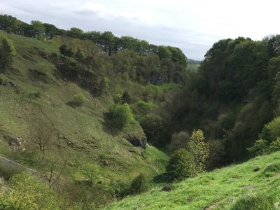
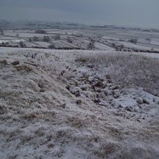
Deep Dale is a steep-sided gorge near Buxton that stretches for several kilometers with sections dropping to significant depths within a surrounding agricultural plateau. The site contains several caves including Thirst House Cave and is fed by seasonal springs.
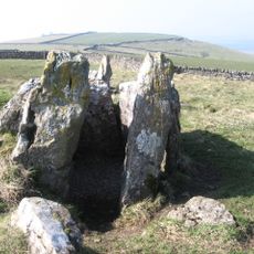
The site gained prominence in the 1880s after the discovery of a bear skull in Thirst House Cave, prompting excavations by local residents Micah Salt and Robert Milletts. These investigations revealed numerous Roman artifacts from earlier occupation.
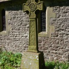
The place is deeply tied to local folklore, particularly the Thirst House Cave which bears a name rooted in a mythological cave-dwelling goblin from regional legends. Visitors can sense these historical connections to regional storytelling as they explore the dale.
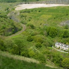
Access is available via the Wye Dale car park where visitors can explore the valley using the Midshires Way footpath network. The trail system allows exploration of different sections and the caves in the area.
The valley contains a winterbourne stream that flows only during the cold months, fed by the Deepdale Side Resurgence spring. This seasonal water system is an unusual feature that shapes the valley's water dynamics.
Location: King Sterndale
Location: Chelmorton
GPS coordinates: 53.24000,-1.85600
Latest update: December 12, 2025 14:25
Five Wells
2.7 km
Blackwell Mill
1.9 km
Wormhill Hall
3.8 km
Duke's Drive Viaduct, Buxton
3.3 km
Christ Church
465 m
Church of St John the Baptist
2.2 km
Pictor Hall
1.2 km
The Brindley Memorial Fountain
3.8 km
War Memorial
3.3 km
Green Farmhouse
780 m
Tombstone of Micah Salt in Buxton Cemetery, Tomb Number 2798
3 km
Cherry Tree Farmhouse and adjoining house
3.8 km
Staden earthwork
2.9 km
Chapelsteads Farmhouse
3.8 km
House And Cottages To The South West Of Green Farmhouse
747 m
Hassop Farmhouse
3.6 km
Barn to east of Townend Farmhouse
2.2 km
Highcliffe Farmhouse And Attached Barn
3.5 km
Outer Gate Piers At Wormhill Hall
3.7 km
Outbuilding To The South Of Chapelsteads Farmhouse
3.7 km
Churchyard cross 10 metres south of south transept of church
2.2 km
Village Cross
784 m
Lodge to Pictor Hall
1.2 km
Milestone, SE of Brierlow Bar
2 km
King Sterndale War Memorial
455 m
Two bowl barrows on Chelmorton Low
1.9 km
Buxton Cemetery Cross of Sacrifice, Derbyshire
3 km
Morrisons
3.5 kmVisited this place? Tap the stars to rate it and share your experience / photos with the community! Try now! You can cancel it anytime.
Discover hidden gems everywhere you go!
From secret cafés to breathtaking viewpoints, skip the crowded tourist spots and find places that match your style. Our app makes it easy with voice search, smart filtering, route optimization, and insider tips from travelers worldwide. Download now for the complete mobile experience.
A unique approach to discovering new places❞
— Le Figaro
All the places worth exploring❞
— France Info
A tailor-made excursion in just a few clicks❞
— 20 Minutes