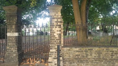
Lauriston Road Cemetery, Jewish cemetery in Hackney, England.
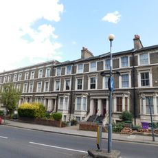
Lauriston Road Cemetery is a Jewish burial ground in Hackney with numerous headstones and chest tombs scattered beneath semi-mature trees. The site has a quiet, green character as vegetation and gravestones coexist throughout the grounds.
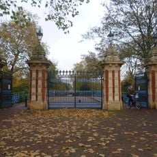
The site was founded in 1788 as Grove Street Cemetery to serve the local Jewish community. It closed to new burials in 1886 as the surrounding area developed.
The gravestones here reflect Jewish burial customs and how this community integrated into British society. The stones and inscriptions from the 18th and 19th centuries show the traditions people brought with them and how they adapted them over time.
Visits require advance appointments and should be arranged beforehand. The location is accessible by Underground to Mile End station, followed by a local bus journey.
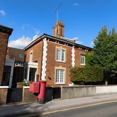
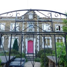
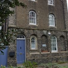
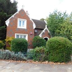
The lodge was built in 1870 and has served different purposes over the years, including as a doctor's office. This small building shows how the cemetery adapted to changing community needs.
Location: London Borough of Hackney
Location: Hackney
GPS coordinates: 51.53735,-0.04357
Latest update: December 14, 2025 14:24
Victoria Park
388 m
Baroness Burdett Coutts Drinking Fountain
272 m
St James-the-Less, Bethnal Green
683 mChisenhale Dance Space
556 m
Old Ford Lock
566 m
Church of St John of Jerusalem
383 m
War memorial at St John of Jerusalem Church
375 m
Hampden Chapel
477 m
4-7, Church Crescent E9
497 m
1-3, Church Crescent E9
500 m
Former French Protestant Hospital (Later Cardinal Pole School)
218 m
Three Colt Bridge, Gunmaker's Lane
666 m
Bonner Gate - the entrance to Victoria Park
579 m
The Crown Hotel
513 m
Bonner Hall Bridge
555 m
20-54, Cassland Road E9
582 m
K2 Telephone Kiosk Outside Adult Education Institute
92 m
Monger House
484 m
K2 Telephone Kiosk Near Junction With Victoria Park Road
104 m
274-290, Old Ford Road E2
529 m
292-302, Old Ford Road E2
516 m
236-256, Old Ford Road E2
572 m
Wall Around Churchyard Of St John Of Jerusalem
385 m
St James Vicarage
672 m
Wall To East Of Number 3, Monger House
477 m
Lodge At Crown Gate West
449 m
Railings, Gate And Gate Piers At St James Vicarage
684 m
Stable Block To North West Of Lock Cottage
558 mVisited this place? Tap the stars to rate it and share your experience / photos with the community! Try now! You can cancel it anytime.
Discover hidden gems everywhere you go!
From secret cafés to breathtaking viewpoints, skip the crowded tourist spots and find places that match your style. Our app makes it easy with voice search, smart filtering, route optimization, and insider tips from travelers worldwide. Download now for the complete mobile experience.
A unique approach to discovering new places❞
— Le Figaro
All the places worth exploring❞
— France Info
A tailor-made excursion in just a few clicks❞
— 20 Minutes