Enable Location

We need your location to show you interesting places around you

Discover nearby places

Find interesting locations and hidden gems around you

Precise directions

Get accurate directions and distances to places

Your location is never shared with other users. It's only used when you tap the location button.

St Ann's Allotments

Log in to your account

Start exploring — it's free

Trusted by 62,800 travelers worldwide

Continue with Google
Continue with Apple
or

We will send you a code to connect

By continuing, you accept our Terms and Conditions and our Privacy Policy

Check your inbox

We've sent a pincode in your inbox. Please enter the code below.

St Ann's Allotments

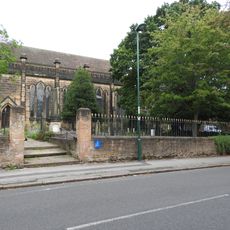
St Ann's Allotments, allotments in Nottingham, Nottinghamshire, England

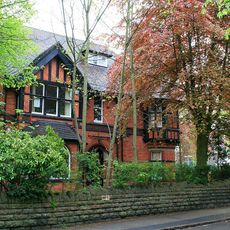
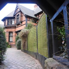
St Ann's Allotments is a historic garden site in Nottingham with small plots where residents grow vegetables and flowers. The place features old structures such as a Victorian-style glasshouse and summer house set among the tended beds and pathways.

The land was originally medieval farmland called Hungerhill and was leased to townspeople by Nottingham from the mid-1400s onward. In the 1800s, wealthy residents transformed parts into leisure gardens with glasshouses, while working families later used small plots to grow food for themselves.

St Ann's Allotments takes its name from a nearby church and shows how Nottingham transformed from medieval open fields into an urban gardening space. The place is tended by neighbors who grow vegetables, flowers, and fruit here, keeping alive a centuries-old tradition of local cultivation.

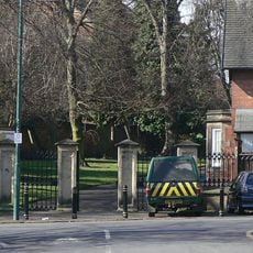
The site is easily accessible on foot with well-maintained paths winding through the beds and structures. The best time to visit is spring through autumn, when the garden is in full growth and the weather is mild.

The site is believed to be the oldest and largest allotment complex in Great Britain with a usage history stretching over 600 years. During the Second World War, residents raised rabbits, chickens, and even goats and pigs here for food production to prevent shortages.

The community of curious travelers

AroundUs brings together thousands of curated places, local tips, and hidden gems, enriched daily by 60,000 contributors worldwide.

Start exploring
GPS coordinates
52.96810,-1.13460
Latest update
February 9, 2026 07:43
Around this place
Stonebridge city farm
United Kingdom

Stonebridge city farm

1.2 km
St Jude's Church, Mapperley
United Kingdom

St Jude's Church, Mapperley

940 m
St. Matthias' Church, Nottingham
United Kingdom

St. Matthias' Church, Nottingham

1.2 km
St. Andrew's Church, Nottingham
United Kingdom

St. Andrew's Church, Nottingham

1.2 km
Church of St. John the Evangelist, Carrington
United Kingdom

Church of St. John the Evangelist, Carrington

1.4 km
Oldknows Factory
United Kingdom

Oldknows Factory

1.1 km
Woodborough Road Baptist Church
United Kingdom

Woodborough Road Baptist Church

983 m
St. Catharine's Church, Nottingham
United Kingdom

St. Catharine's Church, Nottingham

1.3 km
St. Ann with Emmanuel, Nottingham
United Kingdom

St. Ann with Emmanuel, Nottingham

673 m
St Columba's Church
United Kingdom

St Columba's Church

1.2 km
St. Paul's Church, Hyson Green
United Kingdom

St. Paul's Church, Hyson Green

1.2 km
Boulevard United Reformed Church
United Kingdom

Boulevard United Reformed Church

1.2 km
War Memorial and Kerb at South East Corner of Church Cemetery
United Kingdom

War Memorial and Kerb at South East Corner of Church Cemetery

1.3 km
Cavendish Cinema
United Kingdom

Cavendish Cinema

755 m
200 And 202, Mansfield Road
United Kingdom

200 And 202, Mansfield Road

1.2 km
Churchyard Wall, Railings And Gates To Church Of St John The Evangelist
United Kingdom

Churchyard Wall, Railings And Gates To Church Of St John The Evangelist

1.4 km
208, Mansfield Road
United Kingdom

208, Mansfield Road

1.3 km
Boundary Mark At Junction With Redcliffe Road
United Kingdom

Boundary Mark At Junction With Redcliffe Road

697 m
Boundary Wall And Gateway To Numbers 409 And 411
United Kingdom

Boundary Wall And Gateway To Numbers 409 And 411

1.4 km
Boundary Wall To Number 30A Beech Wood
United Kingdom

Boundary Wall To Number 30A Beech Wood

731 m
Malvern House And Attached Courtyard Wall
United Kingdom

Malvern House And Attached Courtyard Wall

875 m
St Andrew's House And Attached Coach House And Boundary Wall
United Kingdom

St Andrew's House And Attached Coach House And Boundary Wall

1.2 km
Forest Lodge
United Kingdom

Forest Lodge

1.3 km
Garden Wall And Lych Gate To Clawson Lodge
United Kingdom

Garden Wall And Lych Gate To Clawson Lodge

1.4 km
Lodge, Gate And Screen Walls At East Entrance To Arboretum
United Kingdom

Lodge, Gate And Screen Walls At East Entrance To Arboretum

1.3 km
196 And 198, Mansfield Road
United Kingdom

196 And 198, Mansfield Road

1.2 km
Beech Wood
United Kingdom

Beech Wood

714 m
Gate Piers And Boundary Wall To Malvern House
United Kingdom

Gate Piers And Boundary Wall To Malvern House

839 m
Show the full map
« St Ann's Allotments - allotments in Nottingham, Nottinghamshire, England » is provided by Around Us (aroundus.com). Images and texts are derived from Wikimedia project under a Creative Commons license. You are allowed to copy, distribute, and modify copies of this page, under the conditions set by the license, as long as this note is clearly visible.

Discover hidden gems everywhere you go!

From secret cafés to breathtaking viewpoints, skip the crowded tourist spots and find places that match your style. Our app makes it easy with voice search, smart filtering, route optimization, and insider tips from travelers worldwide. Download now for the complete mobile experience.

Around Us App Screenshot

A unique approach to discovering new places

Le Figaro

All the places worth exploring

France Info

A tailor-made excursion in just a few clicks

20 Minutes

Around Us
Travel Guide & Maps
Download

Send to your phone

QR Code
1

Open the camera app on your mobile.

2

Point at the QR code with your camera. A notification will appear.

3

Tap the notification to open the link.