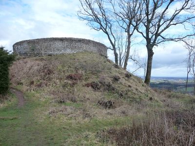
Craig Ruperra Motte, Medieval castle site in Rudry, Wales
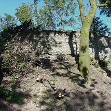
Craig Ruperra Motte is a medieval castle site in Rudry, Wales, situated on a ridge with wide views across the surrounding countryside. The earthwork consists of a raised mound with a flattened top, ringed by ditches that outline the defensive structure.
Norman builders constructed this motte-and-bailey castle around 1100, choosing a location that had already served as a hillfort during the Iron Age. The site remained strategically important throughout the medieval period as control passed between different lords.
The site is known as Castell y Ddraenen in Welsh, marking a place where Norman rule left its imprint on the medieval landscape. Visitors walking here can sense how these structures shaped settlement patterns across the region.
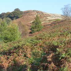
The site is accessible on foot and managed as part of a registered historic park with walking paths available. Visitors should be prepared for uneven ground and changing weather, as the exposed hilltop receives direct wind and rain.
Archaeological digs have revealed that substantial structures lie hidden beneath the surface even though no wooden buildings remain visible above ground. These buried remains offer clues about how daily life unfolded within the medieval fort.
The community of curious travelers
AroundUs brings together thousands of curated places, local tips, and hidden gems, enriched daily by 60,000 contributors worldwide.