Enable Location

We need your location to show you interesting places around you

Discover nearby places

Find interesting locations and hidden gems around you

Precise directions

Get accurate directions and distances to places

Your location is never shared with other users. It's only used when you tap the location button.

Lake Shawnee Amusement Park

Log in to your account

Start exploring — it's free

Trusted by 64,490 travelers worldwide

Continue with Google
Continue with Apple
or

We will send you a code to connect

By continuing, you accept our Terms and Conditions and our Privacy Policy

Check your inbox

We've sent a pincode in your inbox. Please enter the code below.

Lake Shawnee Amusement Park
Discussion Reviews 2 Photos 1 Collections
41.9k Popularity

Lake Shawnee Amusement Park, Abandoned amusement park in the United States

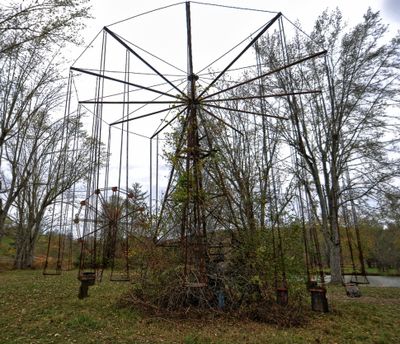
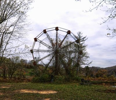
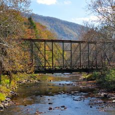
Lake Shawnee Amusement Park is a closed amusement park in Princeton, West Virginia, where the original ride structures and buildings have been left standing on the grounds. Rusting swing sets, overgrown ticket booths, and a weathered ride frame are among the features still visible across the property.

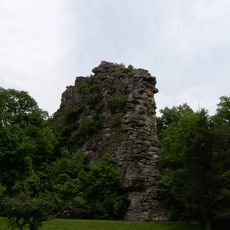
The park opened in 1926 and ran for about four decades before closing in 1966. Before the park was built, the land had served as a burial ground for Indigenous people and was later the site of a settler homestead in the 1700s.

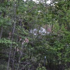
The name "Shawnee" refers to the Indigenous people who once lived on and around this land, and that connection is still felt when walking the grounds today. Some of the old ride structures remain standing, slowly being reclaimed by the surrounding trees and grass, giving the site a layered quality that goes beyond a typical abandoned park.

The site is open to visitors through guided tours, which are offered regularly and more frequently around Halloween. Wear closed shoes with good grip, as the ground is uneven and some paths are partially covered by overgrowth.

Archaeological digs on the property have uncovered human remains and Indigenous artifacts, making it an officially recorded archaeological site. The family that owns the land has chosen to keep it largely as it was after closing, rather than clearing or redeveloping the grounds.

The community of curious travelers

AroundUs brings together thousands of curated places, local tips, and hidden gems, enriched daily by 60,000 contributors worldwide.

Start exploring
Location
Inception
1926
GPS coordinates
37.40780,-81.14060
Latest update
March 3, 2026 10:13
Nature areas and historic sites in West Virginia

West Virginia brings together natural landscapes and historical places. The state features waterfalls, mountain peaks, caves and old railroad lines that invite exploration. Visitors discover national forests, battlefields from America's past and mineral springs that have drawn people for...

Around this place
Pinnacle Rock State Park
United States of America

Pinnacle Rock State Park

16.2 km
Camp Creek State Park
United States of America

Camp Creek State Park

10.7 km
Hancock House
United States of America

Hancock House

16.3 km
Ashland Company Store
United States of America

Ashland Company Store

18.9 km
Wolf Creek Bridge
United States of America

Wolf Creek Bridge

19 km
Mercer Street Historic District
United States of America

Mercer Street Historic District

6.3 km
Bramwell Historic District
United States of America

Bramwell Historic District

17.6 km
United States of America

Hatter Hall

17.7 km
United States of America

Bluefield Downtown Commercial Historic District

17.2 km
Dr. Robert B. McNutt House
United States of America

Dr. Robert B. McNutt House

5.6 km
Mercer County Courthouse
United States of America

Mercer County Courthouse

5.7 km
Dr. James W. Hale House
United States of America

Dr. James W. Hale House

5.7 km
South Bluefield Historic District
United States of America

South Bluefield Historic District

17.9 km
Bramwell Additions Historic District
United States of America

Bramwell Additions Historic District

17.6 km
United States of America

Col. William Henderson French House

10.2 km
United States of America

Virginian Railway Yard Historic District

5.8 km
United States of America

Upper Oakhurst Historic District

17.2 km
Municipal Building
United States of America

Municipal Building

17.2 km
United States of America

Jefferson Street Historic District

18.7 km
United States of America

Tolliver Branch Lake

15.1 km
United States of America

Camp Creek State Forest

12.7 km
United States of America

Bramell Historic District

17.7 km
United States of America

Christian Fork Lake

9.8 km
United States of America

Princeton Elks Country Club Golf Course

8.8 km
United States of America

Pipestem Resort State Park Short Course

18.4 km
United States of America

Camp Creek Stage

11 km
United States of America

Pinnacle Rock Overlook

16.4 km
United States of America

Heritage Point

19 km
Show the full map
Reviews
Share your experience

No review yet

Discussions
Start a discussion...

No discussion yet

« Lake Shawnee Amusement Park - Abandoned amusement park in the United States » is provided by Around Us (aroundus.com). Images and texts are derived from Wikimedia project under a Creative Commons license. You are allowed to copy, distribute, and modify copies of this page, under the conditions set by the license, as long as this note is clearly visible.

Discover hidden gems everywhere you go!

From secret cafés to breathtaking viewpoints, skip the crowded tourist spots and find places that match your style. Our app makes it easy with voice search, smart filtering, route optimization, and insider tips from travelers worldwide. Download now for the complete mobile experience.

Around Us App Screenshot

A unique approach to discovering new places

Le Figaro

All the places worth exploring

France Info

A tailor-made excursion in just a few clicks

20 Minutes

Around Us
Travel Guide & Maps
Download

Send to your phone

QR Code
1

Open the camera app on your mobile.

2

Point at the QR code with your camera. A notification will appear.

3

Tap the notification to open the link.