Enable Location

We need your location to show you interesting places around you

Discover nearby places

Find interesting locations and hidden gems around you

Precise directions

Get accurate directions and distances to places

Your location is never shared with other users. It's only used when you tap the location button.

Pinnacle Rock State Park

Log in to your account

Start exploring — it's free

Trusted by 61,994 travelers worldwide

Continue with Google
Continue with Apple
or

We will send you a code to connect

By continuing, you accept our Terms and Conditions and our Privacy Policy

Check your inbox

We've sent a pincode in your inbox. Please enter the code below.

Pinnacle Rock State Park

Pinnacle Rock State Park, State park in Mercer County, United States

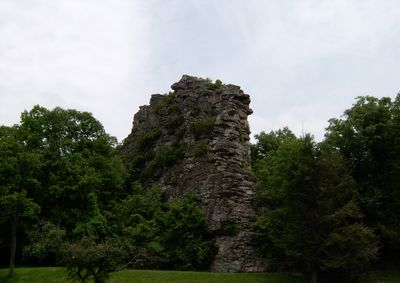
Pinnacle Rock State Park is a 374-acre park in Mercer County featuring a 3,100-foot sandstone rock formation that rises prominently above the surrounding terrain. This geological feature shapes the landscape and provides expansive views across the Appalachian region.

The West Virginia Conservation Commission established this park in 1938 through initial land acquisition and later expanded it. The Works Progress Administration contributed to further development and infrastructure during the mid-20th century.

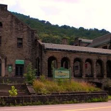
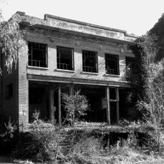
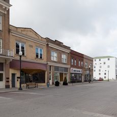
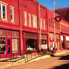
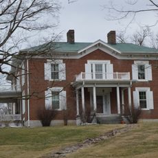
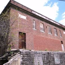
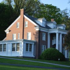
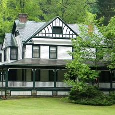
The site sits near Bramwell, a town whose preserved mansions reflect the coal mining era that shaped West Virginia's industrial development.

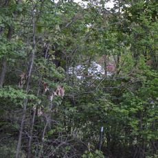
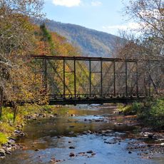
The park offers six miles of hiking trails with multiple access points suited to different fitness levels. Visitors can also fish at Jimmy Lewis Lake and take advantage of picnic areas with tables throughout the grounds.

The site contains two geocaching locations that invite visitors to search for hidden treasures using GPS technology among rock formations and wooded areas. These hidden spots offer adventure opportunities beyond the main walking routes.

The community of curious travelers

AroundUs brings together thousands of curated places, local tips, and hidden gems, enriched daily by 60,000 contributors worldwide.

Start exploring
Location
Inception
1938
Elevation above the sea
746 m
GPS coordinates
37.32220,-81.28920
Latest update
December 12, 2025 12:00
Around this place
Camp Creek State Park
United States of America

Camp Creek State Park

24.5 km
McDowell County Courthouse
United States of America

McDowell County Courthouse

28.8 km
Itmann Company Store and Office
United States of America

Itmann Company Store and Office

30.2 km
World War Memorial
United States of America

World War Memorial

22.4 km
Pocahontas Fuel Company Store and Office Buildings
United States of America

Pocahontas Fuel Company Store and Office Buildings

12.4 km
Walter McDonald Sanders House
United States of America

Walter McDonald Sanders House

9.7 km
Hancock House
United States of America

Hancock House

8 km
Ashland Company Store
United States of America

Ashland Company Store

11.3 km
Wolf Creek Bridge
United States of America

Wolf Creek Bridge

19.2 km
James Wynn House
United States of America

James Wynn House

30.9 km
Mercer Street Historic District
United States of America

Mercer Street Historic District

18.6 km
Bramwell Historic District
United States of America

Bramwell Historic District

1.8 km
Alexander St. Clair House
United States of America

Alexander St. Clair House

10.2 km
Page Coal and Coke Company Store
United States of America

Page Coal and Coke Company Store

15.8 km
Welch Commercial Historic District
United States of America

Welch Commercial Historic District

29 km
Tazewell Historic District
United States of America

Tazewell Historic District

30.7 km
Dr. Robert B. McNutt House
United States of America

Dr. Robert B. McNutt House

17.2 km
Mercer County Courthouse
United States of America

Mercer County Courthouse

17.1 km
Capt. James Moore Homestead
United States of America

Capt. James Moore Homestead

11 km
Dr. James W. Hale House
United States of America

Dr. James W. Hale House

17.6 km
South Bluefield Historic District
United States of America

South Bluefield Historic District

9.7 km
Bramwell Additions Historic District
United States of America

Bramwell Additions Historic District

1.8 km
Pocahontas Historic District
United States of America

Pocahontas Historic District

5 km
Easley House
United States of America

Easley House

9.3 km
Pocahontas Exhibition Coal Mine & Museum
United States of America

Pocahontas Exhibition Coal Mine & Museum

5.3 km
Municipal Building
United States of America

Municipal Building

8.4 km
James Ellwood Jones House
United States of America

James Ellwood Jones House

8.9 km
John J. Lincoln House
United States of America

John J. Lincoln House

13 km
Show the full map
« Pinnacle Rock State Park - State park in Mercer County, United States » is provided by Around Us (aroundus.com). Images and texts are derived from Wikimedia project under a Creative Commons license. You are allowed to copy, distribute, and modify copies of this page, under the conditions set by the license, as long as this note is clearly visible.

Discover hidden gems everywhere you go!

From secret cafés to breathtaking viewpoints, skip the crowded tourist spots and find places that match your style. Our app makes it easy with voice search, smart filtering, route optimization, and insider tips from travelers worldwide. Download now for the complete mobile experience.

Around Us App Screenshot

A unique approach to discovering new places

Le Figaro

All the places worth exploring

France Info

A tailor-made excursion in just a few clicks

20 Minutes

Around Us
Travel Guide & Maps
Download

Send to your phone

QR Code
1

Open the camera app on your mobile.

2

Point at the QR code with your camera. A notification will appear.

3

Tap the notification to open the link.