Enable Location

We need your location to show you interesting places around you

Discover nearby places

Find interesting locations and hidden gems around you

Precise directions

Get accurate directions and distances to places

Your location is never shared with other users. It's only used when you tap the location button.

Mercer County

Log in to your account

Start exploring — it's free

Trusted by 62,505 travelers worldwide

Continue with Google
Continue with Apple
or

We will send you a code to connect

By continuing, you accept our Terms and Conditions and our Privacy Policy

Check your inbox

We've sent a pincode in your inbox. Please enter the code below.

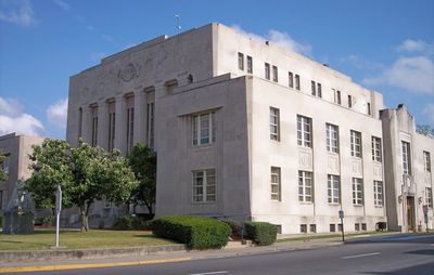
Mercer County, County of West Virginia with Princeton as capital, United States.

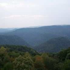
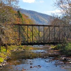
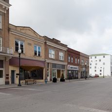
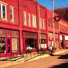
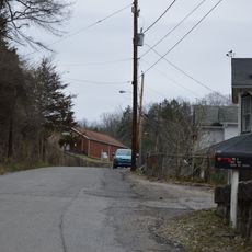
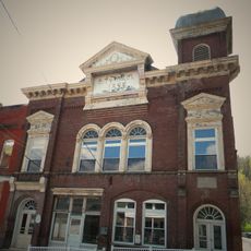
Mercer County is an administrative division in southern West Virginia, situated near the Virginia border. The region comprises rolling terrain with multiple small towns and rural communities connected by various highways.

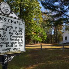
The county was created in 1837 from parts of Giles and Tazewell counties, which were then part of Virginia. It became part of the newly formed state of West Virginia in 1863.

The region maintains seven distinct law enforcement agencies, with the Sheriff's Department controlling jurisdiction in non-incorporated sections of the territory.

Major transportation routes include Interstate 77, US Highways 19, 52, and 460, along with the West Virginia Turnpike. These roads provide good connections to larger cities and make it easy to explore the region.

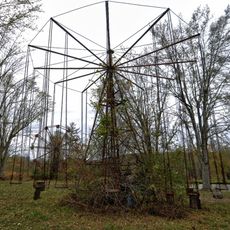
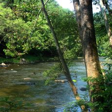
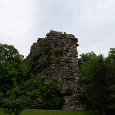
The region contains the abandoned Lake Shawnee Amusement Park, a former entertainment venue with an intriguing past. Pinnacle Rock State Park and White Oak Falls offer natural attractions for those who enjoy outdoor activities.

The community of curious travelers

AroundUs brings together thousands of curated places, local tips, and hidden gems, enriched daily by 60,000 contributors worldwide.

Start exploring
Location
Inception
March 17, 1837
Capital city
Princeton
Shares border with
Raleigh County, Bland County, Tazewell County, Giles County, Summers County, Wyoming County, McDowell County
GPS coordinates
37.41000,-81.11000
Latest update
December 22, 2025 14:12
Around this place
Lake Shawnee Amusement Park
United States of America

Lake Shawnee Amusement Park

2.7 km
Pipestem Resort State Park
United States of America

Pipestem Resort State Park

17 km
Bluestone National Scenic River
United States of America

Bluestone National Scenic River

17.6 km
Pinnacle Rock State Park
United States of America

Pinnacle Rock State Park

18.6 km
Camp Creek State Park
United States of America

Camp Creek State Park

10.6 km
Walter McDonald Sanders House
United States of America

Walter McDonald Sanders House

23.2 km
Hancock House
United States of America

Hancock House

17.8 km
Ashland Company Store
United States of America

Ashland Company Store

21.6 km
Wolf Creek Bridge
United States of America

Wolf Creek Bridge

19 km
Mercer Street Historic District
United States of America

Mercer Street Historic District

4.8 km
Jordan's Chapel
United States of America

Jordan's Chapel

20.1 km
Bramwell Historic District
United States of America

Bramwell Historic District

20.1 km
United States of America

Hatter Hall

19.4 km
United States of America

Bluefield Downtown Commercial Historic District

18.7 km
Dr. Robert B. McNutt House
United States of America

Dr. Robert B. McNutt House

4.8 km
Mercer County Courthouse
United States of America

Mercer County Courthouse

5 km
Dr. James W. Hale House
United States of America

Dr. James W. Hale House

4.7 km
South Bluefield Historic District
United States of America

South Bluefield Historic District

19.3 km
Bramwell Additions Historic District
United States of America

Bramwell Additions Historic District

20.1 km
Pocahontas Historic District
United States of America

Pocahontas Historic District

23.5 km
Easley House
United States of America

Easley House

21 km
United States of America

Col. William Henderson French House

7.5 km
United States of America

Virginian Railway Yard Historic District

4.1 km
United States of America

Country Club Hill Historic District

21 km
United States of America

Upper Oakhurst Historic District

18.5 km
Angels Rest Cluster
United States of America

Angels Rest Cluster

28.2 km
Pocahontas Exhibition Coal Mine & Museum
United States of America

Pocahontas Exhibition Coal Mine & Museum

23.8 km
Municipal Building
United States of America

Municipal Building

18.7 km
Show the full map
« Mercer County - County of West Virginia with Princeton as capital, United States » is provided by Around Us (aroundus.com). Images and texts are derived from Wikimedia project under a Creative Commons license. You are allowed to copy, distribute, and modify copies of this page, under the conditions set by the license, as long as this note is clearly visible.

Discover hidden gems everywhere you go!

From secret cafés to breathtaking viewpoints, skip the crowded tourist spots and find places that match your style. Our app makes it easy with voice search, smart filtering, route optimization, and insider tips from travelers worldwide. Download now for the complete mobile experience.

Around Us App Screenshot

A unique approach to discovering new places

Le Figaro

All the places worth exploring

France Info

A tailor-made excursion in just a few clicks

20 Minutes

Around Us
Travel Guide & Maps
Download

Send to your phone

QR Code
1

Open the camera app on your mobile.

2

Point at the QR code with your camera. A notification will appear.

3

Tap the notification to open the link.