Enable Location

We need your location to show you interesting places around you

Discover nearby places

Find interesting locations and hidden gems around you

Precise directions

Get accurate directions and distances to places

Your location is never shared with other users. It's only used when you tap the location button.

Camp Creek State Park

Log in to your account

Start exploring — it's free

Trusted by 61,993 travelers worldwide

Continue with Google
Continue with Apple
or

We will send you a code to connect

By continuing, you accept our Terms and Conditions and our Privacy Policy

Check your inbox

We've sent a pincode in your inbox. Please enter the code below.

Camp Creek State Park

Camp Creek State Park, State park in Mercer County, West Virginia, United States

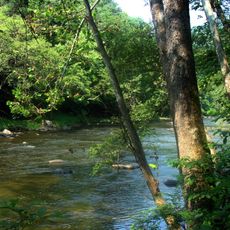
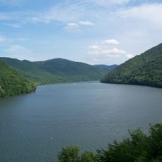
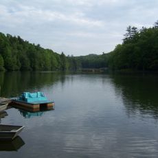
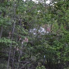
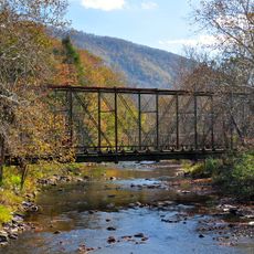
Camp Creek State Park is a forest reserve in West Virginia covering 550 acres with hiking trails, two waterfalls, and seven miles of trout streams flowing through the grounds. The land supports a mix of recreational activities in a single location.

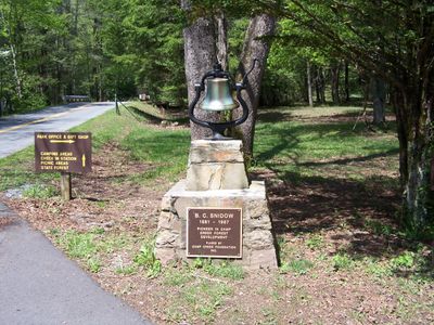
The area was established as a public park in 1987 when the West Virginia Division of Natural Resources separated it from a larger forest tract. This action created a dedicated recreation space managed for both visitor use and conservation.

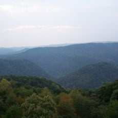
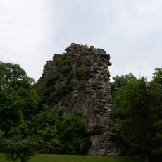
The park contains multiple forest types and streamside habitats that support diverse plant and animal life across the landscape. You can observe how these different zones create distinct environments where you might spot deer, birds, and other wildlife during your visit.

The park is easily reached from Interstate 77 Exit 20, with several campgrounds offering year-round facilities and services. Before visiting, check trail and water conditions as these change with the seasons.

The Pack It In - Pack It Out Campground requires a two-mile trek on Almost Heaven Road and offers the most remote camping experience in the park. This isolated setting appeals to those seeking solitude away from developed areas.

The community of curious travelers

AroundUs brings together thousands of curated places, local tips, and hidden gems, enriched daily by 60,000 contributors worldwide.

Start exploring
Location
Inception
1987
Elevation above the sea
635 m
GPS coordinates
37.50390,-81.13190
Latest update
December 12, 2025 14:40
Around this place
Pipestem Resort State Park
United States of America

Pipestem Resort State Park

12.3 km
Bluestone Lake
United States of America

Bluestone Lake

26.5 km
Bluestone National Scenic River
United States of America

Bluestone National Scenic River

12.4 km
Bluestone State Park
United States of America

Bluestone State Park

21.3 km
Pinnacle Rock State Park
United States of America

Pinnacle Rock State Park

24.5 km
Little Beaver State Park
United States of America

Little Beaver State Park

28.4 km
Itmann Company Store and Office
United States of America

Itmann Company Store and Office

26.4 km
Hancock House
United States of America

Hancock House

26.6 km
Summers County Courthouse
United States of America

Summers County Courthouse

28.3 km
Ashland Company Store
United States of America

Ashland Company Store

22.3 km
Wolf Creek Bridge
United States of America

Wolf Creek Bridge

29.5 km
Hinton Historic District
United States of America

Hinton Historic District

28.7 km
Wyco Church
United States of America

Wyco Church

21.4 km
Mercer Street Historic District
United States of America

Mercer Street Historic District

15.4 km
Jordan's Chapel
United States of America

Jordan's Chapel

15.8 km
Bramwell Historic District
United States of America

Bramwell Historic District

25.5 km
Dr. Robert B. McNutt House
United States of America

Dr. Robert B. McNutt House

15.4 km
Mercer County Courthouse
United States of America

Mercer County Courthouse

15.6 km
Dr. James W. Hale House
United States of America

Dr. James W. Hale House

15.3 km
South Bluefield Historic District
United States of America

South Bluefield Historic District

28.3 km
Bramwell Additions Historic District
United States of America

Bramwell Additions Historic District

25.5 km
Pocahontas Historic District
United States of America

Pocahontas Historic District

28.7 km
Sophia Historic District
United States of America

Sophia Historic District

25.2 km
Pocahontas Exhibition Coal Mine & Museum
United States of America

Pocahontas Exhibition Coal Mine & Museum

29 km
Municipal Building
United States of America

Municipal Building

27.5 km
James Ellwood Jones House
United States of America

James Ellwood Jones House

26.4 km
John J. Lincoln House
United States of America

John J. Lincoln House

28.1 km
Mullens Historic District
United States of America

Mullens Historic District

24 km
Show the full map
« Camp Creek State Park - State park in Mercer County, West Virginia, United States » is provided by Around Us (aroundus.com). Images and texts are derived from Wikimedia project under a Creative Commons license. You are allowed to copy, distribute, and modify copies of this page, under the conditions set by the license, as long as this note is clearly visible.

Discover hidden gems everywhere you go!

From secret cafés to breathtaking viewpoints, skip the crowded tourist spots and find places that match your style. Our app makes it easy with voice search, smart filtering, route optimization, and insider tips from travelers worldwide. Download now for the complete mobile experience.

Around Us App Screenshot

A unique approach to discovering new places

Le Figaro

All the places worth exploring

France Info

A tailor-made excursion in just a few clicks

20 Minutes

Around Us
Travel Guide & Maps
Download

Send to your phone

QR Code
1

Open the camera app on your mobile.

2

Point at the QR code with your camera. A notification will appear.

3

Tap the notification to open the link.