Plage de la Boirie

Log in to your account

AroundUs is a community-driven map of interesting places, built by curious explorers like you. It grows with every review, story, and photo you share.
Connect to save your favorite spots, contribute locations, and create personalized routes.
By continuing, you accept our Terms and Conditions and our Privacy Policy

Plage de la Boirie

Add to collection
Map
Suggest a change
Share

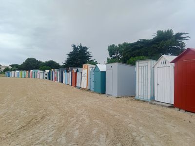
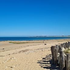
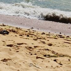
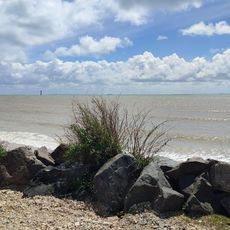
Plage de la Boirie, Beach in Saint-Denis-d'Oléron, France.
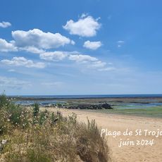
The Plage de la Boirie extends along the northeastern coast of Oléron Island, providing views across to the mainland of Charente-Maritime.

The beach area developed alongside the maritime traditions of Saint-Denis-d'Oléron, where fishing activities shaped the coastal development throughout generations.

Traditional beach cabins line the shoreline near the port section, representing a characteristic element of French Atlantic coastal architecture.
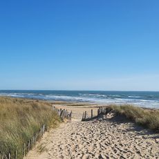
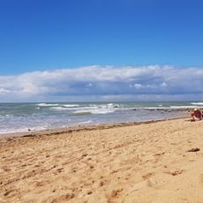
The beach provides supervised swimming zones during summer, with dedicated areas for water sports and facilities including showers, restaurants, and free parking.

The beach incorporates an Audio Plage system with audio beacons and special bracelets to help visually impaired visitors navigate the water safely.

Location: Saint-Denis-d'Oléron

GPS coordinates: 46.03330,-1.37180

Latest update: March 6, 2025 00:01

Best photo locations in La Rochelle

La Rochelle presents photography opportunities at its medieval towers, historical port, and coastal areas. The city features architectural monuments from the Renaissance period, maritime structures, and public spaces. Visitors can photograph the towers guarding the harbor, the clock gate, traditional fishing structures, and the modern Nelson Mandela bridge.

What to see on Oléron Island: tourist sites, historical monuments, and beaches to visit

Oléron Island, the largest island in mainland France after Corsica, features a military, maritime, and natural heritage reflecting its strategic position facing the Atlantic Ocean. This Charente island, connected to the mainland since 1966 by a nearly three-kilometer-long bridge, houses fortifications built under Louis XIV, such as the Citadel of Château d'Oléron and Fort Louvois, as well as the famous Fort Boyard positioned on its sandbank offshore. The Chassiron Lighthouse, standing at forty-six meters high, marks the northern tip of the island and guides ships through the waters of the Pertuis d'Antioche. Beyond its defensive legacy, the island offers various natural areas where sandy beaches, pine forests, and salt marshes alternate. Saint-Trojan-les-Bains extends its wooded shoreline to the south, while Boyardville features a protected coast on its eastern side. Visitors also observe oyster farming along the La Baudissière channel and explore the colorful huts that house artist workshops at the port of Château d'Oléron. The Saltworks Museum traces the history of salt extraction, a resource that shaped the local economy for centuries.

Reviews

Visited this place? Tap the stars to rate it and share your experience / photos with the community! Try now! You can cancel it anytime.

« Plage de la Boirie: Beach in Saint-Denis-d'Oléron, France » is provided by Around Us (aroundus.com). Images and texts are derived from Wikimedia project under a Creative Commons license. You are allowed to copy, distribute, and modify copies of this page, under the conditions set by the license, as long as this note is clearly visible.

Discover hidden gems everywhere you go!

From secret cafés to breathtaking viewpoints, skip the crowded tourist spots and find places that match your style. Our app makes it easy with voice search, smart filtering, route optimization, and insider tips from travelers worldwide. Download now for the complete mobile experience.

Around Us App Screenshot

A unique approach to discovering new places

Le Figaro

All the places worth exploring

France Info

A tailor-made excursion in just a few clicks

20 Minutes