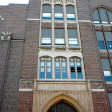
Chest opened
+${chestReward.xp} XP
Explorer
NOUVEAU ×${chestReward.collectible.quantity}
tapez pour fermer
Chest locked

Open chests in the app

Around Us is built for your phone — chests unlock when you walk, explore and capture nearby places.

Enable Location

We need your location to show you interesting places around you

Discover nearby places

Find interesting locations and hidden gems around you

Precise directions

Get accurate directions and distances to places

Your location is never shared with other users. It's only used when you tap the location button.

Broad Street Line

Log in to your account

Start exploring — it's free

Trusted by 72,878 travelers worldwide

Continue with Google
Continue with Apple
or

We will send you a code to connect

By continuing, you accept our Terms and Conditions and our Privacy Policy

Check your inbox

We've sent a pincode in your inbox. Please enter the code below.

Discussion Reviews 1 Photos
1.7k Popularity

Broad Street Line

The Broad Street Line is a rapid transit rail line in Philadelphia that runs mostly underground beneath Broad Street, connecting the city from north to south with over 40 stations. The tunnels are lined with platforms and signage, while a shorter elevated section near the south end serves the sports stadiums and entertainment areas.

The line opened in 1928 and was designed to move people quickly from northern neighborhoods to downtown Philadelphia. It expanded gradually over decades, with new stations added in the 1950s and 1970s to serve growing neighborhoods.

The line is woven into daily Philadelphia life, connecting different neighborhoods where residents work, study, and shop. Visitors can experience how locals rely on it as a natural part of moving through the city.

Trains run every few minutes during the day and less frequently in evenings and on weekends, making it easy to plan your trip. Most stations have elevators or ramps, and clear signage helps you find your way through the tunnels and platforms.

The Broad Street Line operates special frequent service to Pattison Station during sporting events, deploying extra trains to quickly move thousands of fans to and from the stadiums. This game-day coordination reveals how the system adapts to sudden surges in ridership.

The community of curious travelers

AroundUs brings together thousands of curated places, local tips, and hidden gems, enriched daily by 60,000 contributors worldwide.

Start exploring
Location
Operator
Southeastern Pennsylvania Transportation Authority
Address
1135 S Broad St,Philadelphia, PA 19147
GPS coordinates
39.93567,-75.16729
Latest update
February 15, 2026 00:38
Around this place
Philadelphia's Magic Gardens
United States of America

Philadelphia's Magic Gardens

1 km
Institute for Colored Youth
United States of America

Institute for Colored Youth

1.1 km
Marian Anderson House
United States of America

Marian Anderson House

964 m
Samuel S. Fleisher Art Memorial
United States of America

Samuel S. Fleisher Art Memorial

1.1 km
Bartlett School
United States of America

Bartlett School

655 m
Federal Street School
United States of America

Federal Street School

354 m
Washington Avenue Historic District
United States of America

Washington Avenue Historic District

507 m
Walter George Smith School
United States of America

Walter George Smith School

789 m
Francis M. Drexel School
United States of America

Francis M. Drexel School

930 m
Wesley AME Zion Church
United States of America

Wesley AME Zion Church

979 m
Philadelphia, Wilmington and Baltimore Railroad Freight Shed
United States of America

Philadelphia, Wilmington and Baltimore Railroad Freight Shed

396 m
Frances Ellen Watkins Harper House
United States of America

Frances Ellen Watkins Harper House

945 m
Thomas Durham School
United States of America

Thomas Durham School

1 km
Marine Corps Supply Activity
United States of America

Marine Corps Supply Activity

209 m
George W. Childs School
United States of America

George W. Childs School

700 m
Nathaniel Hawthorne School
United States of America

Nathaniel Hawthorne School

744 m
Franklin Hose Company No. 28
United States of America

Franklin Hose Company No. 28

698 m
Mikveh Israel Cemetery
United States of America

Mikveh Israel Cemetery

399 m
Touro Hall
United States of America

Touro Hall

686 m
United States of America

Savoia Theatre

759 m
United States of America

History of Italian Immigration Museum

991 m
G.W. Childs Elementary School
United States of America

G.W. Childs Elementary School

973 m
Edwin M. Stanton School
United States of America

Edwin M. Stanton School

610 m
United States of America

Italian market

888 m
United States of America

Laurie Beechman Cabaret Theater

862 m

Theatre Exile

332 m
United States of America

Glass and Garbage Wall Mural

744 m
United States of America

The Electric Street

741 m
Show the full map
Reviews
Share your experience

No review yet

Discussions
Start a discussion...

No discussion yet

« Broad Street Line » is provided by Around Us (aroundus.com). Images and texts are derived from Wikimedia project under a Creative Commons license. You are allowed to copy, distribute, and modify copies of this page, under the conditions set by the license, as long as this note is clearly visible.

Discover hidden gems everywhere you go!

From secret cafés to breathtaking viewpoints, skip the crowded tourist spots and find places that match your style. Our app makes it easy with voice search, smart filtering, route optimization, and insider tips from travelers worldwide. Download now for the complete mobile experience.

Around Us App Screenshot

A unique approach to discovering new places

Le Figaro

All the places worth exploring

France Info

A tailor-made excursion in just a few clicks

20 Minutes

Around Us
Travel Guide & Maps
Download

Send to your phone

QR Code
1

Open the camera app on your mobile.

2

Point at the QR code with your camera. A notification will appear.

3

Tap the notification to open the link.