Washington Avenue Historic District

Log in to your account

AroundUs is a community-driven map of interesting places, built by curious explorers like you. It grows with every review, story, and photo you share.
Connect to save your favorite spots, contribute locations, and create personalized routes.
Continue with Google
Continue with Apple
Continue with X
Continue with Facebook
Continue with email
By continuing, you accept our Terms and Conditions and our Privacy Policy
Create an account
Add to collection
Map
Suggest a change
Share

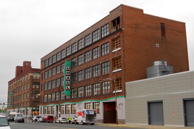
Washington Avenue Historic District, Industrial historic district in South Philadelphia, United States.

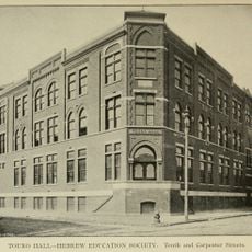
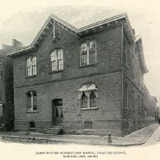
Washington Avenue Historic District is an industrial neighborhood in South Philadelphia containing eight factory buildings constructed between 1889 and 1927 spread across multiple blocks. The structures showcase typical industrial architecture of the era with large windows, brick walls, and heavy steel frames designed for manufacturing operations.

The site was originally a cemetery and lumber yard before the railroad arrived in the 1850s and sparked a transformation into a manufacturing hub. Over the following decades, factory buildings gradually replaced the earlier structures, establishing the neighborhood as a major industrial center for the city.

The district tells the story of Philadelphia's working-class manufacturing past through buildings that once powered the regional economy. Walking through these blocks, you see evidence of how factories organized daily life and shaped the neighborhood's identity for generations.

The neighborhood is easily reached by public transportation with bus routes and a nearby subway station providing access. Walking through the blocks at a relaxed pace is the best way to view the building facades and understand how the factory complex was organized across the district.

One of the factory buildings featured an innovative steel truss system that allowed architects to create wider open floors without support columns in the middle. This structural innovation became influential in how factories across the country were designed and built during the early industrial period.

Location: Pennsylvania

GPS coordinates: 39.93806,-75.16222

Latest update: December 14, 2025 12:26

Photos
Around this place
Pennsylvania Hospital
United States of America

Pennsylvania Hospital

903 m
Kimmel Center for the Performing Arts
United States of America

Kimmel Center for the Performing Arts

993 m
Philadelphia's Magic Gardens
United States of America

Philadelphia's Magic Gardens

587 m
Pennsylvania Hall
United States of America

Pennsylvania Hall

1 km
Institute for Colored Youth
United States of America

Institute for Colored Youth

576 m
Suzanne Roberts Theatre
United States of America

Suzanne Roberts Theatre

825 m
Church of St. Luke and The Epiphany
United States of America

Church of St. Luke and The Epiphany

906 m
United States of America

Wilma Theater

1 km
Giovanni's Room Bookstore
United States of America

Giovanni's Room Bookstore

797 m
George Washington School
United States of America

George Washington School

942 m
New Century Guild
United States of America

New Century Guild

979 m
Wesley AME Zion Church
United States of America

Wesley AME Zion Church

868 m
John Stewart Houses
United States of America

John Stewart Houses

944 m
Roberts-Quay House
United States of America

Roberts-Quay House

953 m
Henry George Birthplace
United States of America

Henry George Birthplace

732 m
Frances Ellen Watkins Harper House
United States of America

Frances Ellen Watkins Harper House

467 m
Marine Corps Supply Activity
United States of America

Marine Corps Supply Activity

480 m
Portico Row
United States of America

Portico Row

931 m
Franklin Hose Company No. 28
United States of America

Franklin Hose Company No. 28

557 m
Clinton Street Historic District
United States of America

Clinton Street Historic District

833 m
Mikveh Israel Cemetery
United States of America

Mikveh Israel Cemetery

374 m
J. Peter Lesley House
United States of America

J. Peter Lesley House

795 m
Social Service Building
United States of America

Social Service Building

871 m
Touro Hall
United States of America

Touro Hall

206 m
James Forten School
United States of America

James Forten School

1 km
Wilson Eyre House
United States of America

Wilson Eyre House

948 m
B’nai Reuben Anshe Sfard
United States of America

B’nai Reuben Anshe Sfard

932 m
Mask and Wig Club of the University of Pennsylvania
United States of America

Mask and Wig Club of the University of Pennsylvania

886 m
Show the full map
Reviews

Visited this place? Tap the stars to rate it and share your experience / photos with the community! Try now! You can cancel it anytime.

« Washington Avenue Historic District - Industrial historic district in South Philadelphia, United States » is provided by Around Us (aroundus.com). Images and texts are derived from Wikimedia project under a Creative Commons license. You are allowed to copy, distribute, and modify copies of this page, under the conditions set by the license, as long as this note is clearly visible.

Discover hidden gems everywhere you go!

From secret cafés to breathtaking viewpoints, skip the crowded tourist spots and find places that match your style. Our app makes it easy with voice search, smart filtering, route optimization, and insider tips from travelers worldwide. Download now for the complete mobile experience.

Around Us App Screenshot

A unique approach to discovering new places

Le Figaro

All the places worth exploring

France Info

A tailor-made excursion in just a few clicks

20 Minutes