Pfannenstiel Hochwacht, Mountain restaurant and tourism office at Pfannenstiel ridge, Meilen, Switzerland
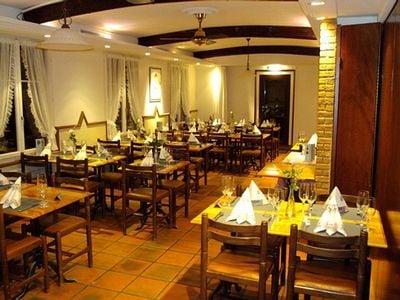
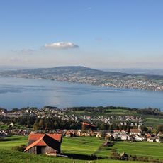
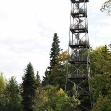
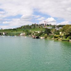
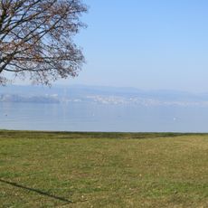
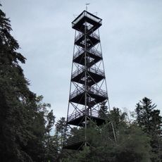
Pfannenstiel Hochwacht is a mountain restaurant and tourism office located on the Pfannenstiel ridge in Meilen. It stands next to a 33-meter observation tower that offers views across Lake Zurich, the Greifensee, and the Zurich Oberland region.
The site served as a signal station in the 17th century, where watchmen used fire and smoke signals to alert neighboring posts to danger. This role shows how the ridge was used for regional communication and oversight for centuries.
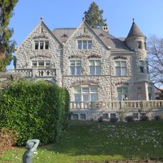
The place takes its name from naturalist Lorenz Oken, who visited and eventually owned the area during the 1800s. Today, visitors can sense the connection to nature that captivated him.
The restaurant and tourism office sit at about 850 meters altitude with direct connections to multiple hiking trails across the region. Visitors should expect variable conditions as the site is exposed to weather and seasonal changes.
The 17th-century signal station used fire and smoke to transmit messages faster than couriers could travel on foot or horseback. This system was an early form of long-distance communication technology in Switzerland.
Location: Meilen
Operator: Zürcher Wanderwege
Address: Hochwacht 3, 8132 Egg, Switzerland
Opening Hours: Monday-Saturday 10:00-22:00; Sunday 09:00-20:00
Phone: +41449840255
Website: https://maps.zh.ch/system/docs/ww/Wegweiser/69323801.pdf
GPS coordinates: 47.28986,8.67579
Latest update: December 14, 2025 18:41
Pfannenstiel
455 m
Pfannenstiel Aussichtsturm
207 m
St. Antonius Church, Egg
1.3 km
Villa Alma
3.8 km
Reformed church
3.6 km
Friedberg Castle
2.8 km
St. Martin
3.1 km
Meilen-Rorenhaab
3.1 km
Vorderpfannenstiel
571 m
Reformierte Kirche Uetikon am See
3.1 km
Zum Löwen Inn
3.6 km
Beugenbach Hängebrücke
2.6 km
Meilen
3.3 km
Reformed church
3.1 km
Reformierte Kirche Egg
1.7 km
Reformierte Kirche Wetzwil
3.9 km
Buchbinderei BUBU
3.6 km
Chemische Fabrik Uetikon am See
3.3 km
Seeufersiedlung
3.7 km
Ramparts
3.2 km
Pfannenstilturm, ehemaliger Bachtelturm (1893)
206 m
Sog. Thommensägi
1.9 km
Burgstelle Liebenberg
4 km
Landsitz Seehalde
3.8 km
Residential building with shed
3.3 km
Rällikon, Doppelwohnhaus (1535, 18. und 19. Jh., ehem. Taverne)
3.5 km
Lakeside settlement
3.8 km
Landsitz Seehof
3.5 kmVisited this place? Tap the stars to rate it and share your experience / photos with the community! Try now! You can cancel it anytime.
Discover hidden gems everywhere you go!
From secret cafés to breathtaking viewpoints, skip the crowded tourist spots and find places that match your style. Our app makes it easy with voice search, smart filtering, route optimization, and insider tips from travelers worldwide. Download now for the complete mobile experience.
A unique approach to discovering new places❞
— Le Figaro
All the places worth exploring❞
— France Info
A tailor-made excursion in just a few clicks❞
— 20 Minutes