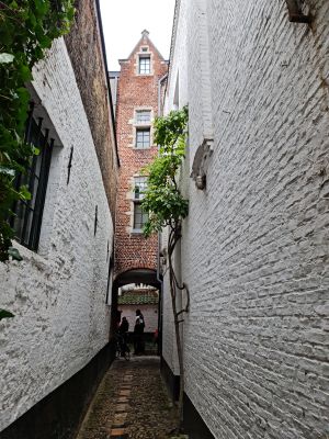
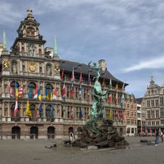
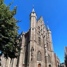
Enable Location

We need your location to show you interesting places around you

Discover nearby places

Find interesting locations and hidden gems around you

Precise directions

Get accurate directions and distances to places

Your location is never shared with other users. It's only used when you tap the location button.

Vlaaikensgang

Log in to your account

Start exploring — it's free

Trusted by 61,602 travelers worldwide

Continue with Google
Continue with Apple
or

We will send you a code to connect

By continuing, you accept our Terms and Conditions and our Privacy Policy

Check your inbox

We've sent a pincode in your inbox. Please enter the code below.

Vlaaikensgang

Vlaaikensgang

Description

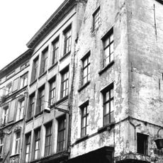
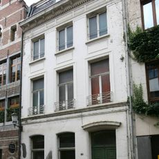
Vlaaikensgang is a narrow pedestrian passageway in the heart of Antwerp that connects two main streets and features a row of tightly packed brick buildings. The passage is shaped by its constricted width and the layered architectural style that reflects different periods of construction and renovation over time.

History

The passage developed in the 17th century as one of many new connecting routes in Antwerp during a period of intense urban growth. This type of pathway became a common solution to link expanding neighborhoods and facilitate commerce across the growing city.

Culture

The narrow passage takes its name from a local word for small pies, reflecting Antwerp's merchant past when food traders worked these lanes. Visitors walking through today encounter the same tight, intimate space where people once bought and sold goods in busy commercial exchange.

Practical

The passage is easy to reach and walkable with standard mobility, though its narrow width means visitors must move carefully through the space. It's best to explore it on foot at a relaxed pace, taking time to notice details and any small shops or side passages that appear along the way.

Did you know?

The passage was originally much narrower and has been widened several times over the centuries, with some of the original stone walls still visible beneath later additions. These hidden layers of construction tell the story of urban adaptation as the city adjusted to accommodate growing foot traffic.

Location
Address
Oude Koornmarkt
GPS coordinates
51.22024,4.39934
Latest update
December 6, 2025 19:06

AroundUs brings together thousands of curated places, local tips, and hidden gems, enriched daily by 60,000 contributors worldwide. Discover all places nearby (Antwerpen).

Best sites to see in Antwerp

Antwerp is a city where history comes alive through its museums, historic buildings, and cultural institutions. Visitors can explore the MAS Museum to learn about the city's architecture and urban development, or stand in awe of the Cathedral of Our Lady, which towers over the old city center. The...

« Vlaaikensgang » is provided by Around Us (aroundus.com). Images and texts are derived from Wikimedia project under a Creative Commons license. You are allowed to copy, distribute, and modify copies of this page, under the conditions set by the license, as long as this note is clearly visible.

Discover hidden gems everywhere you go!

From secret cafés to breathtaking viewpoints, skip the crowded tourist spots and find places that match your style. Our app makes it easy with voice search, smart filtering, route optimization, and insider tips from travelers worldwide. Download now for the complete mobile experience.

Around Us App Screenshot

A unique approach to discovering new places

Le Figaro

All the places worth exploring

France Info

A tailor-made excursion in just a few clicks

20 Minutes

Around Us
Travel Guide & Maps
Download

Send to your phone

QR Code
1

Open the camera app on your mobile.

2

Point at the QR code with your camera. A notification will appear.

3

Tap the notification to open the link.