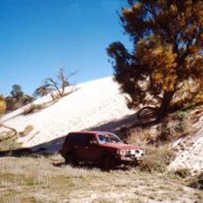
Patchewollock Golf Course
Location: Patchewollock
Location: Rural City of Mildura
GPS coordinates: -35.39518,142.07653
Latest update: October 7, 2024 22:58

Wyperfeld National Park
33.6 km
Lake Corrong Homestead
45.6 km
Hopetoun House
45.3 km
Patchewollock railway station
10.3 km
Hopping Mouse Hill
24.1 km
Lookout Dune
22.1 km
Scenic viewpoint
20.6 km
Ouyen Golf Course
42.2 km
O'Sullivan Lookout (approx)
23.6 km
The Big Mallee Fowl
10.3 km
Speed Golf Club
32.9 km
Possible old silo
10.3 km
Pioneer Memorial
34.6 km
Underbool Golf Course
35.2 km
Ruins
35.8 km
War Memorial
36.4 km
Work of art, mural
42.1 km
Bracky Well disused
12.1 km
Mount Jess Lookout
45.1 km
Patchewollock silo art
10.1 km
Yarriambiack Shire Silo Art Trail
10.1 km
Hopetoun Golf Club
46.2 km
Historic Mural
48.3 km
Lookout Dune
50.6 km
Lascelles silo art
51.3 km
Lascelles silo art
51.4 km
War Memorial gates
51.4 km
Milmed Rock
51.5 kmReviews
Visited this place? Tap the stars to rate it and share your experience / photos with the community! Try now! You can cancel it anytime.
Discover hidden gems everywhere you go!
From secret cafés to breathtaking viewpoints, skip the crowded tourist spots and find places that match your style. Our app makes it easy with voice search, smart filtering, route optimization, and insider tips from travelers worldwide. Download now for the complete mobile experience.

A unique approach to discovering new places❞
— Le Figaro
All the places worth exploring❞
— France Info
A tailor-made excursion in just a few clicks❞
— 20 Minutes