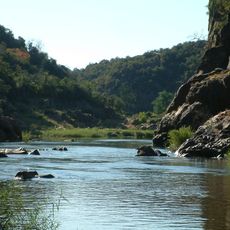
Sagole Baobab
Location: Mutale Local Municipality
GPS coordinates: -22.49872,30.63397
Latest update: November 17, 2025 16:30
Makuleke
58.9 km
Lanner Gorge
53.2 km
Nzhelele Dam
60.8 km
Nwanedi Provincial Park
28.1 km
Luphephe Dam
27.6 km
Nwanedi Dam
28.2 km
Thohoyandou Botanical Garden
54.9 km
Punda Maria
45 km
Nzhelele Reservoir
60.8 km
Phiphidi Falls
55.8 km
Musina Nature Reserve
60.6 km
Klopperfontein Dam Viewpoint (Lower)
57.2 km
Palm Vlei Viewpoint
61 km
Dzundzwini Viewpoint
62.3 km
Punda Maria Hide
45 km
Mandadzidzi Waterhole
58.6 km
Scenic viewpoint
55.7 km
Banyini Pan Viewpoint
47.2 km
Makwadzi Pan Viewpoint
52 km
Lala Palm Viewpoint
57.9 km
Art gallery
56.3 km
Thulamila Water Viewpoint
46.4 km
Klopperfontein Waterhole Viewpoint
56.3 km
Scenic viewpoint
41.1 km
Thulamela Archaelogical Site
58.2 km
Cecil Barnard Plaque
57.3 km
Coetzer Plaque
62.2 km
Tshirovha Waterfall
53.1 kmReviews
Visited this place? Tap the stars to rate it and share your experience / photos with the community! Try now! You can cancel it anytime.
Discover hidden gems everywhere you go!
From secret cafés to breathtaking viewpoints, skip the crowded tourist spots and find places that match your style. Our app makes it easy with voice search, smart filtering, route optimization, and insider tips from travelers worldwide. Download now for the complete mobile experience.

A unique approach to discovering new places❞
— Le Figaro
All the places worth exploring❞
— France Info
A tailor-made excursion in just a few clicks❞
— 20 Minutes