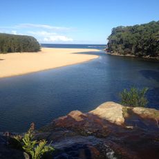
Eagle Rock
Location: Royal National Park
Location: Sutherland Shire Council
GPS coordinates: -34.15368,151.09957
Latest update: November 22, 2025 14:53
Wattamolla
2.5 km
Garie Beach
3.3 km
Royal National Park Coastal Cabin Communities
5.1 km
Wattamolla Beach
2.3 km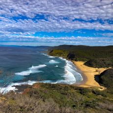
Little Garie Beach
4.1 km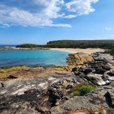
Little Marley Beach
4.9 km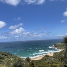
North Era Beach
4.8 km
Scenic viewpoint
140 m
Scenic viewpoint
4 km
Scenic viewpoint
3.9 km
Governor Game Lookout
4.7 km
Scenic viewpoint
2.5 km
Scenic viewpoint
2.4 km
Scenic viewpoint
532 m
Scenic viewpoint
4.5 km
Scenic viewpoint
2.3 km
Scenic viewpoint
2.6 km
Scenic viewpoint
314 m
Scenic viewpoint
3.8 km
Providential Point
2.5 km
Scenic viewpoint
2.3 km
Memorial
2.3 km
Wattamolla
2.2 km
Waterfall
2.3 km
Waterfall
136 m
Waterfall
1.2 km
Waterfall
655 m
Ranger's Pool
4.1 kmReviews
Visited this place? Tap the stars to rate it and share your experience / photos with the community! Try now! You can cancel it anytime.
Discover hidden gems everywhere you go!
From secret cafés to breathtaking viewpoints, skip the crowded tourist spots and find places that match your style. Our app makes it easy with voice search, smart filtering, route optimization, and insider tips from travelers worldwide. Download now for the complete mobile experience.

A unique approach to discovering new places❞
— Le Figaro
All the places worth exploring❞
— France Info
A tailor-made excursion in just a few clicks❞
— 20 Minutes