Avon Tunnel West Portal
Location: Avon
Location: Wollongong City Council
GPS coordinates: -34.43922,150.71770
Latest update: November 21, 2025 07:01
Upper Nepean Scheme
9 km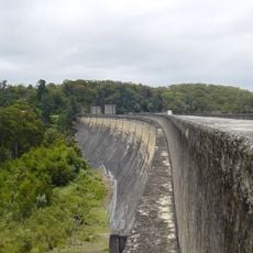
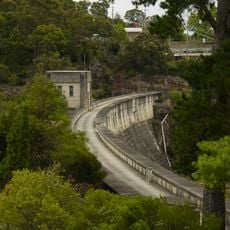
Cordeaux Dam
11.3 km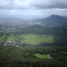
Mount Nebo
11.4 km
Horsley Homestead
7.7 km
Wirrimbirra Field Study Centre and Sanctuary
9.2 km
Beach Memorial Park
9.7 km
Ian Mclennan Park
9.6 km
Hartigan Park
7.8 km
Nudjia Park
10.8 km
Webb Park
10.2 km
Mount Brisbane
11.3 km
Scenic viewpoint
8.3 km
Scenic viewpoint
6.2 km
Mt Kembla Lookout
6.8 km
Kembla Grange Golf Club
9.2 km
Scenic viewpoint
7.2 km
Scenic viewpoint
11.5 km
Whitfields Lookout
4.4 km
Scenic viewpoint
9.1 km
Scenic viewpoint
7.7 km
The Huntley
9 km
Scenic viewpoint
6.3 km
Scenic viewpoint
6.1 km
Soldiers & Miners Memorial
9.3 km
Stephen Jones MP
9.3 km
Ruins
10.6 km
Mt Nebo Bunker
11.5 km
Waterfall
9.3 kmReviews
Visited this place? Tap the stars to rate it and share your experience / photos with the community! Try now! You can cancel it anytime.
Discover hidden gems everywhere you go!
From secret cafés to breathtaking viewpoints, skip the crowded tourist spots and find places that match your style. Our app makes it easy with voice search, smart filtering, route optimization, and insider tips from travelers worldwide. Download now for the complete mobile experience.

A unique approach to discovering new places❞
— Le Figaro
All the places worth exploring❞
— France Info
A tailor-made excursion in just a few clicks❞
— 20 Minutes