Enable Location

We need your location to show you interesting places around you

Discover nearby places

Find interesting locations and hidden gems around you

Precise directions

Get accurate directions and distances to places

Your location is never shared with other users. It's only used when you tap the location button.

Upper Nepean Scheme

Log in to your account

Start exploring — it's free

Trusted by 61,769 travelers worldwide

Continue with Google
Continue with Apple
or

We will send you a code to connect

By continuing, you accept our Terms and Conditions and our Privacy Policy

Check your inbox

We've sent a pincode in your inbox. Please enter the code below.

Upper Nepean Scheme, Water infrastructure network in New South Wales, Australia.

Description

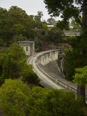
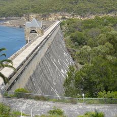
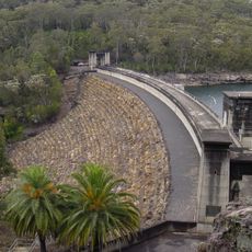
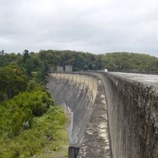
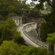
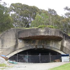
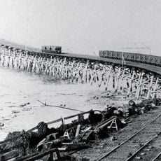
The Upper Nepean Scheme is a water supply network consisting of four dams, two weirs, and canals across the Cataract, Cordeaux, Avon, and Nepean rivers. The system moves water downhill to serve Sydney and surrounding regions through gravity alone.

History

A Royal Commission in 1867 set the foundation for building this water system to solve Sydney's water shortage problem. Construction started in 1880 and took until 1935 to finish.

Culture

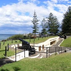
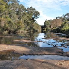
The dams serve as gathering places where local residents fish and celebrate outdoors throughout the year. These waterways remain central to how communities in the region spend their leisure time.

Practical

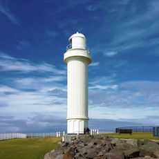
Visitors can access recreational areas at the dams and view the system's structures from walking paths. The best time to visit is outside the hottest summer months when conditions are most comfortable.

Did you know?

Cataract Dam was the first major project in Australia to use pre-cast concrete blocks for the dam face. This approach became a model for water infrastructure construction across the continent.

Location
GPS coordinates
-34.36667,150.76111
Latest update
December 10, 2025 16:28

AroundUs brings together thousands of curated places, local tips, and hidden gems, enriched daily by 60,000 contributors worldwide. Discover all places nearby (New South Wales).

« Upper Nepean Scheme - Water infrastructure network in New South Wales, Australia » is provided by Around Us (aroundus.com). Images and texts are derived from Wikimedia project under a Creative Commons license. You are allowed to copy, distribute, and modify copies of this page, under the conditions set by the license, as long as this note is clearly visible.

Discover hidden gems everywhere you go!

From secret cafés to breathtaking viewpoints, skip the crowded tourist spots and find places that match your style. Our app makes it easy with voice search, smart filtering, route optimization, and insider tips from travelers worldwide. Download now for the complete mobile experience.

Around Us App Screenshot

A unique approach to discovering new places

Le Figaro

All the places worth exploring

France Info

A tailor-made excursion in just a few clicks

20 Minutes

Around Us
Travel Guide & Maps
Download

Send to your phone

QR Code
1

Open the camera app on your mobile.

2

Point at the QR code with your camera. A notification will appear.

3

Tap the notification to open the link.