Lava Cave
Location: Bundella
Location: Liverpool Plains Shire Council
GPS coordinates: -31.69584,150.01171
Latest update: October 26, 2025 17:31
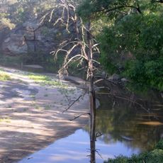
Goulburn River National Park
71.3 km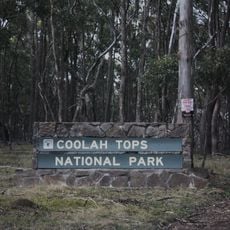
Coolah Tops National Park
11.1 km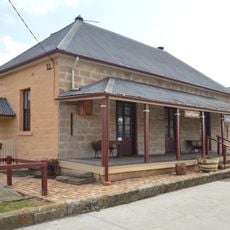
Colonial Cottage Museum
59 km
Bobs Shed
65.1 km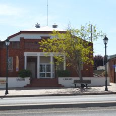
Coolah Library
31.1 km
Lee's Pinch Lookout
67.7 km
Scenic viewpoint
5.7 km
Neptune - Solar System Drive
68.4 km
The Old Pumphouse
62.2 km
The Drip
60.9 km
Solar System Drive - Uranus
48.4 km
Random Rural Art Gallery
67.9 km
Pandora Gallery
31.1 km
Who'd A Though It Lookout
65.3 km
Grass Trees
4.2 km
Scenic viewpoint
5.7 km
Neptune - Solar System Drive
31.7 km
The Bundella Lookout
597 m
Scenic viewpoint
995 m
The Pinnacle Lookout
170 m
Pandora Pass
9.7 km
Shepherd's Peak
23 km
Breeza Lookout
22 km
Scenic viewpoint
10.1 km
Scenic viewpoint
29.1 km
Scenic viewpoint
67.6 km
Lees Pinch Lookout
67.4 km
The Drip Lookout
60.9 kmReviews
Visited this place? Tap the stars to rate it and share your experience / photos with the community! Try now! You can cancel it anytime.
Discover hidden gems everywhere you go!
From secret cafés to breathtaking viewpoints, skip the crowded tourist spots and find places that match your style. Our app makes it easy with voice search, smart filtering, route optimization, and insider tips from travelers worldwide. Download now for the complete mobile experience.

A unique approach to discovering new places❞
— Le Figaro
All the places worth exploring❞
— France Info
A tailor-made excursion in just a few clicks❞
— 20 Minutes