Dawes Range Railway Tunnels
Location: Boyne Valley
Location: Gladstone Regional
GPS coordinates: -24.65409,151.29956
Latest update: October 31, 2025 15:14
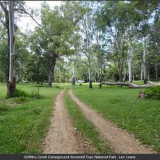
Kroombit Tops National Park
42.4 km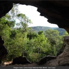
Cania Gorge National Park
31.8 km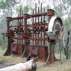
Norton Goldfield
38 km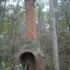
Glassford Creek Smelter Sites
11.6 km
Bulburin National Park
21.1 km
Warro National Park
41.4 km
Soldier Settler House
28.7 km
Ventnor State School
28.6 km
Bunyip Hole Mural
38.5 km
Scenic viewpoint
38.6 km
Dragon Cave
31.8 km
The Overhang
31.2 km
Clarkes Road Gemfields
44.5 km
Mulgildie Hotel, Arthur Hamblin Gallery/Diner
38.4 km
Shamrock mine
30.9 km
Mural, Work of art
29.4 km
Work of art
33.8 km
Dripping Rock
31.5 km
Gorge Lookout
31.8 km
Cania Dam Lookout
32 km
Giants Chair Lookout
32.8 km
Scenic viewpoint
32.4 km
Hurdle Gully Lookout
41.2 km
Cania Dam Wall lookout
32 km
Pioners of Cania District
32.1 km
Clark Bartlett
34.1 km
Beautiful Betsy
30.1 km
Memorial
30 kmReviews
Visited this place? Tap the stars to rate it and share your experience / photos with the community! Try now! You can cancel it anytime.
Discover hidden gems everywhere you go!
From secret cafés to breathtaking viewpoints, skip the crowded tourist spots and find places that match your style. Our app makes it easy with voice search, smart filtering, route optimization, and insider tips from travelers worldwide. Download now for the complete mobile experience.

A unique approach to discovering new places❞
— Le Figaro
All the places worth exploring❞
— France Info
A tailor-made excursion in just a few clicks❞
— 20 Minutes