"Opferwanne"
Location: Bischofsgrüner Forst
GPS coordinates: 50.04537,11.83397
Latest update: October 11, 2024 03:33
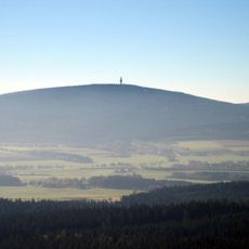
Schneeberg
1.6 km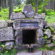
White Main Spring
1.9 km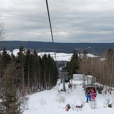
Seilbahn Ochsenkopf-Nord
1.7 km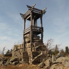
Backöfele
1.6 km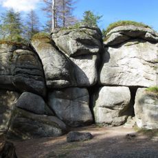
Weißmainfelsen
1.8 km
Haberstein
748 m
Haberstein
736 m
Schneeberggipfel
1.6 km
Aufklärungsturm E
1.5 km
Grenzzeichen, Stein Nr. 40
2.1 km
Eisenglimmer-Bergwerk Beständigkeit ESE von Bischofsgrün
74 m
Weißmain-Felsen am Ochsenkopf
1.8 km
Haberstein am Schneeberg E von Bischofsgrün
714 m
Quellfassung
1.9 km
Opferwanne bei Karches
42 m
Cultural heritage D-4-5937-0060 Bischofsgrüner Forst
59 m
Hammergut
1.9 km
Scenic viewpoint
737 m
Scenic viewpoint
1.9 km
Weißmainfels
1.9 km
Christusfelsen
1.3 km
Hochseilgarten
1.7 km
Memorial stone, memorial
1.9 km
Margarethensteig
1.1 km
Greiner
1.9 km
1005-Meter-Stein
2 km
Ehrenfriedhof, Soldatengedenkstätte
2 km
Steinernes Zelt
2.1 kmReviews
Visited this place? Tap the stars to rate it and share your experience / photos with the community! Try now! You can cancel it anytime.
Discover hidden gems everywhere you go!
From secret cafés to breathtaking viewpoints, skip the crowded tourist spots and find places that match your style. Our app makes it easy with voice search, smart filtering, route optimization, and insider tips from travelers worldwide. Download now for the complete mobile experience.

A unique approach to discovering new places❞
— Le Figaro
All the places worth exploring❞
— France Info
A tailor-made excursion in just a few clicks❞
— 20 Minutes