Šaltinių takas
Location: Ringaudų seniūnija
Accessibility: Niedostępne dla wózków inwalidzkich
Website: https://kacergines.lt/saltiniu-takas2/
Website: https://kacergines.lt/saltiniu-takas2
GPS coordinates: 54.92949,23.72357
Latest update: November 3, 2025 05:31
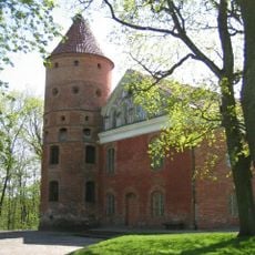
Raudondvaris Castle
4.1 km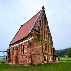
Old Church of St. John the Baptist, Zapyškis
4.4 km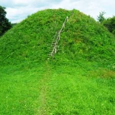
Pypliai Hillfort
1.7 km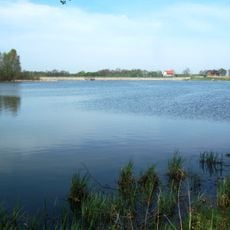
Gaižėnų tvenkinys
2.9 km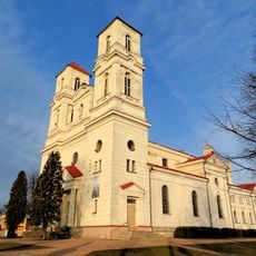
Saint Therese of the Child Jesus church in Raudondvaris
3.9 km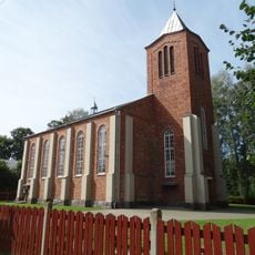
New Church of St. John the Baptist, Zapyškis
4.8 km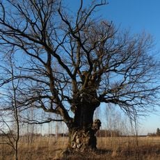
Karveliai Oak
4.8 km
Raudondvaris bridge
4.3 km
Kačerginė chapel
508 m
Santakos gluosnis
4.4 km
Virbališkių piliakalnis
1.8 km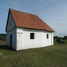
Cemetery chapel, Zapyškis
3.6 km
Kulautuvos pėsčiųjų-sveikatingumo takas II
2.2 km
Paminklas Andriui Višteliui
4.5 km
Duonos kepimo mokyklėlė
2.9 km
Triratis
1.6 km
Triratis
2.5 km
Jie skrenda
1.1 km
Kačerga
207 m
Dock7 Kulautuva vandenlenčių parkas
4.9 km
Sculpture, Work of art
5.1 km
Work of art, sculpture
5 km
Sculpture, Work of art
5.1 km
Work of art, sculpture
5.1 km
Work of art, sculpture
5.1 km
Vaizdas į Nemuną
963 m
Vaizdas į Nemuną
902 m
Netonių šlaitas
1.2 kmReviews
Visited this place? Tap the stars to rate it and share your experience / photos with the community! Try now! You can cancel it anytime.
Discover hidden gems everywhere you go!
From secret cafés to breathtaking viewpoints, skip the crowded tourist spots and find places that match your style. Our app makes it easy with voice search, smart filtering, route optimization, and insider tips from travelers worldwide. Download now for the complete mobile experience.

A unique approach to discovering new places❞
— Le Figaro
All the places worth exploring❞
— France Info
A tailor-made excursion in just a few clicks❞
— 20 Minutes