NWT Sign
Location: Mackenzie County
GPS coordinates: 59.99964,-116.98263
Latest update: November 4, 2025 17:07
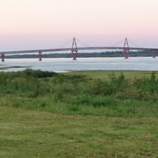
Deh Cho Bridge
145.7 km
Alexandra Falls
67.8 km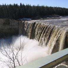
Enterprise
77.1 km
Caribou Mountains Wildland Provincial Park
136.5 km
Louise Falls
69.3 km
Hay-Zama Lakes Wildland Provincial Park
178.4 km
60th Parallel Territorial Park
109 m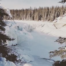
Lady Evelyn Falls Territorial Park
108.7 km
Lady Evelyn Falls
107.6 km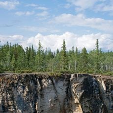
McNallie Creek Territorial Park
89.6 km
Fort Providence Territorial Park
151.9 km
Dory Point Territorial Park
141.3 km
Mellor Rapids
140.8 km
Hay River Territorial Park
117.8 km
Kakisa River Territorial Park
110.8 km
Providence Rapids
148.7 km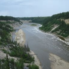
Twin Falls Gorge Territorial Park
71.6 km
Grumbler Rapids
32.1 km
Hay River Golf Course
100.4 km
Fox Haven Golf & Country Club
161.8 km
Centennial Spray Park
165.1 km
Scenic viewpoint
120.3 km
Scenic viewpoint
68.4 km
Scenic viewpoint
69.5 km
Scenic viewpoint
69.8 km
Lady Evelyn Falls viewpoint
109 km
Lady Evelyn Falls
109.1 km
Waterfall
89.5 kmReviews
Visited this place? Tap the stars to rate it and share your experience / photos with the community! Try now! You can cancel it anytime.
Discover hidden gems everywhere you go!
From secret cafés to breathtaking viewpoints, skip the crowded tourist spots and find places that match your style. Our app makes it easy with voice search, smart filtering, route optimization, and insider tips from travelers worldwide. Download now for the complete mobile experience.

A unique approach to discovering new places❞
— Le Figaro
All the places worth exploring❞
— France Info
A tailor-made excursion in just a few clicks❞
— 20 Minutes