Lundbreck Falls
Location: Municipal District of Pincher Creek No. 9
GPS coordinates: 49.58281,-114.20828
Latest update: November 22, 2025 14:35
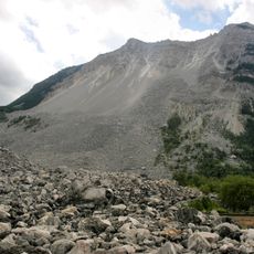
Frank Slide
13.5 km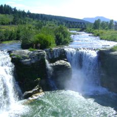
Lundbreck Falls
70 m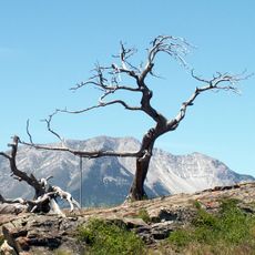
Burmis Tree
7.2 km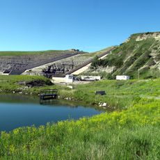
St. Mary River Formation
8 km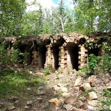
Lille
15.6 km
Frank Slide Interpretive Centre
14 km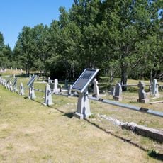
Hillcrest Cemetery
12.4 km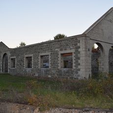
Leitch (Passburg) Collieries
8.7 km
Massacre Butte
10.1 km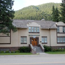
Blairmore Courthouse
16.3 km
West Canadian Collieries Mine
11.3 km
Doukhobor Prayer Home
3.4 km
Bellevue Restaurant
11.6 km
Orpheum Theatre
16.6 km
Byron Creek Falls
11.1 km
DU Ranchlands Cabin
10.1 km
Drewry House
6.8 km
Gushul Studio
16.4 km
Frank Slide Monument
14.1 km
Bellevue Underground Mine Tour
11.4 km
Burmis Tree
7.2 km
Scenic viewpoint
13.6 km
Piitaistakis Eagle Watch Site
10.9 km
Scenic viewpoint
63 m
Scenic viewpoint
26 m
Scenic viewpoint
55 m
Waterfall
13.3 km
Waterfall
13.4 kmReviews
Visited this place? Tap the stars to rate it and share your experience / photos with the community! Try now! You can cancel it anytime.
Discover hidden gems everywhere you go!
From secret cafés to breathtaking viewpoints, skip the crowded tourist spots and find places that match your style. Our app makes it easy with voice search, smart filtering, route optimization, and insider tips from travelers worldwide. Download now for the complete mobile experience.

A unique approach to discovering new places❞
— Le Figaro
All the places worth exploring❞
— France Info
A tailor-made excursion in just a few clicks❞
— 20 Minutes