Mexican Hat Rock
Location: San Juan County
GPS coordinates: 37.17380,-109.84870
Latest update: December 2, 2025 02:40
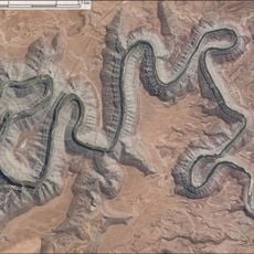
Goosenecks State Park
6.9 km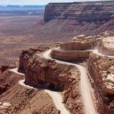
Moki Dugway
13.9 km
Honaker Trail
9.3 km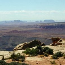
Muley Point
14.4 km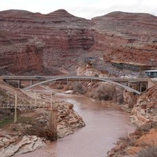
Jason R. Workman Memorial Bridge
3.1 km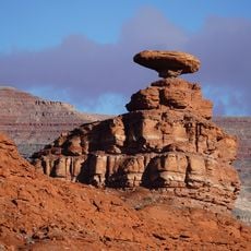
Mexican Hat Rock
18 m
Valley of the Gods
10.4 km
Ledge Rapids
3.4 km
Cedar Point
10.8 km
Moki Dugway Overlook
13.8 km
Forrest Gump Point
14.9 km
Four Foot Rapids
10.3 km
Eight Foot Rapids
5.8 km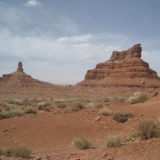
Setting Hen Butte
11.5 km
Seven Sailors
8 km
Scenic viewpoint
13.8 km
Scenic viewpoint
8 km
Muley Point Overlook
13.8 km
San Juan Trading Post
3 km
Scenic viewpoint
13.7 km
Scenic viewpoint
14.6 km
Goosenecks Viewpoint
7 km
Scenic viewpoint
5.6 km
Scenic viewpoint
10.5 km
Scenic viewpoint
7.8 km
Scenic viewpoint
13.7 km
Scenic viewpoint
7.9 km
Valley of the Gods Road Overlook
10.6 kmReviews
Visited this place? Tap the stars to rate it and share your experience / photos with the community! Try now! You can cancel it anytime.
Discover hidden gems everywhere you go!
From secret cafés to breathtaking viewpoints, skip the crowded tourist spots and find places that match your style. Our app makes it easy with voice search, smart filtering, route optimization, and insider tips from travelers worldwide. Download now for the complete mobile experience.

A unique approach to discovering new places❞
— Le Figaro
All the places worth exploring❞
— France Info
A tailor-made excursion in just a few clicks❞
— 20 Minutes