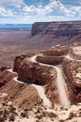
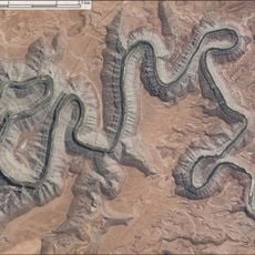
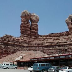
Moki Dugway, Mountain switchback road in San Juan County, US.
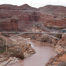
Moki Dugway is an unpaved mountain road in San Juan County featuring multiple hairpin turns that descend steeply across Cedar Mesa. The route runs along Utah State Route 261 and drops significantly from the higher plateau to the desert floor below.
Texas Zinc Mining Company built this route in 1958 to transport uranium ore from the Happy Jack Mine to a processing facility near Mexican Hat. The road served as a critical supply line for mining operations in the region.
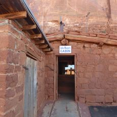
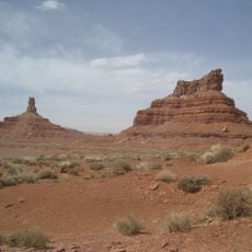
The name reflects both indigenous heritage and the terrain, combining Moki from Spanish references to Pueblo peoples with Dugway, meaning a road cut into a hillside. Visitors see this layered history in every switchback and turn along the route.
The unpaved road requires careful driving through sharp turns, with restrictions on larger vehicles that cannot navigate the narrow passages safely. Travelers should drive slowly and stay alert, as the exposed route offers little protection from the desert conditions.
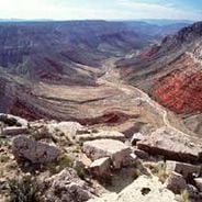
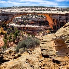
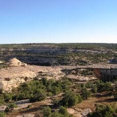
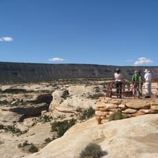
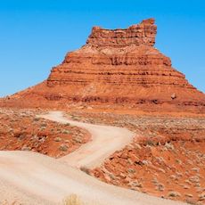
Pullouts along the upper section reveal views of Valley of the Gods, Monument Valley, and the San Juan River canyons spread below. These overlooks showcase the scale and layered landscape that makes the descent so dramatic.
Location: San Juan County
Part of: Utah State Route 261, Trail of the Ancients
GPS coordinates: 37.27550,-109.94004
Latest update: December 6, 2025 17:43
The southwestern United States encompasses desert landscapes, sandstone formations and archaeological sites from several pre-Columbian cultures. The region spans Utah, Arizona, New Mexico and Colorado, featuring geological structures shaped over millions of years by wind and water erosion. National...
Utah preserves thousands of years of human history alongside some of North America's most varied geological landscapes. The region contains extensive rock art panels and Ancestral Pueblo ruins, including the 13th-century stone structures at Bears Ears National Monument and the 650-plus petroglyphs...
West and East Mitten Buttes
33.9 km
Goosenecks State Park
11.3 km
Comb Ridge
31 km
Merrick's Butte
35.3 kmMuley Point
6.7 km
Jason R. Workman Memorial Bridge
15.3 km
Lemuel H. Redd Jr. House
34.2 km
Stimper Arch
25.9 km
Mexican Hat Rock
13.9 km
Bluff Historic District
34.5 km
Joseph Frederick Adams House
34.6 km
James Bean Decker House
33.9 km
John Albert Scorup House
34.6 km
Jens Nielson House
35.5 km
Owachomo Bridge
34.7 km
Kachina Bridge
37 km
Goulding's Trading Post
37.9 km
Owachomo Bridge Trail
34.5 km
House on Fire Ruins
34.5 km
Nokaito Bench
37.5 km
Owachomo Bridge Viewpoint Trailhead
35.1 km
John Wayne's Cabin
38 km
Armstrong Canyon
36.9 km
Castle Butte
8.8 km
Sipapu Bridge View Point
38.1 km
Forrest Gump Point
19.9 km
Setting Hen Butte
11.8 km
Seven Sailors
10.9 kmVisited this place? Tap the stars to rate it and share your experience / photos with the community! Try now! You can cancel it anytime.
Discover hidden gems everywhere you go!
From secret cafés to breathtaking viewpoints, skip the crowded tourist spots and find places that match your style. Our app makes it easy with voice search, smart filtering, route optimization, and insider tips from travelers worldwide. Download now for the complete mobile experience.
A unique approach to discovering new places❞
— Le Figaro
All the places worth exploring❞
— France Info
A tailor-made excursion in just a few clicks❞
— 20 Minutes