See the monuments around you in AROpen chests in the app
Around Us is built for your phone — point your camera at the streets and discover the monuments and places around you in augmented reality.Around Us is built for your phone — chests unlock when you walk, explore and capture nearby places.
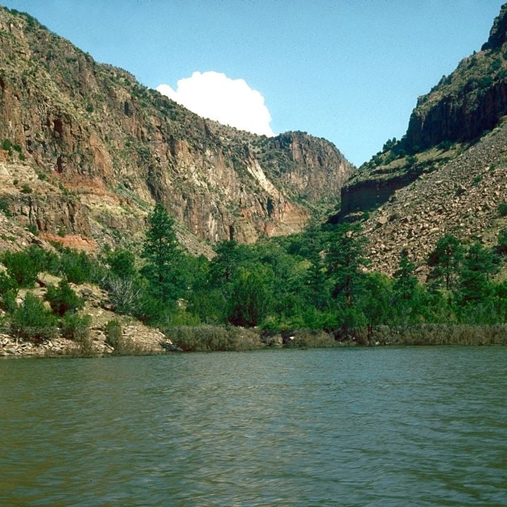
The southwestern United States encompasses desert landscapes, sandstone formations and archaeological sites from several pre-Columbian cultures. The region spans Utah, Arizona, New Mexico and Colorado, featuring geological structures shaped over millions of years by wind and water erosion. National parks such as Canyonlands and Capitol Reef display canyons, mesas and rock spires in shades of red, orange and ochre.
The area preserves evidence of the Ancestral Puebloans, who built cliff dwellings and communal structures between the 12th and 14th centuries. Sites like Bandelier National Monument and Gila Cliff Dwellings provide access to these habitations. Chaco Culture National Historical Park documents a pre-Hispanic trading center with multistory stone complexes. Petroglyphs at locations such as Three Rivers and the petrified trees of Petrified Forest National Park offer additional historical records.
The Navajo Nation administers Monument Valley and the Navajo Zoo, while Hubbell Trading Post operates as a functioning 19th-century trading post. Volcanic features mark Sunset Crater and El Malpais, while White Sands covers more than 275 square miles (700 square kilometers) of gypsum dunes. Glen Canyon and the man-made Lake Cochiti provide water access in this largely arid region. Elevation differences range from the Organ Pipe Cactus Desert to Great Basin National Park with its ridges above 13,000 feet (3,900 meters).
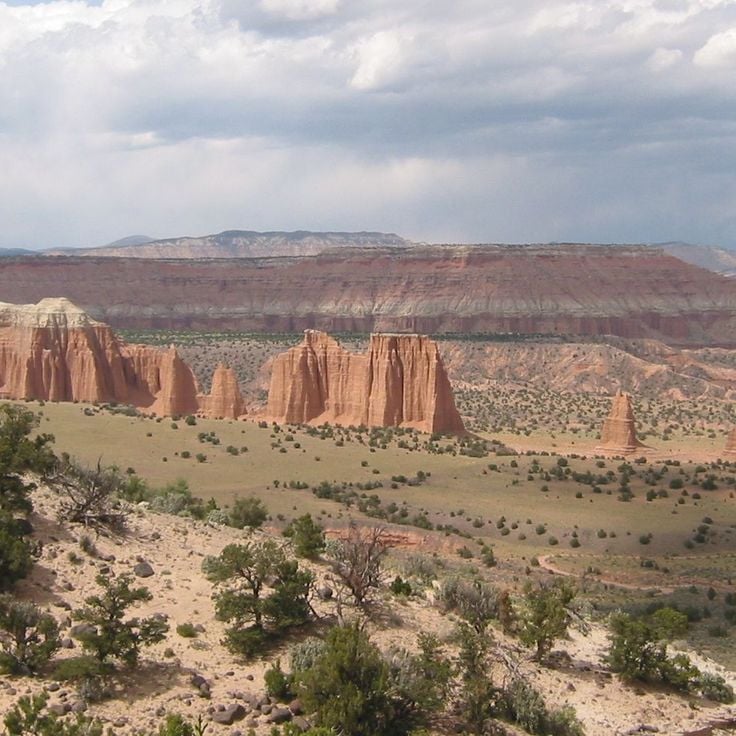
This national park within the Canyonlands follows the Waterpocket Fold, a cliff stretching for 100 miles (161 kilometers). The Fruita Historic District preserves orchards from the 1880s. Rock engravings on the cliff walls display symbols from the Fremont culture. Raised monoliths and narrow canyons traverse the area. The territory covers 378 square miles (979 square kilometers) of sedimentary layers documenting millions of years of geological change.
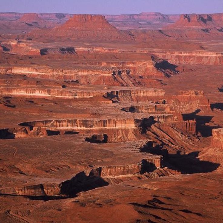
Canyonlands presents a landscape of red and white sandstone carved into three districts by the Colorado River and its tributary, the Green River. The park covers 527 square miles (1,364 square kilometers) and displays mesas, spires, arches and deep canyons. Island in the Sky offers viewpoints from 6,000 feet (1,800 meters) elevation. The Needles shows formations of layered sandstone. The Maze is a remote labyrinth of canyons. The White Rim Trail follows a rock terrace between the upper and lower layers. Petroglyphs created by Ancestral Puebloans are visible at several locations.
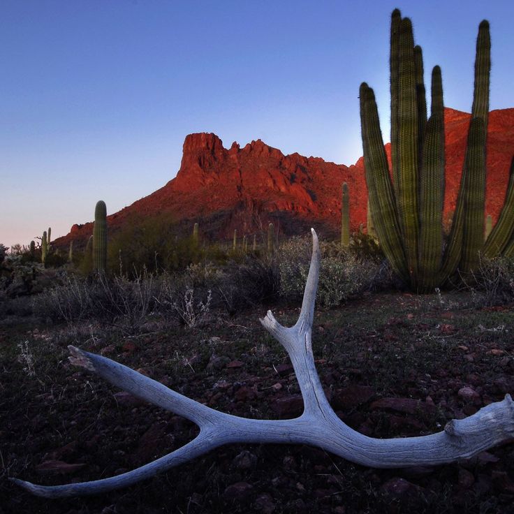
Monument National du Cactus-d'Orgue protects stands of the namesake organ pipe cactus across 133 square miles (344 square kilometers) of Sonoran Desert near the Mexican border. The protected area preserves more than 30 cactus species alongside the title plant, including stands of saguaro, cholla, and prickly pear distributed across creosote bush flats and palo verde thickets. Hiking trails access areas with the densest cactus concentrations, while a 21-mile (34-kilometer) loop road allows vehicle-based touring.
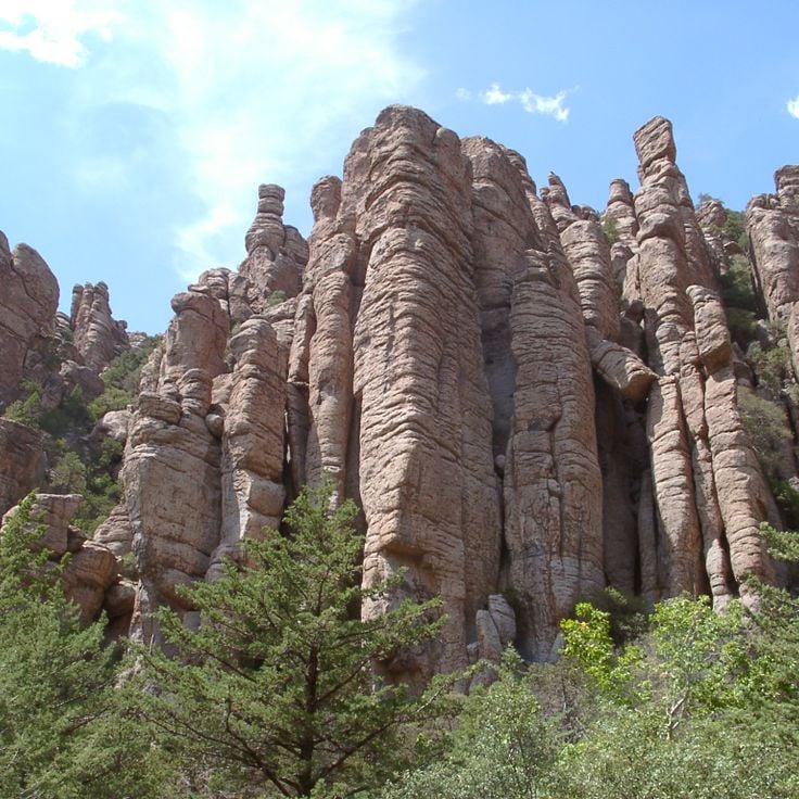
Chiricahua National Monument displays volcanic rock formations and vertical stone pillars formed from solidified ash. The area originated from volcanic activity about 27 million years ago, when pyroclastic material fused into rhyolite tuff. Erosion shaped the rock columns that rise above the canyons and valleys. Trails wind through the formations, including the Echo Canyon Trail and the Heart of Rocks Loop. The monument sits in the Chiricahua Mountains of southeastern Arizona and preserves these geological structures along with evidence of Apache history.
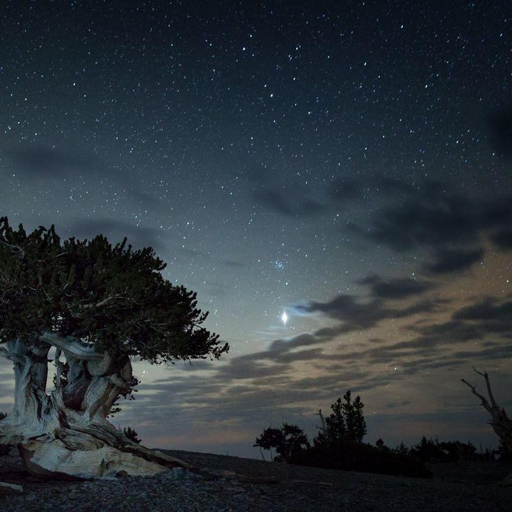
Great Basin National Park protects the Snake Range in Nevada, with Wheeler Peak rising to 13,065 feet (3,982 meters). Bristlecone pines over 3,000 years old grow above the tree line. Lehman Caves displays stalactites, stalagmites and shield formations in limestone chambers. Black bears, bighorn sheep and elk inhabit the upper elevations with alpine lakes and glacial moraines.
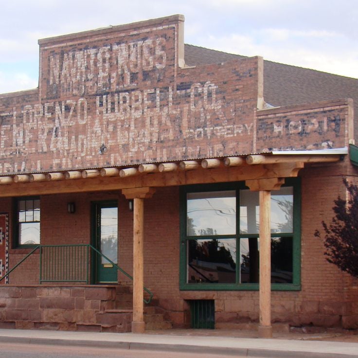
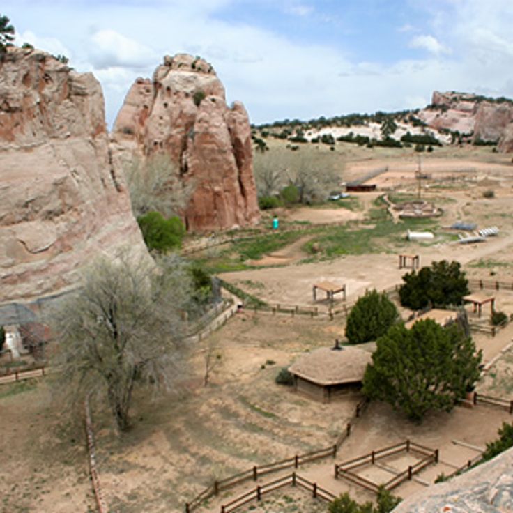
This trading post was established in 1878 and continues to operate as an active marketplace for Navajo crafts. The site preserves the traditional trading relationships between the Navajo people and regional merchants, showcasing handwoven rugs, silver jewelry and other cultural products. The post features original late 19th-century rooms including the trading floor, warehouse and living quarters of the Hubbell family, who managed the business across several generations.
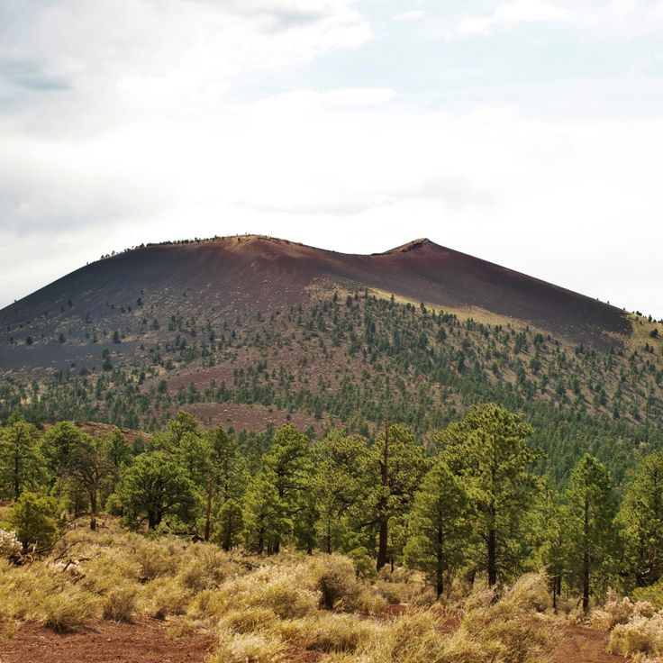
The monument encompasses a 340-foot (100-meter) cinder cone and lava fields created by an eruption roughly 900 years ago. Trails cross the volcanic terrain with black lava flows and scoria formations. The visitor center explains the geological history and how the eruption affected prehistoric inhabitants in the area.
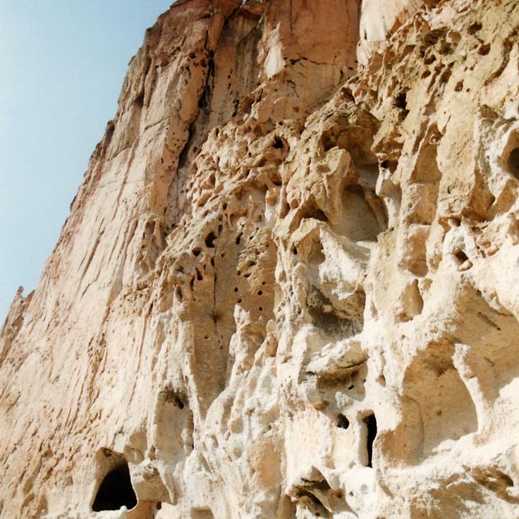
This archaeological site in northern New Mexico preserves dwellings of the Ancestral Puebloans who inhabited this highland region from the 12th to late 15th centuries. Cave homes and freestanding masonry structures are carved into tuff walls formed from volcanic ash. Over 70 miles (113 kilometers) of trails traverse Frijoles Canyon and surrounding mesas, where visitors can examine rooms cut into the rock, circular ceremonial structures, and petroglyphs. The 50 square mile (130 square kilometer) area shows evidence of agricultural terraces and settlement patterns that reflect adaptation to the highland climate and water availability.
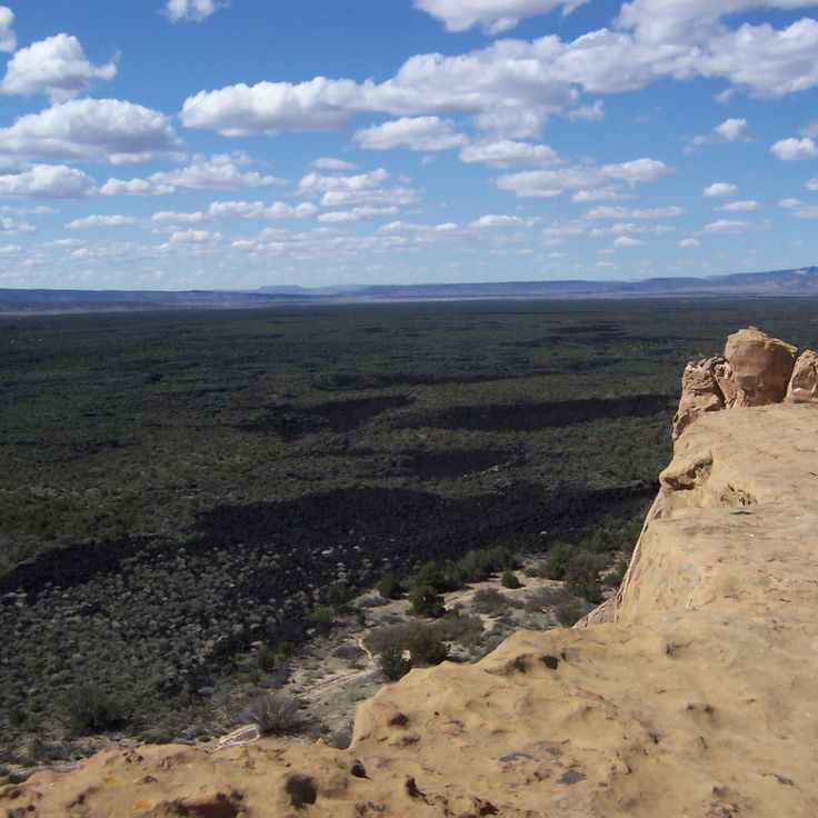
This national monument spans volcanic terrain with black lava flows, basalt fields, cinder cones and sandstone cliffs. The area displays geological formations created by volcanic activity over the past 700,000 years. The lava fields cover approximately 44 square miles (114 square kilometers) and form a rugged landscape with caves, natural tunnels and ice fissures. Hiking trails traverse the lava fields and follow the sandstone cliffs, showing the contrast between volcanic and sedimentary rock.
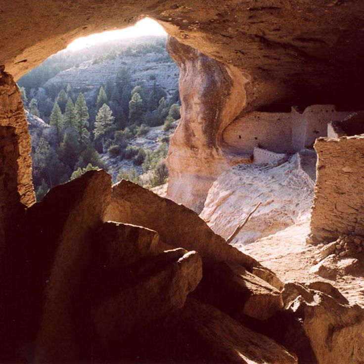
The monument encompasses approximately 40 rooms built by the Mogollon people between 1276 and 1287. These dwellings were constructed within six natural caves located about 150 feet (45 meters) above the West Fork Gila River valley floor. The inhabitants built the structures using stone, wooden beams and adobe mortar. A one-mile (1.6-kilometer) loop trail provides access to the cliff dwellings. The site contains agricultural terraces and remnants of irrigation systems that supported the community.
Parc historique national de Tumacácori preserves the ruins of three Spanish colonial missions established between the 17th and 19th centuries in Arizona. The site displays church structures with adobe walls, remains of living quarters and agricultural features. The visit provides insight into colonial mission architecture and the encounters between Spanish Franciscans and the indigenous O'odham people. Interpretive panels document the history of the religious settlements and the archaeological preservation process.
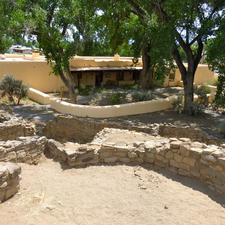
The Monument national des ruines aztèques preserves the remains of a major Pueblo settlement from the 12th and 13th centuries with more than 400 rooms, including a reconstructed great kiva measuring 40 feet (12 meters) in diameter. The site demonstrates the characteristic stone masonry of Pueblo culture with multistory structures. Visitors can walk through excavated areas and view living quarters, storage rooms and ceremonial chambers. The grounds offer a loop trail through the main ruin and explain the inhabitants' way of life and their trade relationships with other Pueblo communities across the Southwest.
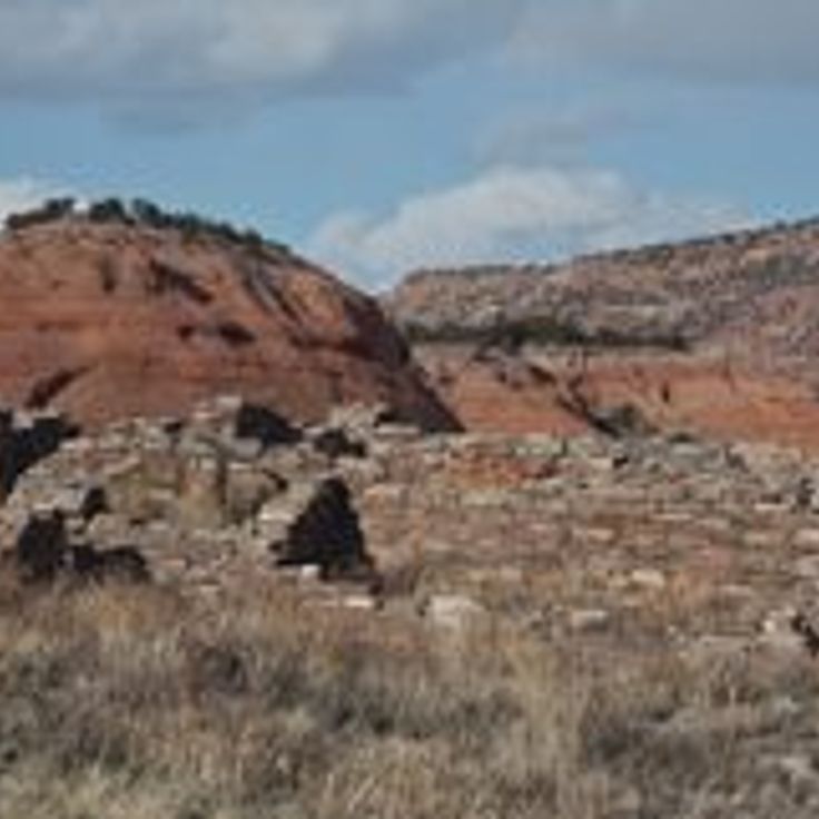
Casamero Pueblo is a remote 11th-century ruin near Prewitt. The site contains a large pueblo structure with roughly 20 rooms and a great kiva measuring 15 meters (49 feet) in diameter. Archaeologists link the site to Chaco culture, which was active in the region between 1000 and 1125 CE. Visitors reach the ruins via a short trail through scrubland.
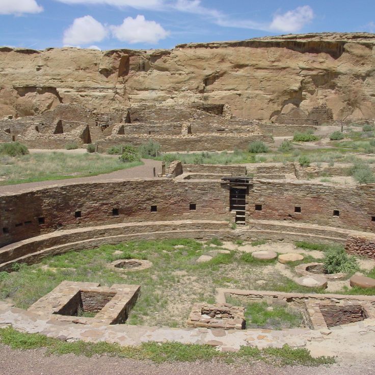
Chaco Culture National Historical Park preserves the remains of a major pre-Columbian Pueblo civilization that flourished in this remote desert region between 850 and 1250 CE. The park encompasses several large pueblo structures with up to five stories and precisely aligned masonry, along with a network of ancient roads extending for miles that suggest complex social and ceremonial connections. The archaeological site documents advanced construction techniques, astronomical knowledge and a far-reaching trade system that linked the region with distant areas.
The Navajo Nation Zoological and Botanical Park is the only zoo in the United States owned and operated by Native Americans. The facility houses native wildlife including coyotes, cougars, wolves, elk and various bird species. The zoo focuses on caring for injured or orphaned animals that cannot be released back into the wild. The grounds also display regional plant life and teach visitors about the significance of these species in Navajo culture.
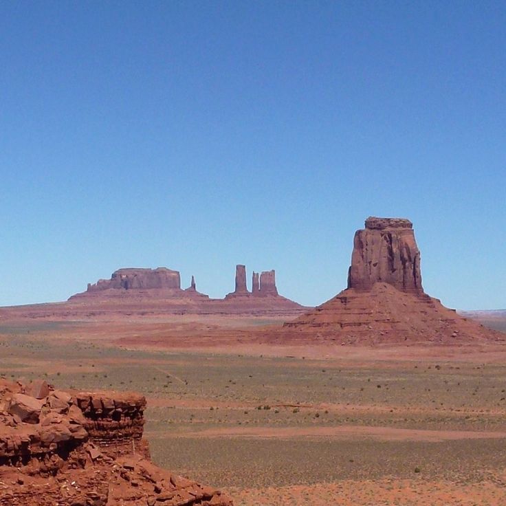
This Navajo Nation park along the Arizona-Utah border covers roughly 37,000 acres (15,000 hectares) of desert land with towering sandstone formations. The red sandstone mesas and buttes rise up to 1,000 feet (300 meters) above the valley floor and formed through millions of years of erosion. Visitors drive the 17-mile (27-kilometer) loop road through the valley, which passes distinctive formations including the Mittens, Merrick Butte and Three Sisters. The area sits within the Navajo Reservation, and tribal government manages all access permits and guided tours. The main scene extends along U.S. Route 163 in both directions and has been featured in numerous films since the 1930s. The visitor center provides basic facilities, and local Navajo guides arrange trips to more remote sites. The unpaved road requires caution during wet weather.
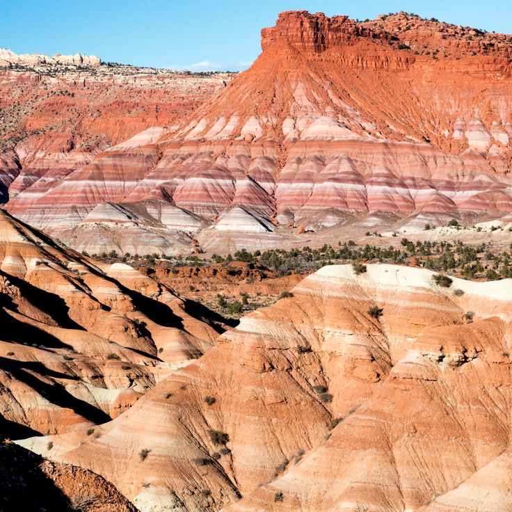
The Grand Staircase-Escalante National Monument covers 2,930 square miles (7,600 square kilometers) and protects sandstone formations, canyons and archaeological sites. The area encompasses three main regions: the Grand Staircase with its colorful cliffs, the Kaiparowits Plateau with fossil deposits and the Escalante Canyons with river courses. The management permits hiking, camping and geological research.
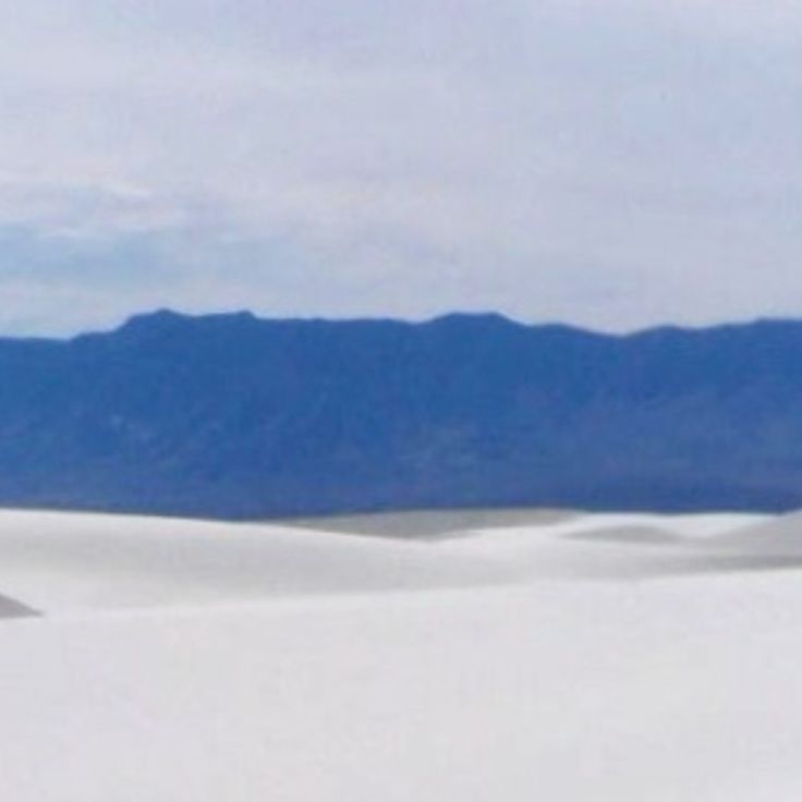
White Sands National Park protects the world's largest gypsum dunefield, covering 275 square miles (712 square kilometers) in the Tularosa Desert. The white dunes rise up to 60 feet (18 meters) and form from gypsum crystals that erode from the surrounding mountains. The park features marked trails including the Dune Life Nature Trail and the Alkali Flat Trail, plus an eight-mile (13-kilometer) scenic drive through the dunefield. Rangers conduct evening programs and full moon hikes. The visitor center presents exhibits on the park's geology and wildlife.
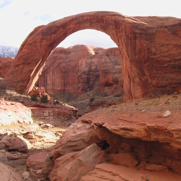
Rainbow Bridge National Monument protects the world's tallest natural bridge, spanning 275 feet (84 m) and rising 290 feet (88 m) above the canyon floor. This sandstone arch stands in a remote side canyon of Lake Powell, carved over millions of years by water and wind. Visitors reach the formation by boat across the lake followed by a short walk, or via a multi-day trek from the Navajo Nation. The site holds sacred significance for several Native American tribes.
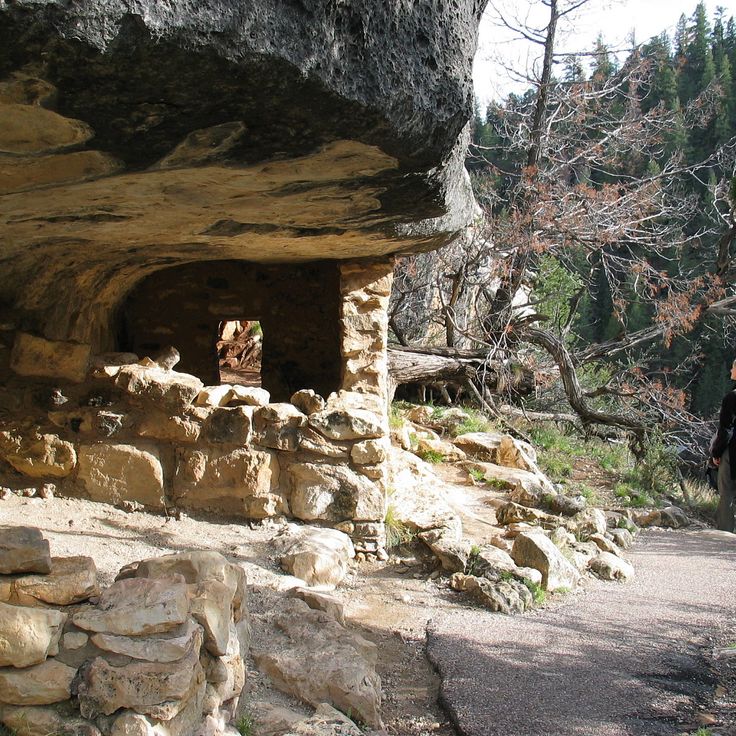
Walnut Canyon National Monument protects more than 80 Puebloan cliff dwellings from the 12th and 13th centuries set within the limestone walls of this forested canyon. The Sinagua people used natural rock overhangs to build their homes and farmed the plateau above. A trail descending into the canyon provides access to twenty-five of these rooms, while the rim trail offers views across the site and demonstrates the plant diversity found across multiple elevation zones.
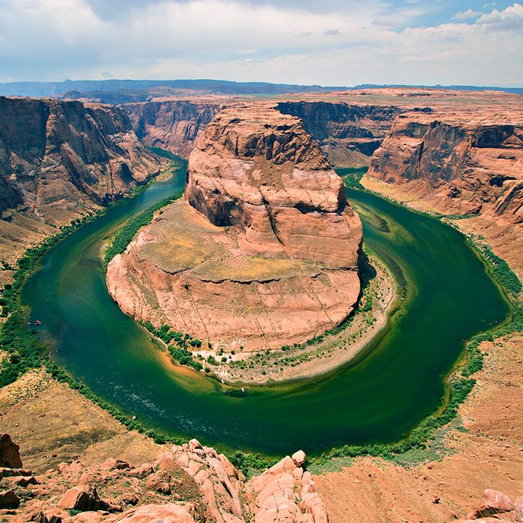
The Glen Canyon National Recreation Area encompasses Lake Powell, a reservoir extending 186 miles (299 kilometers) formed by the damming of the Colorado River at Glen Canyon Dam. Navajo sandstone formations frame the water with orange and cream-colored walls, while side canyons provide access to hiking trails and archaeological sites of the Ancestral Puebloans. Visitors can boat, fish, swim and explore the lake's waterways by houseboat. The National Park Service manages the area.
Cochiti Lake is a man-made reservoir on the Rio Grande covering approximately 20 square miles (50 square kilometers). The reservoir was built for flood control in the high desert terrain of northern New Mexico.
Goosenecks State Park protects a series of entrenched meanders where the San Juan River has cut 300 feet (90 meters) into sedimentary rock layers. The river bends span 6 miles (10 kilometers) and create a textbook example of geological erosion patterns. A viewpoint at the canyon rim provides views of the looping river course and exposed rock formations documenting hundreds of millions of years of deposition.
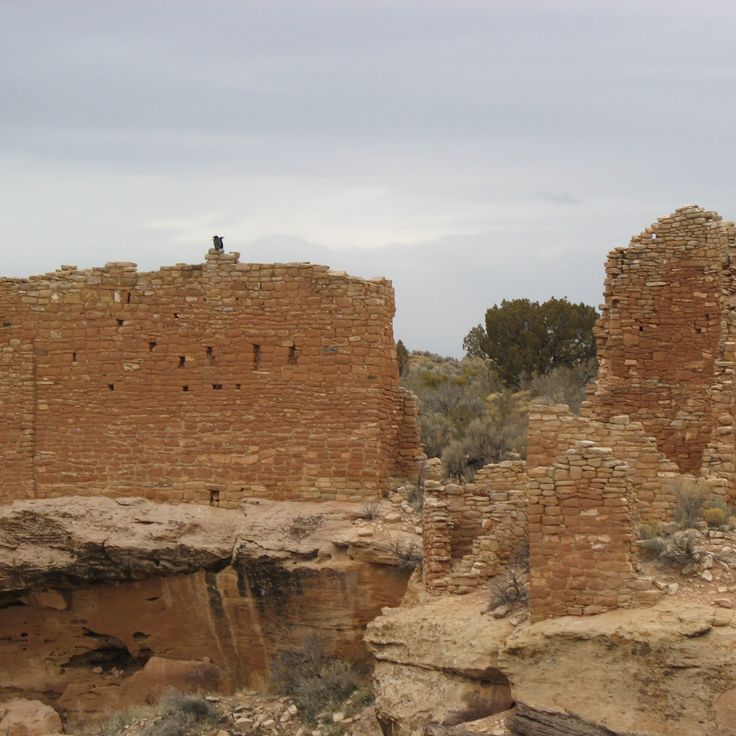
Hovenweep National Monument protects six archaeological sites with 13th-century stone structures spread across 20 miles (32 kilometers) of mesa terrain. The sites demonstrate Ancestral Puebloan construction techniques, with towers and dwelling structures built along canyon rims. The monument spans the Colorado-Utah border and documents the late occupation period before abandonment of the region.
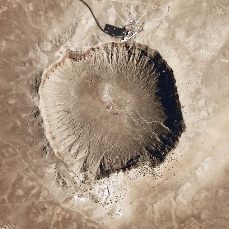
This circular crater formed roughly 50,000 years ago when an iron meteorite measuring about 164 feet (50 meters) across struck the high desert. The resulting depression spans 3,900 feet (1,200 meters) in diameter and reaches 560 feet (170 meters) deep. A visitor center on the rim presents information about impact processes, meteorites and the scientific study of the site. Trails follow the crater rim and provide views across the structure and surrounding plateau.
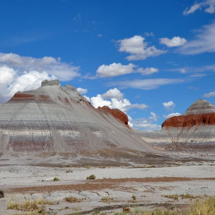
Petrified Forest National Park preserves fossilized tree trunks from the Triassic period. The mineralized logs formed roughly 225 million years ago when volcanic sediment replaced organic tissue with quartz and other minerals. The park covers 146 square miles (378 square kilometers) and includes sections of the Painted Desert to the north, along with sites containing petroglyphs and archaeological remains from ancestral Pueblo cultures. The Rainbow Forest area in the southern section displays concentrations of petrified logs, while the Crystal Forest Trail provides access to fragments containing quartz crystals. The visitor center offers exhibits on Triassic ecosystems and fossilization processes.
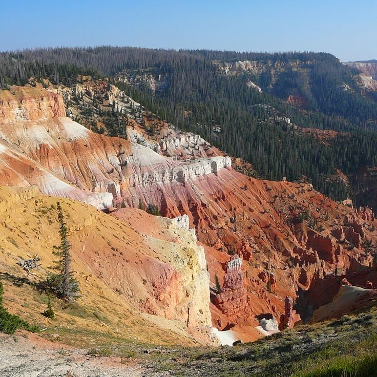
Cedar Breaks National Monument preserves a natural limestone amphitheater with red and white cliffs at elevations exceeding 10,000 feet (3,000 meters). The park protects bristlecone pines that rank among the oldest living organisms on Earth, along with alpine wildflower meadows that bloom during summer months.
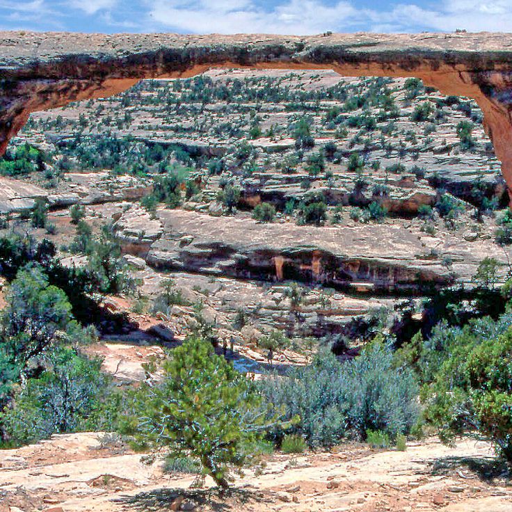
The monument protects three major natural sandstone bridges carved by millennia of water erosion through the canyon walls of White Canyon. Sipapu Bridge spans 268 feet (82 m) and ranks among the longest natural bridges in North America. A nine-mile loop road connects the three main formations and provides access to the valleys below. The area sits on a high plateau ranging from 6,200 to 6,900 feet (1,890 to 2,100 m) in elevation and also preserves 13th-century pueblo ruins.
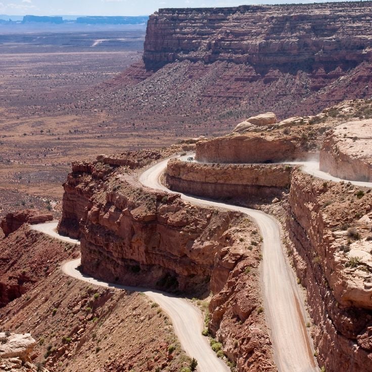
The Moki Dugway is an unpaved mountain road with an 11 percent grade that switchbacks along the sandstone cliffs of Cedar Mesa. This route connects the high plateau to the valley floor and provides direct access to remote regions of southeastern Utah. Originally constructed in the 1950s to transport uranium ore, the road now serves travelers heading to Monument Valley or Natural Bridges. The route descends approximately 1,100 feet (335 meters) over 3 miles (4.8 kilometers).
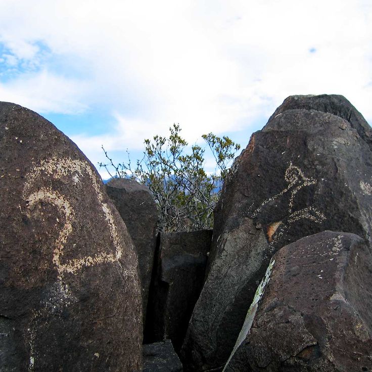
Three Rivers Petroglyphs contains more than 21,000 prehistoric rock carvings made by the Jornada Mogollon people across a 50-acre site at the base of the Sacramento Mountains. The engravings depict animals, humans, geometric shapes and ritual symbols created between 900 and 1400 CE. A one-mile trail winds through the area of dark basalt boulders that hold the carvings.
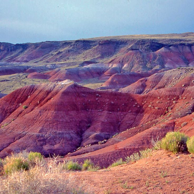
The Painted Desert covers 140 square miles (360 square kilometers) in northern Arizona and displays horizontal rock layers in red, orange and purple tones. These sedimentary strata date from different periods of the Triassic and represent roughly 200 million years of geological history. The color variations result from different minerals in the deposits, particularly iron oxide and manganese compounds. The area lies partially within Petrified Forest National Park and offers several viewpoints along the park road.
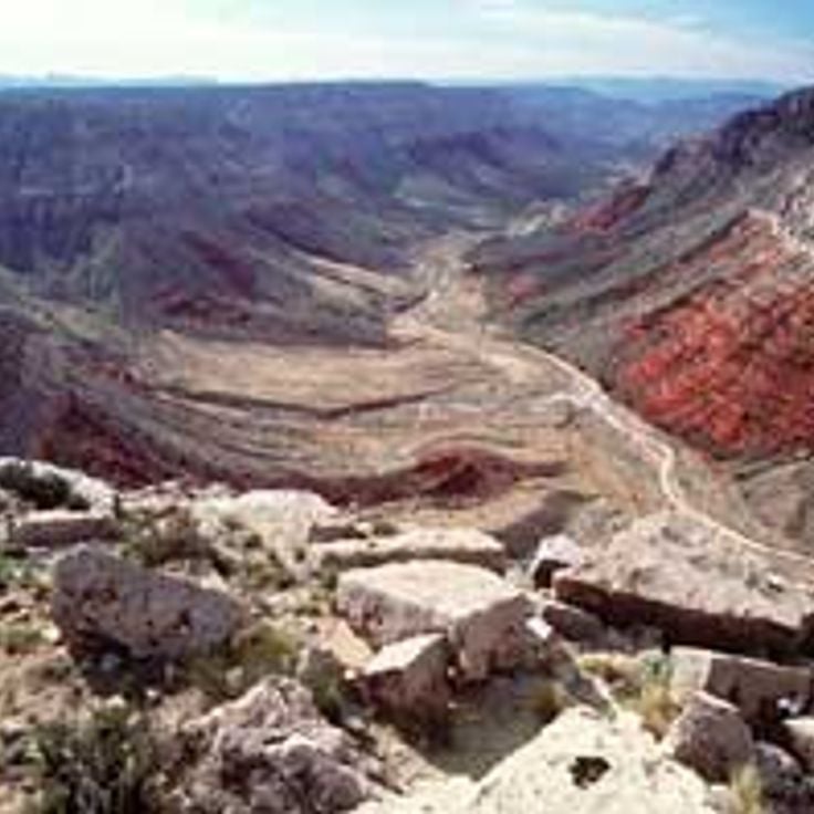
Grand Canyon-Parashant National Monument spans 1,590 square miles (4,115 square kilometers) of desert, canyons and mountains in northwestern Arizona. The landscape features ancient volcanic cones, lava fields and deep gorges that descend toward the Colorado River. Archaeological sites document prehistoric occupation by Ancestral Puebloans and Paiute peoples. The remote area borders Grand Canyon National Park directly and preserves geological formations spanning several hundred million years.
This national park within the Canyonlands follows the Waterpocket Fold, a cliff stretching for 100 miles (161 kilometers). The Fruita Historic District preserves orchards from the 1880s. Rock engravings on the cliff walls display symbols from the Fremont culture. Raised monoliths and narrow canyons traverse the area. The territory covers 378 square miles (979 square kilometers) of sedimentary layers documenting millions of years of geological change.
Canyonlands presents a landscape of red and white sandstone carved into three districts by the Colorado River and its tributary, the Green River. The park covers 527 square miles (1,364 square kilometers) and displays mesas, spires, arches and deep canyons. Island in the Sky offers viewpoints from 6,000 feet (1,800 meters) elevation. The Needles shows formations of layered sandstone. The Maze is a remote labyrinth of canyons. The White Rim Trail follows a rock terrace between the upper and lower layers. Petroglyphs created by Ancestral Puebloans are visible at several locations.
Monument National du Cactus-d'Orgue protects stands of the namesake organ pipe cactus across 133 square miles (344 square kilometers) of Sonoran Desert near the Mexican border. The protected area preserves more than 30 cactus species alongside the title plant, including stands of saguaro, cholla, and prickly pear distributed across creosote bush flats and palo verde thickets. Hiking trails access areas with the densest cactus concentrations, while a 21-mile (34-kilometer) loop road allows vehicle-based touring.
Chiricahua National Monument displays volcanic rock formations and vertical stone pillars formed from solidified ash. The area originated from volcanic activity about 27 million years ago, when pyroclastic material fused into rhyolite tuff. Erosion shaped the rock columns that rise above the canyons and valleys. Trails wind through the formations, including the Echo Canyon Trail and the Heart of Rocks Loop. The monument sits in the Chiricahua Mountains of southeastern Arizona and preserves these geological structures along with evidence of Apache history.
Great Basin National Park protects the Snake Range in Nevada, with Wheeler Peak rising to 13,065 feet (3,982 meters). Bristlecone pines over 3,000 years old grow above the tree line. Lehman Caves displays stalactites, stalagmites and shield formations in limestone chambers. Black bears, bighorn sheep and elk inhabit the upper elevations with alpine lakes and glacial moraines.
This trading post was established in 1878 and continues to operate as an active marketplace for Navajo crafts. The site preserves the traditional trading relationships between the Navajo people and regional merchants, showcasing handwoven rugs, silver jewelry and other cultural products. The post features original late 19th-century rooms including the trading floor, warehouse and living quarters of the Hubbell family, who managed the business across several generations.
The monument encompasses a 340-foot (100-meter) cinder cone and lava fields created by an eruption roughly 900 years ago. Trails cross the volcanic terrain with black lava flows and scoria formations. The visitor center explains the geological history and how the eruption affected prehistoric inhabitants in the area.
This archaeological site in northern New Mexico preserves dwellings of the Ancestral Puebloans who inhabited this highland region from the 12th to late 15th centuries. Cave homes and freestanding masonry structures are carved into tuff walls formed from volcanic ash. Over 70 miles (113 kilometers) of trails traverse Frijoles Canyon and surrounding mesas, where visitors can examine rooms cut into the rock, circular ceremonial structures, and petroglyphs. The 50 square mile (130 square kilometer) area shows evidence of agricultural terraces and settlement patterns that reflect adaptation to the highland climate and water availability.
This national monument spans volcanic terrain with black lava flows, basalt fields, cinder cones and sandstone cliffs. The area displays geological formations created by volcanic activity over the past 700,000 years. The lava fields cover approximately 44 square miles (114 square kilometers) and form a rugged landscape with caves, natural tunnels and ice fissures. Hiking trails traverse the lava fields and follow the sandstone cliffs, showing the contrast between volcanic and sedimentary rock.
The monument encompasses approximately 40 rooms built by the Mogollon people between 1276 and 1287. These dwellings were constructed within six natural caves located about 150 feet (45 meters) above the West Fork Gila River valley floor. The inhabitants built the structures using stone, wooden beams and adobe mortar. A one-mile (1.6-kilometer) loop trail provides access to the cliff dwellings. The site contains agricultural terraces and remnants of irrigation systems that supported the community.
Parc historique national de Tumacácori preserves the ruins of three Spanish colonial missions established between the 17th and 19th centuries in Arizona. The site displays church structures with adobe walls, remains of living quarters and agricultural features. The visit provides insight into colonial mission architecture and the encounters between Spanish Franciscans and the indigenous O'odham people. Interpretive panels document the history of the religious settlements and the archaeological preservation process.
The Monument national des ruines aztèques preserves the remains of a major Pueblo settlement from the 12th and 13th centuries with more than 400 rooms, including a reconstructed great kiva measuring 40 feet (12 meters) in diameter. The site demonstrates the characteristic stone masonry of Pueblo culture with multistory structures. Visitors can walk through excavated areas and view living quarters, storage rooms and ceremonial chambers. The grounds offer a loop trail through the main ruin and explain the inhabitants' way of life and their trade relationships with other Pueblo communities across the Southwest.
Casamero Pueblo is a remote 11th-century ruin near Prewitt. The site contains a large pueblo structure with roughly 20 rooms and a great kiva measuring 15 meters (49 feet) in diameter. Archaeologists link the site to Chaco culture, which was active in the region between 1000 and 1125 CE. Visitors reach the ruins via a short trail through scrubland.
Chaco Culture National Historical Park preserves the remains of a major pre-Columbian Pueblo civilization that flourished in this remote desert region between 850 and 1250 CE. The park encompasses several large pueblo structures with up to five stories and precisely aligned masonry, along with a network of ancient roads extending for miles that suggest complex social and ceremonial connections. The archaeological site documents advanced construction techniques, astronomical knowledge and a far-reaching trade system that linked the region with distant areas.
The Navajo Nation Zoological and Botanical Park is the only zoo in the United States owned and operated by Native Americans. The facility houses native wildlife including coyotes, cougars, wolves, elk and various bird species. The zoo focuses on caring for injured or orphaned animals that cannot be released back into the wild. The grounds also display regional plant life and teach visitors about the significance of these species in Navajo culture.
This Navajo Nation park along the Arizona-Utah border covers roughly 37,000 acres (15,000 hectares) of desert land with towering sandstone formations. The red sandstone mesas and buttes rise up to 1,000 feet (300 meters) above the valley floor and formed through millions of years of erosion. Visitors drive the 17-mile (27-kilometer) loop road through the valley, which passes distinctive formations including the Mittens, Merrick Butte and Three Sisters. The area sits within the Navajo Reservation, and tribal government manages all access permits and guided tours. The main scene extends along U.S. Route 163 in both directions and has been featured in numerous films since the 1930s. The visitor center provides basic facilities, and local Navajo guides arrange trips to more remote sites. The unpaved road requires caution during wet weather.
The Grand Staircase-Escalante National Monument covers 2,930 square miles (7,600 square kilometers) and protects sandstone formations, canyons and archaeological sites. The area encompasses three main regions: the Grand Staircase with its colorful cliffs, the Kaiparowits Plateau with fossil deposits and the Escalante Canyons with river courses. The management permits hiking, camping and geological research.
White Sands National Park protects the world's largest gypsum dunefield, covering 275 square miles (712 square kilometers) in the Tularosa Desert. The white dunes rise up to 60 feet (18 meters) and form from gypsum crystals that erode from the surrounding mountains. The park features marked trails including the Dune Life Nature Trail and the Alkali Flat Trail, plus an eight-mile (13-kilometer) scenic drive through the dunefield. Rangers conduct evening programs and full moon hikes. The visitor center presents exhibits on the park's geology and wildlife.
Rainbow Bridge National Monument protects the world's tallest natural bridge, spanning 275 feet (84 m) and rising 290 feet (88 m) above the canyon floor. This sandstone arch stands in a remote side canyon of Lake Powell, carved over millions of years by water and wind. Visitors reach the formation by boat across the lake followed by a short walk, or via a multi-day trek from the Navajo Nation. The site holds sacred significance for several Native American tribes.
Walnut Canyon National Monument protects more than 80 Puebloan cliff dwellings from the 12th and 13th centuries set within the limestone walls of this forested canyon. The Sinagua people used natural rock overhangs to build their homes and farmed the plateau above. A trail descending into the canyon provides access to twenty-five of these rooms, while the rim trail offers views across the site and demonstrates the plant diversity found across multiple elevation zones.
The Glen Canyon National Recreation Area encompasses Lake Powell, a reservoir extending 186 miles (299 kilometers) formed by the damming of the Colorado River at Glen Canyon Dam. Navajo sandstone formations frame the water with orange and cream-colored walls, while side canyons provide access to hiking trails and archaeological sites of the Ancestral Puebloans. Visitors can boat, fish, swim and explore the lake's waterways by houseboat. The National Park Service manages the area.
Cochiti Lake is a man-made reservoir on the Rio Grande covering approximately 20 square miles (50 square kilometers). The reservoir was built for flood control in the high desert terrain of northern New Mexico.
Goosenecks State Park protects a series of entrenched meanders where the San Juan River has cut 300 feet (90 meters) into sedimentary rock layers. The river bends span 6 miles (10 kilometers) and create a textbook example of geological erosion patterns. A viewpoint at the canyon rim provides views of the looping river course and exposed rock formations documenting hundreds of millions of years of deposition.
Hovenweep National Monument protects six archaeological sites with 13th-century stone structures spread across 20 miles (32 kilometers) of mesa terrain. The sites demonstrate Ancestral Puebloan construction techniques, with towers and dwelling structures built along canyon rims. The monument spans the Colorado-Utah border and documents the late occupation period before abandonment of the region.
This circular crater formed roughly 50,000 years ago when an iron meteorite measuring about 164 feet (50 meters) across struck the high desert. The resulting depression spans 3,900 feet (1,200 meters) in diameter and reaches 560 feet (170 meters) deep. A visitor center on the rim presents information about impact processes, meteorites and the scientific study of the site. Trails follow the crater rim and provide views across the structure and surrounding plateau.
Petrified Forest National Park preserves fossilized tree trunks from the Triassic period. The mineralized logs formed roughly 225 million years ago when volcanic sediment replaced organic tissue with quartz and other minerals. The park covers 146 square miles (378 square kilometers) and includes sections of the Painted Desert to the north, along with sites containing petroglyphs and archaeological remains from ancestral Pueblo cultures. The Rainbow Forest area in the southern section displays concentrations of petrified logs, while the Crystal Forest Trail provides access to fragments containing quartz crystals. The visitor center offers exhibits on Triassic ecosystems and fossilization processes.
Cedar Breaks National Monument preserves a natural limestone amphitheater with red and white cliffs at elevations exceeding 10,000 feet (3,000 meters). The park protects bristlecone pines that rank among the oldest living organisms on Earth, along with alpine wildflower meadows that bloom during summer months.
The monument protects three major natural sandstone bridges carved by millennia of water erosion through the canyon walls of White Canyon. Sipapu Bridge spans 268 feet (82 m) and ranks among the longest natural bridges in North America. A nine-mile loop road connects the three main formations and provides access to the valleys below. The area sits on a high plateau ranging from 6,200 to 6,900 feet (1,890 to 2,100 m) in elevation and also preserves 13th-century pueblo ruins.
The Moki Dugway is an unpaved mountain road with an 11 percent grade that switchbacks along the sandstone cliffs of Cedar Mesa. This route connects the high plateau to the valley floor and provides direct access to remote regions of southeastern Utah. Originally constructed in the 1950s to transport uranium ore, the road now serves travelers heading to Monument Valley or Natural Bridges. The route descends approximately 1,100 feet (335 meters) over 3 miles (4.8 kilometers).
Three Rivers Petroglyphs contains more than 21,000 prehistoric rock carvings made by the Jornada Mogollon people across a 50-acre site at the base of the Sacramento Mountains. The engravings depict animals, humans, geometric shapes and ritual symbols created between 900 and 1400 CE. A one-mile trail winds through the area of dark basalt boulders that hold the carvings.
The Painted Desert covers 140 square miles (360 square kilometers) in northern Arizona and displays horizontal rock layers in red, orange and purple tones. These sedimentary strata date from different periods of the Triassic and represent roughly 200 million years of geological history. The color variations result from different minerals in the deposits, particularly iron oxide and manganese compounds. The area lies partially within Petrified Forest National Park and offers several viewpoints along the park road.
Grand Canyon-Parashant National Monument spans 1,590 square miles (4,115 square kilometers) of desert, canyons and mountains in northwestern Arizona. The landscape features ancient volcanic cones, lava fields and deep gorges that descend toward the Colorado River. Archaeological sites document prehistoric occupation by Ancestral Puebloans and Paiute peoples. The remote area borders Grand Canyon National Park directly and preserves geological formations spanning several hundred million years.