Natural Bridges National Monument, Nature reserve in San Juan County, Utah.
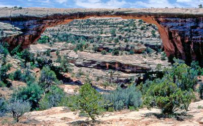
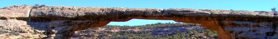
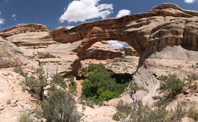
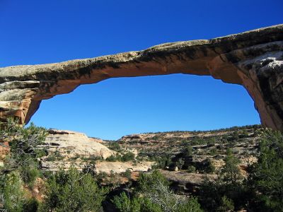
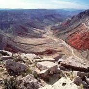
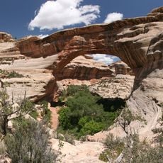
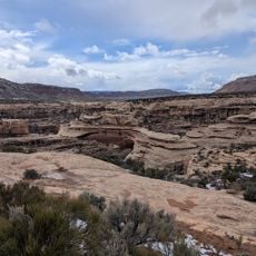
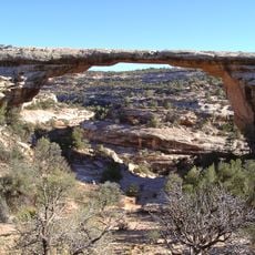
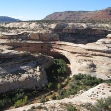
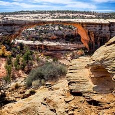
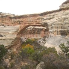
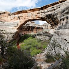
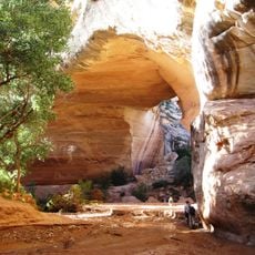
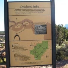
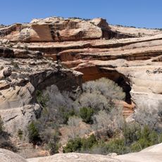
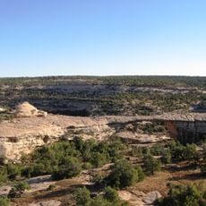
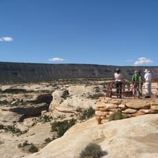
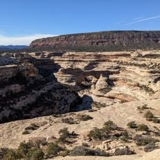
Three natural bridges named Sipapu, Kachina, and Owachomo span across deep sandstone canyons on a forested plateau in southeastern Utah.
President Theodore Roosevelt established this national monument on April 16, 1908, marking the first national monument designation in Utah.
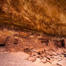
The three natural bridges carry names from Hopi culture, reflecting the Native American heritage of this region in southeastern Utah.
The 9-mile paved scenic drive connects observation points for each bridge, with moderate hiking trails leading to the base of these formations.
The International Dark Sky Park designation makes this location an exceptional destination for astronomical observation and night sky photography.
Location: San Juan County
Inception: April 16, 1908
Operator: United States National Park Service
Website: http://nps.gov/nabr
GPS coordinates: 37.60138,-110.01374
Latest update: May 27, 2025 08:47
The southwestern United States encompasses desert landscapes, sandstone formations and archaeological sites from several pre-Columbian cultures. The region spans Utah, Arizona, New Mexico and Colorado, featuring geological structures shaped over millions of years by wind and water erosion. National parks such as Canyonlands and Capitol Reef display canyons, mesas and rock spires in shades of red, orange and ochre. The area preserves evidence of the Ancestral Puebloans, who built cliff dwellings and communal structures between the 12th and 14th centuries. Sites like Bandelier National Monument and Gila Cliff Dwellings provide access to these habitations. Chaco Culture National Historical Park documents a pre-Hispanic trading center with multistory stone complexes. Petroglyphs at locations such as Three Rivers and the petrified trees of Petrified Forest National Park offer additional historical records. The Navajo Nation administers Monument Valley and the Navajo Zoo, while Hubbell Trading Post operates as a functioning 19th-century trading post. Volcanic features mark Sunset Crater and El Malpais, while White Sands covers more than 275 square miles (700 square kilometers) of gypsum dunes. Glen Canyon and the man-made Lake Cochiti provide water access in this largely arid region. Elevation differences range from the Organ Pipe Cactus Desert to Great Basin National Park with its ridges above 13,000 feet (3,900 meters).
Goosenecks State Park
48.1 km
Cataract Canyon
39.4 km
Comb Ridge
37.8 km
Dark Canyon Wilderness
22 km
Hite Crossing Bridge
45 km
Edge of the Cedars State Park Museum
46.3 km
Moki Dugway
36.9 km
Sipapu Bridge
1.7 km
White Canyon
43.3 km
Muley Point
41 km
Jason R. Workman Memorial Bridge
51.8 km
Kirk's Cabin Complex
48.9 km
Swallow's Nest
47.9 km
Stimper Arch
12.1 km
Mexican Hat Rock
49.8 km
James Bean Decker House
53.5 km
Owachomo Bridge
2.2 km
Kachina Bridge
1.5 km
Horse Collar Ruin
1.4 km
Owachomo Bridge Trail
2.3 km
House on Fire Ruins
24.6 km
Owachomo Bridge Viewpoint Trailhead
1.8 km
Armstrong Canyon
1.5 km
Castle Butte
34.9 km
Narrow Canyon
45.9 km
Sipapu Bridge View Point
1.6 km
Setting Hen Butte
41 km
Seven Sailors
43.2 kmReviews
Visited this place? Tap the stars to rate it and share your experience / photos with the community! Try now! You can cancel it anytime.
Discover hidden gems everywhere you go!
From secret cafés to breathtaking viewpoints, skip the crowded tourist spots and find places that match your style. Our app makes it easy with voice search, smart filtering, route optimization, and insider tips from travelers worldwide. Download now for the complete mobile experience.
A unique approach to discovering new places❞
— Le Figaro
All the places worth exploring❞
— France Info
A tailor-made excursion in just a few clicks❞
— 20 Minutes