Hovenweep National Monument, Archaeological site and nature reserve in San Juan and Montezuma Counties, United States.
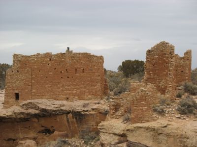
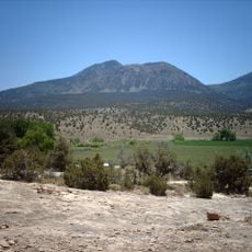
Hovenweep National Monument contains six ancient Puebloan villages scattered across canyons and mesas along the Utah-Colorado border, with multi-story towers and complex stone structures throughout. The settlements are positioned on ridges and plateaus, displaying various forms of dwellings and fortified buildings.
Native peoples inhabited the region starting around 8,000 BC, but the major stone structures were built between the 12th and 13th centuries by Ancestral Puebloans. The settlements were eventually abandoned, with the reasons for departure remaining partially unclear.
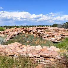
The ruins reveal skilled construction methods through structures like Hovenweep Castle and Square Tower, built by residents near water sources. These buildings show how the community adapted to life in this dry region and organized itself around essential resources.
The main ruins are accessible through a network of trails, with the Square Tower Group featuring a 2-mile loop from the visitor center. The best time to explore is fall and spring when temperatures are mild.
The monument holds International Dark Sky Park status, offering exceptional conditions for astronomical observation without light pollution interference. This makes it a rare location where visitors can experience the night sky in natural clarity.
The community of curious travelers
AroundUs brings together thousands of curated places, local tips, and hidden gems, enriched daily by 60,000 contributors worldwide.