Cochiti Lake

Log in to your account

AroundUs is a community-driven map of interesting places, built by curious explorers like you. It grows with every review, story, and photo you share.
Connect to save your favorite spots, contribute locations, and create personalized routes.
By continuing, you accept our Terms and Conditions and our Privacy Policy
Add to collection
Map
Suggest a change
Share

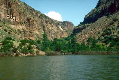
Cochiti Lake, Recreational lake and residential area in Sandoval County, United States

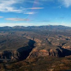
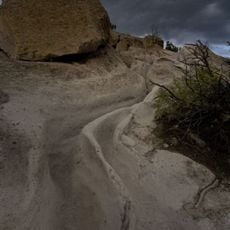
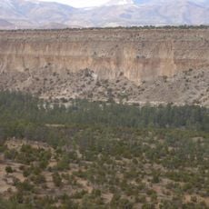
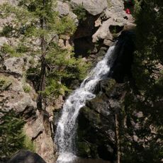
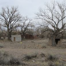
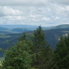
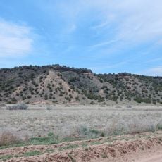
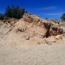
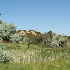
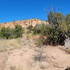
Cochiti Lake is a man-made reservoir sitting in high desert terrain, ringed by juniper and pinon forests and the surrounding foothills of the Jemez Mountains. The shoreline features steep banks with sandy and rocky areas, while the broader landscape shifts between open water and dry scrubland.

The Cochiti Dam was built in the early 1970s to create this water body as part of broader water management for the region. It ranks among the ten largest earth-fill dams in the country and continues to shape how water resources are used in this area.

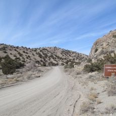
The name originates from the Cochiti Pueblo, a Native American community whose reservation borders encompass the recreational areas of the lake.

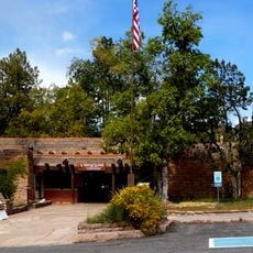
The lake has four camping loops open year-round with amenities including electric hookups and water facilities at each location. Weather can shift quickly at this elevation, so visitors should prepare for temperature changes and check conditions before planning outdoor activities.

Four osprey nesting platforms are positioned around the lake where visitors can watch these birds dive and hunt for fish in the water. These structures were installed specifically to support the population of this species in the area.

Location: Sandoval County

GPS coordinates: 35.64780,-106.34200

Latest update: December 6, 2025 17:43

Photos
National parks and monuments in Southwestern US

The southwestern United States encompasses desert landscapes, sandstone formations and archaeological sites from several pre-Columbian cultures. The region spans Utah, Arizona, New Mexico and Colorado, featuring geological structures shaped over millions of years by wind and water erosion. National...

Around this place
Show the full map
Los Alamos National Laboratory
United States of America

Los Alamos National Laboratory

25.4 km
Meow Wolf
United States of America

Meow Wolf

31.2 km
Penitentiary of New Mexico
United States of America

Penitentiary of New Mexico

27.3 km
Pajarito Plateau
United States of America

Pajarito Plateau

22.8 km
Tsankawi
United States of America

Tsankawi

26.5 km
Bradbury Science Museum
United States of America

Bradbury Science Museum

26.3 km
El Rancho de las Golondrinas
United States of America

El Rancho de las Golondrinas

22.4 km
Bandelier Tuff
United States of America

Bandelier Tuff

13 km
Jemez Falls
United States of America

Jemez Falls

29.5 km
Los Alamos Historical Museum
United States of America

Los Alamos Historical Museum

26.4 km
Budaghers
United States of America

Budaghers

21.1 km
Cerrillos Hills State Park
United States of America

Cerrillos Hills State Park

26.6 km
Otowi Historic District
United States of America

Otowi Historic District

31.1 km
Mesa Public Library
United States of America

Mesa Public Library

26.4 km
Santa Fe Rail Trail
United States of America

Santa Fe Rail Trail

31.3 km
Otowi Suspension Bridge
United States of America

Otowi Suspension Bridge

31.1 km
Cerro Grande
United States of America

Cerro Grande

25.5 km
Ancha Formation
United States of America

Ancha Formation

25.9 km
Bandelier CCC Historic District
United States of America

Bandelier CCC Historic District

16 km
The Santa Fe Reptile and Bug Museum
United States of America

The Santa Fe Reptile and Bug Museum

28.4 km
Tanos Formation
United States of America

Tanos Formation

26.2 km
Jardín botánico de Santa Fe
United States of America

Jardín botánico de Santa Fe

22 km
Leonora Curtin Wetland Preserve
United States of America

Leonora Curtin Wetland Preserve

22 km
Tsankawi Prehistoric Sites
United States of America

Tsankawi Prehistoric Sites

25.9 km
Frijoles Canyon Visitor Center
United States of America

Frijoles Canyon Visitor Center

16 km
Los Alamos VLBA station
United States of America

Los Alamos VLBA station

16.6 km
Becoming Human
United States of America

Becoming Human

31.2 km
Omega Bridge
United States of America

Omega Bridge

25.9 km
Show the full map
Reviews

Visited this place? Tap the stars to rate it and share your experience / photos with the community! Try now! You can cancel it anytime.

« Cochiti Lake - Recreational lake and residential area in Sandoval County, United States » is provided by Around Us (aroundus.com). Images and texts are derived from Wikimedia project under a Creative Commons license. You are allowed to copy, distribute, and modify copies of this page, under the conditions set by the license, as long as this note is clearly visible.

Discover hidden gems everywhere you go!

From secret cafés to breathtaking viewpoints, skip the crowded tourist spots and find places that match your style. Our app makes it easy with voice search, smart filtering, route optimization, and insider tips from travelers worldwide. Download now for the complete mobile experience.

Around Us App Screenshot

A unique approach to discovering new places

Le Figaro

All the places worth exploring

France Info

A tailor-made excursion in just a few clicks

20 Minutes