Canyonlands National Park

Log in to your account

AroundUs is a community-driven map of interesting places, built by curious explorers like you. It grows with every review, story, and photo you share.
Connect to save your favorite spots, contribute locations, and create personalized routes.
By continuing, you accept our Terms and Conditions and our Privacy Policy
Add to collection
Map
Suggest a change
Share

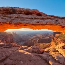
Canyonlands National Park, National Park in southeastern Utah, United States.

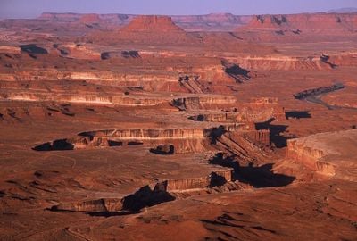
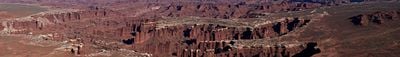
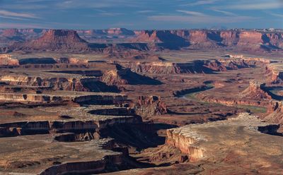
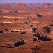
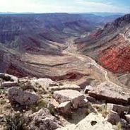
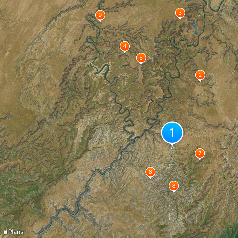
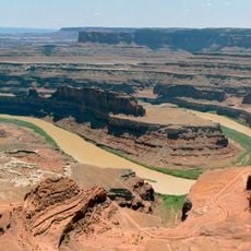
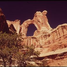
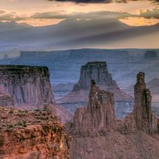
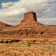
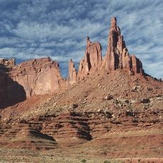
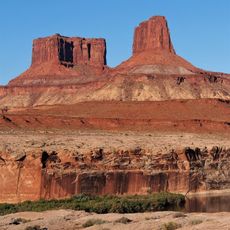
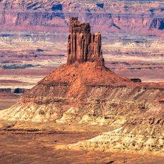
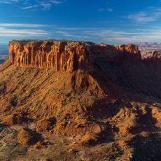
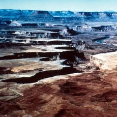
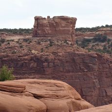
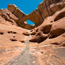
Canyonlands is a national park in southeastern Utah where the Colorado River and the Green River meet, cutting deep canyons, flat-topped plateaus, and complex rock formations across a wide area. The terrain spreads into four sections: Island in the Sky, The Needles, The Maze, and the Rivers, each with its own landscapes and access roads.

The area became a national park in 1964 to protect its rock formations and archaeological sites. Before that, ranchers and miners used the land occasionally, while native people had lived in the canyons for thousands of years.

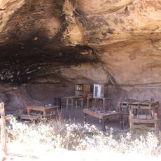
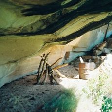
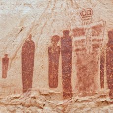
Ancestral Puebloan people left red-painted pictographs and carved petroglyphs on the canyon walls, showing figures, animals, and geometric patterns in rock shelters and alcoves. These images remain visible today near some of the trails, giving a quiet sense of people who lived here long before the land became a park.

The four sections of the park have separate entrances, and there are no through roads between them, so plan your route in advance. Hiking trails range from short overlook walks to long canyon hikes, and many cross open ground without shade.

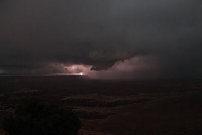
The park holds certification as an International Dark Sky Park, and on clear nights thousands of stars and the Milky Way are visible to the naked eye. The remoteness and low air pollution create one of the darkest night skies in the United States.

Location: Utah

Inception: September 12, 1964

Operator: National Park Service

Part of: Mighty Five

Website: https://nps.gov/cany

GPS coordinates: 38.16690,-109.76000

Latest update: December 4, 2025 23:02

Natural wonders of the American West

The western United States protects some of North America's most diverse natural landscapes. From the layered canyons of Canyonlands in Utah to the white gypsum dunes of White Sands in New Mexico, this region spans multiple climate zones and geological formations. Visitors find national parks, Pueblo archaeological sites and natural phenomena that document millions of years of Earth's history.The collection includes the ruins of Mesa Verde, where Ancestral Pueblo communities built cliff dwellings into sandstone alcoves from the 6th century until the late 1200s. Dinosaur National Monument preserves one of the world's most significant fossil beds, with more than 1,500 exposed dinosaur bones. Colorado's Great Sand Dunes rise to 750 feet (229 meters), making them the tallest dunes in North America. Carlsbad Caverns extends through 30 miles (48 kilometers) of underground passages with more than 120 known caves.The region's geology appears in the 2,000-foot (610-meter) depths of the Black Canyon of the Gunnison and the petrified tree trunks in Petrified Forest that date back more than 200 million years. Monument Valley presents sandstone formations rising 400 to 1,000 feet (122 to 305 meters) above the valley floor. Utah's Mystic Hot Springs feeds natural mineral pools at temperatures around 160 to 180 degrees Fahrenheit (71 to 82 degrees Celsius). Wolf Creek ski area records an average annual snowfall of 465 inches (11.4 meters).

National parks and monuments in Southwestern US

The southwestern United States encompasses desert landscapes, sandstone formations and archaeological sites from several pre-Columbian cultures. The region spans Utah, Arizona, New Mexico and Colorado, featuring geological structures shaped over millions of years by wind and water erosion. National parks such as Canyonlands and Capitol Reef display canyons, mesas and rock spires in shades of red, orange and ochre. The area preserves evidence of the Ancestral Puebloans, who built cliff dwellings and communal structures between the 12th and 14th centuries. Sites like Bandelier National Monument and Gila Cliff Dwellings provide access to these habitations. Chaco Culture National Historical Park documents a pre-Hispanic trading center with multistory stone complexes. Petroglyphs at locations such as Three Rivers and the petrified trees of Petrified Forest National Park offer additional historical records. The Navajo Nation administers Monument Valley and the Navajo Zoo, while Hubbell Trading Post operates as a functioning 19th-century trading post. Volcanic features mark Sunset Crater and El Malpais, while White Sands covers more than 275 square miles (700 square kilometers) of gypsum dunes. Glen Canyon and the man-made Lake Cochiti provide water access in this largely arid region. Elevation differences range from the Organ Pipe Cactus Desert to Great Basin National Park with its ridges above 13,000 feet (3,900 meters).

Reviews

Visited this place? Tap the stars to rate it and share your experience / photos with the community! Try now! You can cancel it anytime.

« Canyonlands National Park - National Park in southeastern Utah, United States » is provided by Around Us (aroundus.com). Images and texts are derived from Wikimedia project under a Creative Commons license. You are allowed to copy, distribute, and modify copies of this page, under the conditions set by the license, as long as this note is clearly visible.

Discover hidden gems everywhere you go!

From secret cafés to breathtaking viewpoints, skip the crowded tourist spots and find places that match your style. Our app makes it easy with voice search, smart filtering, route optimization, and insider tips from travelers worldwide. Download now for the complete mobile experience.

Around Us App Screenshot

A unique approach to discovering new places

Le Figaro

All the places worth exploring

France Info

A tailor-made excursion in just a few clicks

20 Minutes