Goosenecks State Park
Goosenecks State Park, State park in San Juan County, United States.
Description
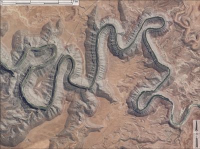
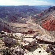
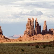
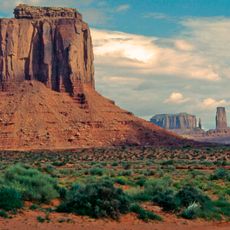
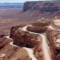
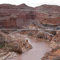
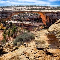
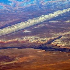
Goosenecks State Park is a nature reserve in southeastern Utah where the San Juan River has carved deep canyons with three tight meanders below the main viewpoint. The river forms entrenched loops that drop approximately 305 m (1,000 ft), creating dramatic views from above.
History
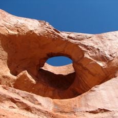
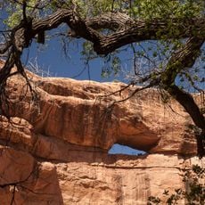
The meanders formed roughly 300 million years ago when the Colorado Plateau underwent uplift, forcing the river to cut deeper into the land. As the plateau rose, the river maintained its winding course rather than changing direction.
Culture
The park earned International Dark Sky designation in 2021, becoming a place where visitors come to observe stars without light pollution. This recognition highlights how the place has become important for people who want to experience the night sky as it naturally appears.
Practical
The park is accessible via Utah Route 261 north of Mexican Hat, with a parking area near the viewpoint. Visit on clear nights to best enjoy both the canyon views and the dark sky opportunities the place offers.
Did you know?
The river travels more than 9 km (5.6 mi) through the meandering sections while advancing only about 2 km (1.2 mi) in straight-line distance. This extreme winding demonstrates how dramatically the river twists to cut through the hard rock layers.
AroundUs brings together thousands of curated places, local tips, and hidden gems, enriched daily by 60,000 contributors worldwide. Discover all places nearby (San Juan County).
The southwestern United States encompasses desert landscapes, sandstone formations and archaeological sites from several pre-Columbian cultures. The region spans Utah, Arizona, New Mexico and Colorado, featuring geological structures shaped over millions of years by wind and water erosion. National...
Utah preserves thousands of years of human history alongside some of North America's most varied geological landscapes. The region contains extensive rock art panels and Ancestral Pueblo ruins, including the 13th-century stone structures at Bears Ears National Monument and the 650-plus petroglyphs...
West and East Mitten Buttes
24.2 km
Totem Pole
29.4 km
Comb Ridge
37.6 km
Merrick's Butte
25.9 km
Moki Dugway
11.3 km
Oljato Trading Post
38 kmMuley Point
8.7 km
Jason R. Workman Memorial Bridge
5.9 km
Pine Tree Arch
37.1 km
Lemuel H. Redd Jr. House
35.2 km
Stimper Arch
37.1 km
Mexican Hat Rock
6.9 km
Bluff Historic District
35.6 km
Joseph Frederick Adams House
35.6 km
James Bean Decker House
35 km
John Albert Scorup House
35.7 km
Jens Nielson House
36.4 km
Owachomo Bridge
45.9 km
Goulding's Trading Post
30.8 km
Owachomo Bridge Trail
45.8 km
Valley of the Gods
13.1 km
House on Fire Ruins
44.1 km
Nokaito Bench
30.7 km
John Wayne's Cabin
30.9 km
Castle Butte
16.8 km
Forrest Gump Point
9.9 km
Monument Valley Navajo Tribal Park
30.9 km
Setting Hen Butte
15.1 kmDiscover hidden gems everywhere you go!
From secret cafés to breathtaking viewpoints, skip the crowded tourist spots and find places that match your style. Our app makes it easy with voice search, smart filtering, route optimization, and insider tips from travelers worldwide. Download now for the complete mobile experience.
A unique approach to discovering new places❞
— Le Figaro
All the places worth exploring❞
— France Info
A tailor-made excursion in just a few clicks❞
— 20 Minutes